
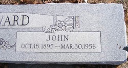
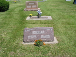
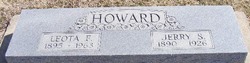
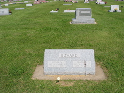
John Howard
| Birth | : | 18 Oct 1895 |
| Death | : | 30 Mar 1956 |
| Burial | : | Indianapolis Cemetery, Rose Hill, Mahaska County, USA |
| Coordinate | : | 41.4053001, -92.4364014 |
| Plot | : | Block 14, Lot 3, grave 1 & 2 |
| Description | : | Obituary from Wichita Eagle dated Sunday Morning, April 1, 1956: Services Planned For Mulvane Man Funeral services for John Howard, 60, of Mulvane, who died Friday at St. Francis Hospital, will be held at 2 p.m. Monday at Mulvane Methodist Church. The Rev. D.N. McAllister, pastor of the church, will officiate. Burial will be in Mulvane Cemetery with the Masonic Lodge in charge of graveside services. Mr. Howard, who had been in poor health for two years, was born... Read More |
frequently asked questions (FAQ):
-
Where is John Howard's memorial?
John Howard's memorial is located at: Indianapolis Cemetery, Rose Hill, Mahaska County, USA.
-
When did John Howard death?
John Howard death on 30 Mar 1956 in
-
Where are the coordinates of the John Howard's memorial?
Latitude: 41.4053001
Longitude: -92.4364014
Family Members:
Parent

Spouse
Siblings
Flowers:


Nearby Cemetories:
1. Indianapolis Cemetery
Rose Hill, Mahaska County, USA
Coordinate: 41.4053001, -92.4364014
2. Tinsley Cemetery
Mahaska County, USA
Coordinate: 41.3941994, -92.4783020
3. Bedwell Cemetery
Monroe Township, Mahaska County, USA
Coordinate: 41.3667400, -92.4637400
4. Rice Cemetery
What Cheer, Keokuk County, USA
Coordinate: 41.3793983, -92.3891983
5. Coal Creek Cemetery
What Cheer, Keokuk County, USA
Coordinate: 41.4392520, -92.3843340
6. Hopewell Cemetery
Rose Hill, Mahaska County, USA
Coordinate: 41.3502998, -92.4494019
7. Waddell Cemetery
Keokuk County, USA
Coordinate: 41.3574982, -92.3874969
8. Mormon Point Cemetery
Mahaska County, USA
Coordinate: 41.4344406, -92.5080566
9. Turner-Tinkerville-Wapalo Cemetery
Rose Hill, Mahaska County, USA
Coordinate: 41.3426130, -92.4177970
10. Roberts Cemetery
Mahaska County, USA
Coordinate: 41.3793983, -92.5235977
11. Highland Cemetery
What Cheer, Keokuk County, USA
Coordinate: 41.3936005, -92.3407974
12. McFarlan Cemetery
What Cheer, Keokuk County, USA
Coordinate: 41.4085999, -92.3371964
13. Wymore Cemetery
Rose Hill, Mahaska County, USA
Coordinate: 41.3499985, -92.5069427
14. Saint Josephs Cemetery
What Cheer, Keokuk County, USA
Coordinate: 41.4007988, -92.3300018
15. Sixteen Cemetery
Thornburg, Keokuk County, USA
Coordinate: 41.4622002, -92.3538971
16. Hewitt Cemetery
Delta, Keokuk County, USA
Coordinate: 41.3277874, -92.3807409
17. Jackson Cemetery
Rose Hill, Mahaska County, USA
Coordinate: 41.3191986, -92.4730988
18. Springfield Cemetery
Delta, Keokuk County, USA
Coordinate: 41.3386002, -92.3531036
19. Old Rose Hill Cemetery
Rose Hill, Mahaska County, USA
Coordinate: 41.3209991, -92.4929962
20. Ruby Cemetery
Lacey, Mahaska County, USA
Coordinate: 41.3633320, -92.5527550
21. Barnes City Cemetery
Barnes City, Mahaska County, USA
Coordinate: 41.5036390, -92.4746930
22. Saint Martin Evangelical Lutheran Cemetery
Keokuk County, USA
Coordinate: 41.4100075, -92.2971268
23. Humes Cemetery
Thornburg, Keokuk County, USA
Coordinate: 41.4085999, -92.2968979
24. Union Mills Cemetery
Union Mills, Mahaska County, USA
Coordinate: 41.4482994, -92.5643997