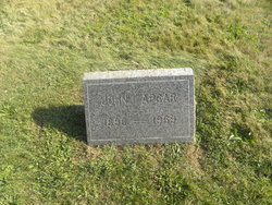
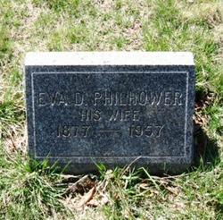
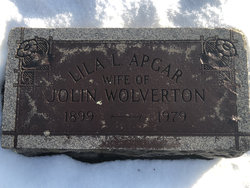
John I. Apgar
| Birth | : | 1896 Cokesbury, Hunterdon County, New Jersey, USA |
| Death | : | 13 Jan 1969 Clinton Township, Hunterdon County, New Jersey, USA |
| Burial | : | Mountain View Cemetery, Cokesbury, Hunterdon County, USA |
| Coordinate | : | 40.6832600, -74.8447000 |
| Description | : | John I. Apgar, 72, Clinton Township supervisor of roads, died unexpectedly at his home on Route 78. He had lived at Cokesbury most of his life and was a farmer. He worked for the Clinton Township road force for 20 years, with 10 years as a supervisor. He was also a special police officer in Clinton Township. Mr. Apgar had made his home for 11 years with his sister, Mrs. Lila Wolverton on Route 78. She was his only near survivor, other than two nieces. Funeral services were held at the Bright Colonial Funeral... Read More |
frequently asked questions (FAQ):
-
Where is John I. Apgar's memorial?
John I. Apgar's memorial is located at: Mountain View Cemetery, Cokesbury, Hunterdon County, USA.
-
When did John I. Apgar death?
John I. Apgar death on 13 Jan 1969 in Clinton Township, Hunterdon County, New Jersey, USA
-
Where are the coordinates of the John I. Apgar's memorial?
Latitude: 40.6832600
Longitude: -74.8447000
Family Members:
Parent
Siblings
Flowers:
Nearby Cemetories:
1. Mountain View Cemetery
Cokesbury, Hunterdon County, USA
Coordinate: 40.6832600, -74.8447000
2. Cokesbury Presbyterian Church Cemetery
Cokesbury, Hunterdon County, USA
Coordinate: 40.6847700, -74.8369600
3. Cokesbury United Methodist Church Cemetery
Cokesbury, Hunterdon County, USA
Coordinate: 40.6826000, -74.8357200
4. Apgar Homestead Graveyard
Cokesbury, Hunterdon County, USA
Coordinate: 40.6724360, -74.8308210
5. Church of the Holy Spirit Memorial Garden
Lebanon, Hunterdon County, USA
Coordinate: 40.6583340, -74.8299010
6. Philhower Family Burying Ground
Lebanon, Hunterdon County, USA
Coordinate: 40.7055560, -74.8722220
7. Union Cemetery
Lebanon, Hunterdon County, USA
Coordinate: 40.6425018, -74.8399963
8. New Lebanon Reformed Church Cemetery
Lebanon, Hunterdon County, USA
Coordinate: 40.6390800, -74.8345700
9. Lower Valley Union Cemetery
Califon, Hunterdon County, USA
Coordinate: 40.7289009, -74.8431015
10. Old Lebanon Reformed Church Cemetery
Lebanon, Hunterdon County, USA
Coordinate: 40.6372223, -74.8333359
11. Immaculate Conception Cemetery and Mausoleum
Annandale, Hunterdon County, USA
Coordinate: 40.6354700, -74.8794900
12. Runkle Weart Burying Ground
Lebanon, Hunterdon County, USA
Coordinate: 40.6358986, -74.8835983
13. Potterstown Cemetery
Hunterdon County, USA
Coordinate: 40.6602770, -74.7766660
14. Evergreen Cemetery
Clinton, Hunterdon County, USA
Coordinate: 40.6451378, -74.9116669
15. Old Saint Mary Cemetery
Clinton, Hunterdon County, USA
Coordinate: 40.6440964, -74.9116669
16. Riverside Cemetery
Clinton, Hunterdon County, USA
Coordinate: 40.6395800, -74.9067700
17. Spruce Run Cemetery
Glen Gardner, Hunterdon County, USA
Coordinate: 40.7085953, -74.9230576
18. Clinton Presbyterian Churchyard
Clinton, Hunterdon County, USA
Coordinate: 40.6393000, -74.9076500
19. Fairmount Rural Cemetery
Califon, Hunterdon County, USA
Coordinate: 40.7257690, -74.7772070
20. Fairmount Methodist Churchyard
Fairmount, Hunterdon County, USA
Coordinate: 40.7259712, -74.7759705
21. Clinton Baptist Church Cemetery
Clinton, Hunterdon County, USA
Coordinate: 40.6335030, -74.9071198
22. Farley Burial Site
Califon, Hunterdon County, USA
Coordinate: 40.6839409, -74.7528610
23. Fairmount Cemetery
Fairmount, Hunterdon County, USA
Coordinate: 40.7338104, -74.7751770
24. Zion Lutheran Church Cemetery
Oldwick, Hunterdon County, USA
Coordinate: 40.6724510, -74.7490768


