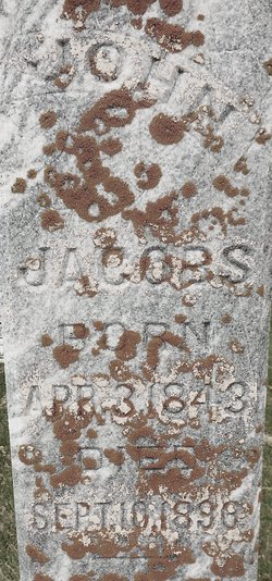
John Jacobs
| Birth | : | 3 Apr 1843 Hanover, Region Hannover, Lower Saxony (Niedersachsen), Germany |
| Death | : | 10 Sep 1896 Carroll County, Iowa, USA |
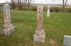
| Burial | : | East Liberty Cemetery, Lidderdale, Carroll County, USA |
| Coordinate | : | 42.1591988, -94.7636032 |
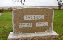
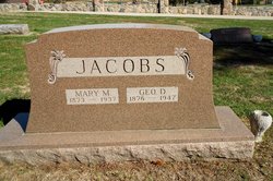
| Description | : | John married Anna Meyers. They were the parents of Henry and George D "Gid" (1877 IA) Sept 10, 1896 - Carroll Sentinel - John Jacobs, a wealthy farmer in Sheridan township, committed suicide this forenoon by hanging. He was a man of about 60 years and since the death of his wife last spring has been believed to be melancholy and it is thought that this worried on his mind until it gave way. The family consists of two sons who are engaged in teaching school. History of Carroll county, Iowa - John and Catherine (Meyers) Jacobs, natives of... Read More |
frequently asked questions (FAQ):
-
Where is John Jacobs's memorial?
John Jacobs's memorial is located at: East Liberty Cemetery, Lidderdale, Carroll County, USA.
-
When did John Jacobs death?
John Jacobs death on 10 Sep 1896 in Carroll County, Iowa, USA
-
Where are the coordinates of the John Jacobs's memorial?
Latitude: 42.1591988
Longitude: -94.7636032
Family Members:
Spouse
Children
Flowers:
Nearby Cemetories:
1. East Liberty Cemetery
Lidderdale, Carroll County, USA
Coordinate: 42.1591988, -94.7636032
2. Immanuel Cemetery
Lidderdale, Carroll County, USA
Coordinate: 42.1389008, -94.8022003
3. Lanesboro Cemetery
Lanesboro, Carroll County, USA
Coordinate: 42.1810989, -94.7230988
4. Holy Family Cemetery
Lidderdale, Carroll County, USA
Coordinate: 42.1178017, -94.7839966
5. Dickson Cemetery
Glidden Township, Carroll County, USA
Coordinate: 42.1074982, -94.6939011
6. North Coon Cemetery
Carroll County, USA
Coordinate: 42.1260986, -94.6716995
7. Cottonwood Cemetery
Lake City, Calhoun County, USA
Coordinate: 42.2491989, -94.7936020
8. West Lawn Cemetery
Glidden, Carroll County, USA
Coordinate: 42.0649986, -94.7406006
9. Our Lady Of Mount Carmel Cemetery
Mount Carmel, Carroll County, USA
Coordinate: 42.1547012, -94.9088974
10. Bishop Cemetery
Calhoun Township, Calhoun County, USA
Coordinate: 42.2230400, -94.6453190
11. Lake City Cemetery
Lake City, Calhoun County, USA
Coordinate: 42.2719002, -94.7574997
12. Saint Marys Catholic Cemetery
Lake City, Calhoun County, USA
Coordinate: 42.2730000, -94.7567000
13. Carroll City Cemetery
Carroll, Carroll County, USA
Coordinate: 42.0560963, -94.8599856
14. Mount Olivet Cemetery
Carroll, Carroll County, USA
Coordinate: 42.0536340, -94.8595510
15. Luckow Cemetery
Auburn, Sac County, USA
Coordinate: 42.2168999, -94.9266968
16. Saint Marys Cemetery
Sac County, USA
Coordinate: 42.2611008, -94.8839035
17. Oak Lawn Cemetery
Auburn, Sac County, USA
Coordinate: 42.2611008, -94.8852997
18. Dillavou Cemetery
Kendrick Township, Greene County, USA
Coordinate: 42.0802994, -94.6138992
19. Saint Francis Cemetery
Maple River, Carroll County, USA
Coordinate: 42.0969009, -94.9372025
20. Grant City Cemetery
Grant City, Sac County, USA
Coordinate: 42.2681007, -94.8908005
21. Saint Bernards Cemetery
Breda, Carroll County, USA
Coordinate: 42.1786003, -94.9732971
22. Saint Patricks Cemetery
Churdan, Greene County, USA
Coordinate: 42.1605988, -94.5511017
23. Old Cedar Cemetery
Adaza, Greene County, USA
Coordinate: 42.1874821, -94.5419194
24. Saint Marys Catholic Cemetery
Willey, Carroll County, USA
Coordinate: 41.9783363, -94.8212204


