


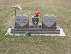
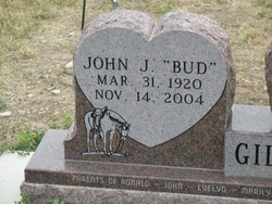
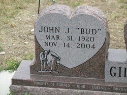
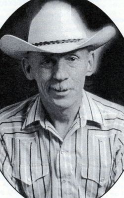
John Joseph “Bud” Gillaspie
| Birth | : | 31 Mar 1920 Ottumwa, Haakon County, South Dakota, USA |
| Death | : | 14 Nov 2004 Rapid City, Pennington County, South Dakota, USA |
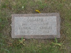
| Burial | : | Moshassuck Cemetery, Central Falls, Providence County, USA |
| Coordinate | : | 41.8907089, -71.4024200 |
| Description | : | Son of James H. & Mary Margaret (Ball) Gillaspie. ∼John J. Gillaspie was born March 31, 1920 on his parents' farm-ranch in the Ottumwa, South Dakota area, the son of James H. and Mary Margaret (Ball) Gillaspie. He attended rural school through the 9th grade and graduated from Midland High School in 1938. As a young man he worked for various ranchers in Haakon County. He was united in marriage to Avis Schilling on April 30, 1945 in Midland, South Dakota. After their marriage, they made their home in Midland until October 1945 when they moved to a ranch north of... Read More |
frequently asked questions (FAQ):
-
Where is John Joseph “Bud” Gillaspie's memorial?
John Joseph “Bud” Gillaspie's memorial is located at: Moshassuck Cemetery, Central Falls, Providence County, USA.
-
When did John Joseph “Bud” Gillaspie death?
John Joseph “Bud” Gillaspie death on 14 Nov 2004 in Rapid City, Pennington County, South Dakota, USA
-
Where are the coordinates of the John Joseph “Bud” Gillaspie's memorial?
Latitude: 41.8907089
Longitude: -71.4024200
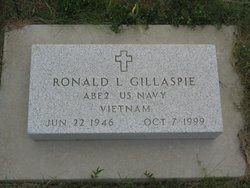
Family Members:
Spouse

Children


Flowers:


Nearby Cemetories:
1. Moshassuck Cemetery
Central Falls, Providence County, USA
Coordinate: 41.8907089, -71.4024200
2. Whipple-Northup Lot
Lincoln, Providence County, USA
Coordinate: 41.8995370, -71.4168610
3. Pierce Park and Riverwalk
Central Falls, Providence County, USA
Coordinate: 41.8938300, -71.3833000
4. Friends Burial Ground
Lincoln, Providence County, USA
Coordinate: 41.9006000, -71.4180000
5. Arnold Lot
Lincoln, Providence County, USA
Coordinate: 41.9009000, -71.4182000
6. Christ Church Cemetery
Lincoln, Providence County, USA
Coordinate: 41.9070816, -71.4021378
7. Jencks-Phetteplace-Whipple Lot
Lincoln, Providence County, USA
Coordinate: 41.9017330, -71.4187510
8. Rhode Island Historical Cemetery Lincoln #81
Lincoln, Providence County, USA
Coordinate: 41.9015560, -71.4191330
9. Mineral Spring Cemetery
Pawtucket, Providence County, USA
Coordinate: 41.8756450, -71.3919830
10. Saint Patricks Church Cemetery
Cumberland, Providence County, USA
Coordinate: 41.9070778, -71.3930817
11. Governor Joseph Jencks Lot
Pawtucket, Providence County, USA
Coordinate: 41.8790310, -71.3831690
12. Arnold Lot
Lincoln, Providence County, USA
Coordinate: 41.8817400, -71.4242600
13. Saint Johns Ukrainian Cemetery
Cumberland, Providence County, USA
Coordinate: 41.9076805, -71.3888626
14. Saint Patricks Cemetery
Cumberland, Providence County, USA
Coordinate: 41.9083290, -71.3900375
15. Austin-Thayer-Gorton Lot
Lincoln, Providence County, USA
Coordinate: 41.9092520, -71.4146090
16. Old Saint Marys Cemetery
Pawtucket, Providence County, USA
Coordinate: 41.8717117, -71.3885193
17. Consolation Church Grounds
Pawtucket, Providence County, USA
Coordinate: 41.8902140, -71.3727310
18. William Blackstone Memorial Park
Cumberland, Providence County, USA
Coordinate: 41.9148216, -71.3995132
19. Emerson Cemetery
Cumberland, Providence County, USA
Coordinate: 41.9148360, -71.3995040
20. Oak Grove Cemetery
Pawtucket, Providence County, USA
Coordinate: 41.8844910, -71.3709030
21. Cumberland Cemetery
Cumberland, Providence County, USA
Coordinate: 41.9133072, -71.3879623
22. Old Indian Cemetery
Cumberland, Providence County, USA
Coordinate: 41.9135132, -71.3865662
23. Olney Burial Ground
Lincoln, Providence County, USA
Coordinate: 41.8910000, -71.4381000
24. Rhode Island Historical Cemetery Lincoln #61
Lincoln, Providence County, USA
Coordinate: 41.8814780, -71.4372690