
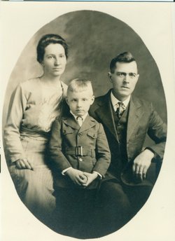
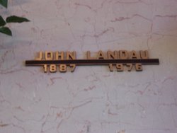
John Landau
| Birth | : | 2 Jul 1887 Germany |
| Death | : | 5 Jul 1976 Napa, Napa County, California, USA |
| Burial | : | Adams State Road Cemetery, Honeyville, Jefferson County, USA |
| Coordinate | : | 43.8600006, -75.9918976 |
frequently asked questions (FAQ):
-
Where is John Landau's memorial?
John Landau's memorial is located at: Adams State Road Cemetery, Honeyville, Jefferson County, USA.
-
When did John Landau death?
John Landau death on 5 Jul 1976 in Napa, Napa County, California, USA
-
Where are the coordinates of the John Landau's memorial?
Latitude: 43.8600006
Longitude: -75.9918976
Family Members:
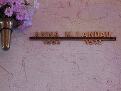
Spouse
Children

Flowers:


Nearby Cemetories:
1. Adams State Road Cemetery
Honeyville, Jefferson County, USA
Coordinate: 43.8600006, -75.9918976
2. Union Cemetery
Adams Center, Jefferson County, USA
Coordinate: 43.8532982, -76.0089035
3. Green Settlement Cemetery
Green Settlement, Jefferson County, USA
Coordinate: 43.8557014, -76.0378036
4. Wood Family Cemetery
Rodman, Jefferson County, USA
Coordinate: 43.8502808, -75.9450073
5. North Adams Cemetery
Jefferson County, USA
Coordinate: 43.8889008, -76.0286026
6. Thompson Cemetery
Adams, Jefferson County, USA
Coordinate: 43.8196983, -75.9775009
7. Isham Cemetery
Rodman, Jefferson County, USA
Coordinate: 43.8521996, -75.9349976
8. Elmwood Cemetery
Adams, Jefferson County, USA
Coordinate: 43.8143997, -76.0299988
9. Fairview Cemetery
Rodman, Jefferson County, USA
Coordinate: 43.8386002, -75.9191971
10. Adams Rural Cemetery
Adams, Jefferson County, USA
Coordinate: 43.8055400, -76.0242000
11. Rices Corners Cemetery
Jefferson County, USA
Coordinate: 43.8947200, -76.0605600
12. Ross Corners Cemetery
Rodman, Jefferson County, USA
Coordinate: 43.8024200, -75.9475200
13. Fassetts Cemetery
Rodman, Jefferson County, USA
Coordinate: 43.8619400, -75.8919500
14. Gould Cemetery
Lorraine, Jefferson County, USA
Coordinate: 43.7887400, -75.9582000
15. Grow Cemetery
Jefferson County, USA
Coordinate: 43.8624992, -76.1025009
16. Jerusalem Road
Lorraine, Jefferson County, USA
Coordinate: 43.7899440, -75.9383060
17. Crandall Hill Cemetery
Rodman, Jefferson County, USA
Coordinate: 43.8871670, -75.8854170
18. Smithville Cemetery
Smithville, Jefferson County, USA
Coordinate: 43.8726800, -76.1046700
19. Fields Settlement Cemetery
Fields Settlement, Jefferson County, USA
Coordinate: 43.9504800, -75.9817900
20. Degel Israel Cemetery
Jefferson County, USA
Coordinate: 43.9342003, -75.9163971
21. Paul's Corner Cemetery
Adams, Jefferson County, USA
Coordinate: 43.8080000, -76.0980000
22. Lorraine Rural Cemetery
Lorraine, Jefferson County, USA
Coordinate: 43.7666300, -75.9623700
23. Giddingsville Cemetery
Jefferson County, USA
Coordinate: 43.7742004, -76.0556030
24. Dickinson Family Cemetery
Ellisburg, Jefferson County, USA
Coordinate: 43.7816180, -76.0730860