

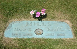
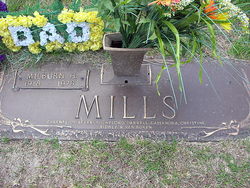
John Louis Mills
| Birth | : | 2 Oct 1874 West Liberty, Muscatine County, Iowa, USA |
| Death | : | 18 Dec 1955 Muscatine, Muscatine County, Iowa, USA |
| Burial | : | Nemaha Cemetery, Nemaha, Sac County, USA |
| Coordinate | : | 42.5102997, -95.0905991 |
| Description | : | John L. Mills, 81, died at 4 a.m. Sunday, 18 December, 1955 at the Hershey Convalescent home, as the result of complications. He had been ill for three weeks. Mr. Mills home was on Rural Route No. 1, Nichols. The son of Van Buren and Eunice Foster Mills, he was born Oct. 2, 1874, at Muscatine and was a life-long resident of this community. He married Mary Spratford Feb. 8, 1905, at Nichols. His occupation was that of a farmer of 80 acres along the Cedar River east of... Read More |
frequently asked questions (FAQ):
-
Where is John Louis Mills's memorial?
John Louis Mills's memorial is located at: Nemaha Cemetery, Nemaha, Sac County, USA.
-
When did John Louis Mills death?
John Louis Mills death on 18 Dec 1955 in Muscatine, Muscatine County, Iowa, USA
-
Where are the coordinates of the John Louis Mills's memorial?
Latitude: 42.5102997
Longitude: -95.0905991
Family Members:
Parent
Spouse
Siblings

Children
Flowers:


Nearby Cemetories:
1. Nemaha Cemetery
Nemaha, Sac County, USA
Coordinate: 42.5102997, -95.0905991
2. Sacred Heart Cemetery
Early, Sac County, USA
Coordinate: 42.4650002, -95.1446991
3. Early Union Cemetery
Early, Sac County, USA
Coordinate: 42.4578018, -95.1425018
4. Donna Lynn Salis-Christensen Burial Plot
Newell, Buena Vista County, USA
Coordinate: 42.5882134, -95.0544960
5. Sac County Farm Cemetery
Early, Sac County, USA
Coordinate: 42.4295560, -95.1175190
6. Protestant Union Cemetery
Early, Sac County, USA
Coordinate: 42.4294014, -95.1483002
7. Chase Cemetery
Sac County, USA
Coordinate: 42.5036011, -95.2288971
8. Immanuel Reformed Cemetery
Schaller, Sac County, USA
Coordinate: 42.5396996, -95.2294006
9. Oakland Cemetery
Sac City, Sac County, USA
Coordinate: 42.4272100, -94.9910760
10. Newell Catholic Prairie Cemetery
Newell, Buena Vista County, USA
Coordinate: 42.6144000, -95.0328000
11. German Methodist Cemetery
Schaller, Sac County, USA
Coordinate: 42.5045000, -95.2481000
12. Newell Cemetery
Newell, Buena Vista County, USA
Coordinate: 42.6123800, -94.9994800
13. Storm Lake Cemetery
Storm Lake, Buena Vista County, USA
Coordinate: 42.6352800, -95.1744400
14. Emmanuel Cemetery
Cook Township, Sac County, USA
Coordinate: 42.3993988, -95.2063980
15. Cory Grove Cemetery
Sac City, Sac County, USA
Coordinate: 42.3932991, -94.9788971
16. Cook Center Cemetery
Schaller, Sac County, USA
Coordinate: 42.4432983, -95.2649994
17. Saint Mary's Catholic Cemetery
Storm Lake, Buena Vista County, USA
Coordinate: 42.6470000, -95.1660000
18. Cedar Cemetery
Sac City, Sac County, USA
Coordinate: 42.4430000, -94.9110000
19. Saint Josephs Catholic Church Cemetery
Schaller, Sac County, USA
Coordinate: 42.5035000, -95.3095000
20. Schaller Cemetery
Schaller, Sac County, USA
Coordinate: 42.5046000, -95.3117600
21. Saint John Cemetery
Williams Township, Calhoun County, USA
Coordinate: 42.4747009, -94.8672028
22. Salem Reform Cemetery
Sac County, USA
Coordinate: 42.3555984, -95.1866989
23. Buena Vista Memorial Park Cemetery
Storm Lake, Buena Vista County, USA
Coordinate: 42.6539001, -95.2339020
24. Maple Valley Township Cemetery
Alta, Buena Vista County, USA
Coordinate: 42.5752600, -95.3199980