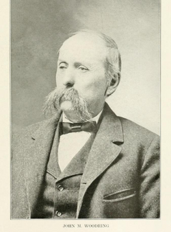
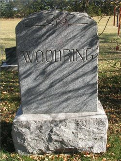
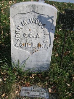
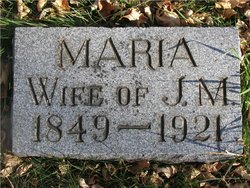
John Manuel Woodring
| Birth | : | 29 Aug 1838 Easton, Northampton County, Pennsylvania, USA |
| Death | : | 11 Mar 1923 Spink County, South Dakota, USA |
| Burial | : | Frankfort Cemetery, Frankfort, Spink County, USA |
| Coordinate | : | 44.8784800, -98.2965200 |
| Plot | : | Block G, Lot 4 |
| Description | : | Biography: Doland Centenial Book John Manuel & Maria Woodring Soldier's claim on homestead land was granted to participants in the Civil War. John enlisted in Co. A, 46th Regiment of Illinois Volunteers in 1861 and was discharged at the close of the war in 1865. Maria and John Woodring, who in 1882 filed a Soldier's Claim on land 6 1/2 miles northwest of Doland, brought their family from Osage, Iowa in the Spring of 1883, to make their home on the Dakota Prairie. They brought with them 4 children, Lida,... Read More |
frequently asked questions (FAQ):
-
Where is John Manuel Woodring's memorial?
John Manuel Woodring's memorial is located at: Frankfort Cemetery, Frankfort, Spink County, USA.
-
When did John Manuel Woodring death?
John Manuel Woodring death on 11 Mar 1923 in Spink County, South Dakota, USA
-
Where are the coordinates of the John Manuel Woodring's memorial?
Latitude: 44.8784800
Longitude: -98.2965200
Family Members:
Parent
Spouse
Siblings
Children
Flowers:
Nearby Cemetories:
1. Frankfort Cemetery
Frankfort, Spink County, USA
Coordinate: 44.8784800, -98.2965200
2. Saint Ann Cemetery
Frankfort, Spink County, USA
Coordinate: 44.8821983, -98.3028030
3. Poor Farm Cemetery
Frankfort, Spink County, USA
Coordinate: 44.8836350, -98.3591071
4. Guttenberg Cemetery
Spink County, USA
Coordinate: 44.8205986, -98.2972031
5. Glendale Colony Cemetery
Spink County, USA
Coordinate: 44.7999900, -98.2856600
6. Irving Cemetery
Doland, Spink County, USA
Coordinate: 44.7751500, -98.2203600
7. Clifton Cemetery
Clifton Township, Spink County, USA
Coordinate: 45.0106010, -98.3197021
8. Spink Colony Cemetery
Spink Colony, Spink County, USA
Coordinate: 44.7440800, -98.2923800
9. Crandon Cemetery
Spink County, USA
Coordinate: 44.7825012, -98.4436035
10. Ebenezer Cemetery
Doland, Spink County, USA
Coordinate: 44.7602997, -98.1797028
11. Graceland Cemetery
Tulare, Spink County, USA
Coordinate: 44.7481003, -98.3861008
12. Rose Hill Cemetery
Doland, Spink County, USA
Coordinate: 44.7484600, -98.1993600
13. Irving Cemetery
Spink County, USA
Coordinate: 44.7486000, -98.1986008
14. Doland Cemetery
Doland, Spink County, USA
Coordinate: 44.8993988, -98.0828018
15. Saint Bernard Cemetery
Redfield, Spink County, USA
Coordinate: 44.8857994, -98.5139008
16. Greenlawn Cemetery
Redfield, Spink County, USA
Coordinate: 44.8857994, -98.5164032
17. South Dakota Developmental Center Cemetery
Spink County, USA
Coordinate: 44.8880120, -98.5234880
18. Hillestad Cemetery
Spink County, USA
Coordinate: 44.6944008, -98.2596970
19. Tulare Cemetery
Tulare, Spink County, USA
Coordinate: 44.7486000, -98.4922028
20. Ashton Cemetery
Ashton, Spink County, USA
Coordinate: 44.9914017, -98.5224991
21. Emmanuel Mennonite Cemetery
Spink County, USA
Coordinate: 44.7041300, -98.1207900
22. Hillside Colony Cemetery
Hillside Colony, Spink County, USA
Coordinate: 44.7404700, -98.0486100
23. Saint Josephs Cemetery
Turton, Spink County, USA
Coordinate: 45.0479660, -98.0899500
24. Sunnyside Cemetery
Turton, Spink County, USA
Coordinate: 45.0472600, -98.0849800

