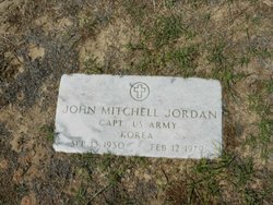
John Mitchell Jordan
| Birth | : | 13 Sep 1930 Horry County, South Carolina, USA |
| Death | : | 12 Feb 1979 Horry County, South Carolina, USA |
| Burial | : | Mount Ararat Cemetery, Point, Union Parish, USA |
| Coordinate | : | 32.6544400, -92.3416700 |
frequently asked questions (FAQ):
-
Where is John Mitchell Jordan's memorial?
John Mitchell Jordan's memorial is located at: Mount Ararat Cemetery, Point, Union Parish, USA.
-
When did John Mitchell Jordan death?
John Mitchell Jordan death on 12 Feb 1979 in Horry County, South Carolina, USA
-
Where are the coordinates of the John Mitchell Jordan's memorial?
Latitude: 32.6544400
Longitude: -92.3416700
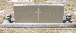
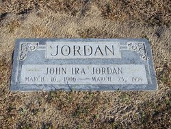
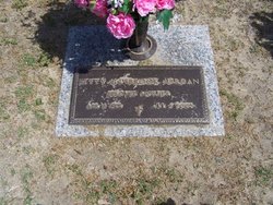
Family Members:
Parent
Spouse
Siblings
Flowers:
Nearby Cemetories:
1. Mount Ararat Cemetery
Point, Union Parish, USA
Coordinate: 32.6544400, -92.3416700
2. King Cemetery
Union Parish, USA
Coordinate: 32.6561012, -92.3392029
3. Mars Hill Cemetery
Union Parish, USA
Coordinate: 32.6328011, -92.3131027
4. Pleasant Grove Baptist Church Cemetery
Downsville, Union Parish, USA
Coordinate: 32.6156610, -92.3226750
5. Cedar Grove Cemetery
Union Parish, USA
Coordinate: 32.6856003, -92.3863983
6. Mount Nebo Cemetery
Downsville, Union Parish, USA
Coordinate: 32.6758900, -92.3965240
7. Smyrna Cemetery
Union Parish, USA
Coordinate: 32.6072006, -92.3771973
8. Ruggs Bluff Cemetery
Downsville, Union Parish, USA
Coordinate: 32.7052994, -92.3056030
9. Willhite Cemetery
Downsville, Union Parish, USA
Coordinate: 32.6185989, -92.2846985
10. Holmesville Baptist Church Cemetery
Union Parish, USA
Coordinate: 32.6937480, -92.3956580
11. Acree Cemetery
Point, Union Parish, USA
Coordinate: 32.6563988, -92.2683029
12. Downsville Cemetery
Downsville, Union Parish, USA
Coordinate: 32.6296997, -92.4150009
13. Lanes Chapel Baptist Church Cemetery
Downsville, Union Parish, USA
Coordinate: 32.6146760, -92.4084480
14. Carter Cemetery
Union Parish, USA
Coordinate: 32.6478004, -92.2593994
15. Spillers Cemetery
Union Parish, USA
Coordinate: 32.5868988, -92.3625031
16. Aulds Chapel Cemetery
Ouachita Parish, USA
Coordinate: 32.5805990, -92.3424000
17. Promised Land
Farmerville, Union Parish, USA
Coordinate: 32.7372000, -92.3198300
18. Shady Grove Cemetery
Farmerville, Union Parish, USA
Coordinate: 32.7378006, -92.2936020
19. Temple Family Cemetery
Crossroads, Union Parish, USA
Coordinate: 32.7097900, -92.2507000
20. Butler Cemetery
Calhoun, Ouachita Parish, USA
Coordinate: 32.5657997, -92.2949982
21. Enterprise Cemetery
Farmerville, Union Parish, USA
Coordinate: 32.7532997, -92.3233032
22. Millard Hill Church Cemetery
Farmerville, Union Parish, USA
Coordinate: 32.7113180, -92.4410910
23. Pleasant Valley Cemetery
Pleasant Valley, Ouachita Parish, USA
Coordinate: 32.5613900, -92.3894200
24. Feazel Cemetery
Farmerville, Union Parish, USA
Coordinate: 32.6986008, -92.4621964

