John Monroe Moore
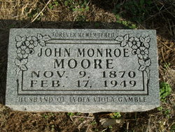
| Birth | : | 9 Nov 1870 Missouri, USA |
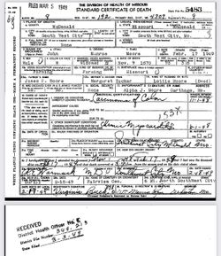
| Death | : | 17 Feb 1949 South West City, McDonald County, Missouri, USA |
| Burial | : | Sunnyhill Cemetery, Adair, Adair County, USA |
| Coordinate | : | 41.4907990, -94.6402969 |
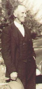
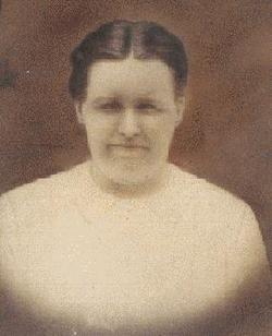
| Description | : | John Monroe Moore is buried next to his wife, Lydia (Littie) Viola Gamble Moore. He and Littie had six children: Loy Mae Moore, Vernie Haskel Moore, Alpha James Moore, Sylvia Irene Moore, Mary Lorene Moore, and Alma E. Moore. Anyone with more information about my relative is encouraged to contact me and to share by posting to this page. Thank you! Many thanks to Raylene for sharing this photo of John. |
frequently asked questions (FAQ):
-
Where is John Monroe Moore's memorial?
John Monroe Moore's memorial is located at: Sunnyhill Cemetery, Adair, Adair County, USA.
-
When did John Monroe Moore death?
John Monroe Moore death on 17 Feb 1949 in South West City, McDonald County, Missouri, USA
-
Where are the coordinates of the John Monroe Moore's memorial?
Latitude: 41.4907990
Longitude: -94.6402969
Family Members:
Parent
Spouse
Siblings
Children
Nearby Cemetories:
1. Sunnyhill Cemetery
Adair, Adair County, USA
Coordinate: 41.4907990, -94.6402969
2. Saint John's Catholic Cemetery
Adair, Adair County, USA
Coordinate: 41.4902992, -94.6425018
3. Immanuel Lutheran Cemetery
Adair, Guthrie County, USA
Coordinate: 41.5104000, -94.6431700
4. Saint Johns Cemetery
Brayton, Audubon County, USA
Coordinate: 41.5625000, -94.7019000
5. Saint Johns Lutheran Cemetery
Audubon, Audubon County, USA
Coordinate: 41.5625000, -94.7019000
6. Canby Cemetery
Walnut Township, Adair County, USA
Coordinate: 41.4178030, -94.5658250
7. Evergreen Cemetery
Anita, Cass County, USA
Coordinate: 41.4514008, -94.7528000
8. Saint Joseph's Cemetery
Walnut Township, Adair County, USA
Coordinate: 41.4986000, -94.5096970
9. Oakwood Cemetery
Walnut Township, Adair County, USA
Coordinate: 41.4977989, -94.5074997
10. Stanfield Cemetery
Casey, Guthrie County, USA
Coordinate: 41.5124870, -94.5016370
11. Spring Valley Cemetery
Casey, Guthrie County, USA
Coordinate: 41.5220000, -94.5046000
12. Pleasant Hill Cemetery
Audubon County, USA
Coordinate: 41.5806007, -94.7210999
13. Dalmanutha Cemetery
Guthrie Center, Guthrie County, USA
Coordinate: 41.5867004, -94.5543976
14. Eureka Cemetery
Eureka Township, Adair County, USA
Coordinate: 41.3736000, -94.6408005
15. Abandoned Timber Cemetery
Canby, Adair County, USA
Coordinate: 41.4833208, -94.4808020
16. Grove Cemetery
Oakfield, Audubon County, USA
Coordinate: 41.5462000, -94.7952000
17. Lutheran Cemetery
Prussia Township, Adair County, USA
Coordinate: 41.3956108, -94.5102768
18. Prussia Cemetery
Fontanelle, Adair County, USA
Coordinate: 41.3753014, -94.5278015
19. Highland Cemetery
Cass County, USA
Coordinate: 41.4907990, -94.8352966
20. Lincoln Center Cemetery
Anita, Cass County, USA
Coordinate: 41.3742000, -94.7668000
21. Bear Grove Cemetery
Guthrie Center, Guthrie County, USA
Coordinate: 41.6455994, -94.6194000
22. Highland Cemetery
Audubon County, USA
Coordinate: 41.5113983, -94.8581009
23. Bowen Cemetery
Audubon, Audubon County, USA
Coordinate: 41.5113600, -94.8585700
24. North Branch Cemetery
Guthrie County, USA
Coordinate: 41.6460000, -94.7222000

