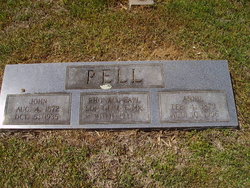
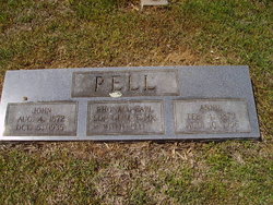
John Pell
| Birth | : | 4 Aug 1872 Missouri, USA |
| Death | : | 5 Oct 1935 |
| Burial | : | Belleville Cemetery, Lockesburg, Sevier County, USA |
| Coordinate | : | 33.9380989, -94.1694031 |
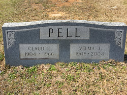
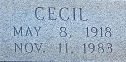
| Description | : | John Pell Event Type: Census Event Date: 1920 Event Place: McKey, Sequoyah, Oklahoma, United States Household Role Sex Age Birthplace John Pell Head Male 44 Missouri Anna Pell Wife Female 36 Arkansas Ider Pell Daughter Female 18 Oklahoma Claud Pell Son Male 16 Oklahoma Pearley Pell Daughter Female 15 Oklahoma Willie Pell Son Male 12 Oklahoma Clide Pell Son Male 8 Oklahoma Cecil Pell Son Male 2 Oklahoma Linard Croson Laborer Male 16 Arkansas |
frequently asked questions (FAQ):
-
Where is John Pell's memorial?
John Pell's memorial is located at: Belleville Cemetery, Lockesburg, Sevier County, USA.
-
When did John Pell death?
John Pell death on 5 Oct 1935 in
-
Where are the coordinates of the John Pell's memorial?
Latitude: 33.9380989
Longitude: -94.1694031
Family Members:
Spouse
Children
Flowers:
Nearby Cemetories:
1. Belleville Cemetery
Lockesburg, Sevier County, USA
Coordinate: 33.9380989, -94.1694031
2. Sand Field Cemetery
Lockesburg, Sevier County, USA
Coordinate: 33.9611015, -94.1406021
3. Coulter Memorial Garden
Lockesburg, Sevier County, USA
Coordinate: 33.9736830, -94.1691510
4. Odd Fellows Cemetery
Lockesburg, Sevier County, USA
Coordinate: 33.9745407, -94.1683731
5. Lockesburg Cemetery
Lockesburg, Sevier County, USA
Coordinate: 33.9752998, -94.1688995
6. Williamson Cemetery
Sevier County, USA
Coordinate: 33.8999760, -94.1453510
7. Old Union Cemetery
Lockesburg, Sevier County, USA
Coordinate: 33.9838982, -94.1408005
8. Kingree Chapel Cemetery
Sevier County, USA
Coordinate: 33.9589005, -94.1044006
9. Holly Springs Cemetery
Sevier County, USA
Coordinate: 33.9725680, -94.1134310
10. Falls Chapel Cemetery
Lockesburg, Sevier County, USA
Coordinate: 33.8586006, -94.1605988
11. Hopson Cemetery
Sevier County, USA
Coordinate: 33.8535995, -94.1722031
12. Millwee Cemetery
Sevier County, USA
Coordinate: 33.9477997, -94.2711029
13. Mount Ida Cemetery
Sevier County, USA
Coordinate: 33.9928017, -94.2493973
14. Old Center Cemetery
De Queen, Sevier County, USA
Coordinate: 33.9007630, -94.2639610
15. Rice Cemetery
Sevier County, USA
Coordinate: 33.8746986, -94.0883026
16. Wright's Chapel Cemetery
Cowlingsville, Sevier County, USA
Coordinate: 33.8748960, -94.0880330
17. Wright Cemetery
Ben Lomond, Sevier County, USA
Coordinate: 33.8421900, -94.1367820
18. McHorse Cemetery
Sevier County, USA
Coordinate: 34.0258323, -94.1110505
19. New Bethel Cemetery
Sevier County, USA
Coordinate: 34.0424995, -94.1722031
20. Woffords Chapel Cemetery
Sevier County, USA
Coordinate: 34.0386009, -94.2241974
21. Ben Lomond Cemetery
Ben Lomond, Sevier County, USA
Coordinate: 33.8246994, -94.1156006
22. Beacon Hill Cemetery
De Queen, Sevier County, USA
Coordinate: 33.9930400, -94.3021320
23. Clear Creek Cemetery
Sevier County, USA
Coordinate: 33.9350014, -94.3181000
24. Piney Grove Cemetery
De Queen, Sevier County, USA
Coordinate: 34.0635986, -94.1616974

