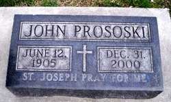
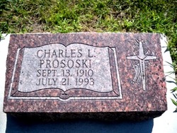
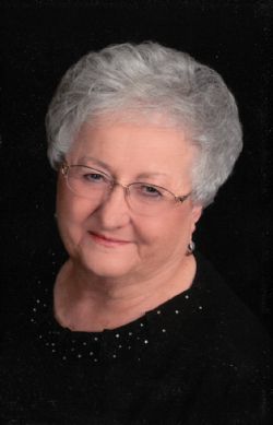
John Prososki
| Birth | : | 12 Jun 1905 Krakow, Nance County, Nebraska, USA |
| Death | : | 31 Dec 2000 Columbus, Platte County, Nebraska, USA |
| Burial | : | Glenwood Cemetery, East Greenwich, Kent County, USA |
| Coordinate | : | 41.6550900, -71.4645200 |
| Description | : | Son of John W. & Veronica (Kmiecik) Prososki. Married to Rose Tarnick. He was a farmer near Fullerton, until 1972 when they moved to Columbus and John went to work for John Deere Company until he retired. Was a member of the Prososki Orchestra and played the Violin. |
frequently asked questions (FAQ):
-
Where is John Prososki's memorial?
John Prososki's memorial is located at: Glenwood Cemetery, East Greenwich, Kent County, USA.
-
When did John Prososki death?
John Prososki death on 31 Dec 2000 in Columbus, Platte County, Nebraska, USA
-
Where are the coordinates of the John Prososki's memorial?
Latitude: 41.6550900
Longitude: -71.4645200
Family Members:
Parent
Spouse
Siblings
Children
Flowers:
Nearby Cemetories:
1. Glenwood Cemetery
East Greenwich, Kent County, USA
Coordinate: 41.6550900, -71.4645200
2. Daniel Howland Lot
East Greenwich, Kent County, USA
Coordinate: 41.6564331, -71.4653168
3. Captain Samuel Fry Lot
East Greenwich, Kent County, USA
Coordinate: 41.6567039, -71.4653168
4. Payne-Spencer Lot
East Greenwich, Kent County, USA
Coordinate: 41.6566772, -71.4657288
5. Saint Patrick Cemetery
East Greenwich, Kent County, USA
Coordinate: 41.6522179, -71.4576416
6. East Greenwich Cemetery
East Greenwich, Kent County, USA
Coordinate: 41.6553345, -71.4551392
7. Nichols Lot
East Greenwich, Kent County, USA
Coordinate: 41.6505810, -71.4751300
8. Clement Weaver Lot
East Greenwich, Kent County, USA
Coordinate: 41.6620800, -71.4743700
9. Gertrude Parker Stone
East Greenwich, Kent County, USA
Coordinate: 41.6593490, -71.4521600
10. Quaker Lot
East Greenwich, Kent County, USA
Coordinate: 41.6602500, -71.4524600
11. Henry Spencer Lot
East Greenwich, Kent County, USA
Coordinate: 41.6471980, -71.4743470
12. Saint Lukes Episcopal Churchyard
East Greenwich, Kent County, USA
Coordinate: 41.6614456, -71.4518433
13. Governor Greene Cemetery
Warwick, Kent County, USA
Coordinate: 41.6661000, -71.4594300
14. Captain Joseph Spencer Lot
Warwick, Kent County, USA
Coordinate: 41.6456108, -71.4551392
15. Doctor Peter Turner Lot (Defunct)
East Greenwich, Kent County, USA
Coordinate: 41.6628700, -71.4525360
16. Peirce-Spencer Lot
East Greenwich, Kent County, USA
Coordinate: 41.6422500, -71.4683610
17. Spencer Lot
East Greenwich, Kent County, USA
Coordinate: 41.6460533, -71.4808731
18. Baptist Burial Ground
East Greenwich, Kent County, USA
Coordinate: 41.6631241, -71.4467926
19. East Greenwich Swedish Cemetery
East Greenwich, Kent County, USA
Coordinate: 41.6628900, -71.4826600
20. Lutheran Church Cemetery
East Greenwich, Kent County, USA
Coordinate: 41.6628680, -71.4828150
21. Oliver Wickes Lot
East Greenwich, Kent County, USA
Coordinate: 41.6629524, -71.4834213
22. Anthony Hall Lot
East Greenwich, Kent County, USA
Coordinate: 41.6622500, -71.4839280
23. Major General Thomas Holden Lot
Warwick, Kent County, USA
Coordinate: 41.6636300, -71.4850800
24. Major Pardon Potter Lot
Warwick, Kent County, USA
Coordinate: 41.6728610, -71.4705830

