

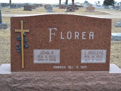
John R. Florea
| Birth | : | 11 Feb 1903 Nodaway County, Missouri, USA |
| Death | : | 17 Mar 1998 Aurora, Hamilton County, Nebraska, USA |
| Burial | : | Stillman-Crandall Lot, Westerly, Washington County, USA |
| Coordinate | : | 41.4019305, -71.8114270 |
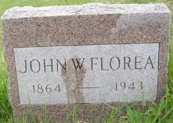
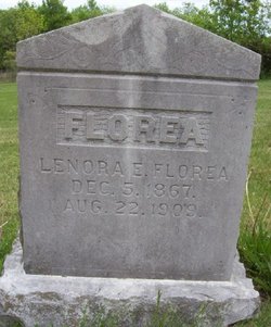
| Description | : | John R. Florea, the son of John William and Lenora (Killam) Florea, was born near Hopkins, Missouri, on February 11, 1903, and died at Aurora, Nebraska on March 17, 1998 at the age of 95 years, 1 month, and 6 days. He grew up and received his education near Hopkins. His mother died when he was six years old, and the family was separated and placed with other families. He stayed with neighbors and worked as a farm hand in the area. Following a short stint in the Army, he and a friend came to Aurora in 1923,... Read More |
frequently asked questions (FAQ):
-
Where is John R. Florea's memorial?
John R. Florea's memorial is located at: Stillman-Crandall Lot, Westerly, Washington County, USA.
-
When did John R. Florea death?
John R. Florea death on 17 Mar 1998 in Aurora, Hamilton County, Nebraska, USA
-
Where are the coordinates of the John R. Florea's memorial?
Latitude: 41.4019305
Longitude: -71.8114270
Family Members:
Parent
Spouse
Siblings
Children

Flowers:


Nearby Cemetories:
1. Stillman-Crandall Lot
Westerly, Washington County, USA
Coordinate: 41.4019305, -71.8114270
2. First Hopkinton Cemetery
Hopkinton, Washington County, USA
Coordinate: 41.4009094, -71.7971878
3. Knowles Ground (Defunct)
Westerly, Washington County, USA
Coordinate: 41.4018330, -71.7970000
4. Peleg Saunders Ground #4 (Defunct)
Westerly, Washington County, USA
Coordinate: 41.4018330, -71.7970000
5. Cordner Ground (Defunct)
Westerly, Washington County, USA
Coordinate: 41.4018800, -71.7969810
6. Austin Ground
Westerly, Washington County, USA
Coordinate: 41.3928120, -71.8196550
7. Clark Ground
Westerly, Washington County, USA
Coordinate: 41.3958060, -71.7991390
8. Captain Clark Lamphear Ground
Westerly, Washington County, USA
Coordinate: 41.3924170, -71.8200280
9. Clark Ground
Westerly, Washington County, USA
Coordinate: 41.3913310, -71.8030920
10. Pardon Lewis Ground
Westerly, Washington County, USA
Coordinate: 41.4014700, -71.8288700
11. Frazier Lot
Westerly, Washington County, USA
Coordinate: 41.3865830, -71.8135000
12. Brumley Ground
Westerly, Washington County, USA
Coordinate: 41.3907220, -71.8282220
13. Lamphear Ground
Westerly, Washington County, USA
Coordinate: 41.4031940, -71.8343890
14. Citizen Ground
Westerly, Washington County, USA
Coordinate: 41.3886680, -71.8296100
15. Simeon Pendleton Ground
Westerly, Washington County, USA
Coordinate: 41.3886670, -71.8296110
16. Vose Lot
Westerly, Washington County, USA
Coordinate: 41.3825000, -71.8028330
17. Childrens Ground
Westerly, Washington County, USA
Coordinate: 41.4015670, -71.8387240
18. Sumner Chapman Lot #2
Westerly, Washington County, USA
Coordinate: 41.3847500, -71.7945280
19. Lewis Cemetery
North Stonington, New London County, USA
Coordinate: 41.4234543, -71.8172226
20. New Saint Michael Cemetery
Pawcatuck, New London County, USA
Coordinate: 41.3881798, -71.8342819
21. Saint Michael Cemetery
New London County, USA
Coordinate: 41.3885994, -71.8360977
22. Dixon Burial Ground
Westerly, Washington County, USA
Coordinate: 41.3828530, -71.8282830
23. Babcock Ground #2
Westerly, Washington County, USA
Coordinate: 41.3802380, -71.8252730
24. Hardy Ground
Westerly, Washington County, USA
Coordinate: 41.3775490, -71.8026650