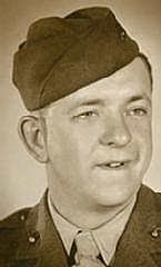
John Richard DeVore
| Birth | : | 2 Aug 1923 Lane, Franklin County, Kansas, USA |
| Death | : | 14 Aug 2011 Paola, Miami County, Kansas, USA |
| Burial | : | Estes Park Cemetery, Easton, Aroostook County, USA |
| Coordinate | : | 46.6418110, -67.9181820 |
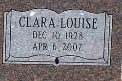
| Description | : | John Richard DeVore, Osawatomie, died Aug 14, 2011, at the North Point Nursing Home in Paola. John was born Aug 2, 1923, in Lane to John Orson and Vida Cooley DeVore. He grew up in the area and, on Mar 10, 1944, he enlisted in the United States Marine Corps. He served two years and received his honorable discharge in May of 1946 after reaching the rank of corporal. On Dec 24, 1946, he was united in marriage to Clara Louise Swearingen in Burlington.They made their home in Osawatomie. He was employed with the Phillips Petroleum Company as an electrician from Mar 3, 1942,... Read More |
frequently asked questions (FAQ):
-
Where is John Richard DeVore's memorial?
John Richard DeVore's memorial is located at: Estes Park Cemetery, Easton, Aroostook County, USA.
-
When did John Richard DeVore death?
John Richard DeVore death on 14 Aug 2011 in Paola, Miami County, Kansas, USA
-
Where are the coordinates of the John Richard DeVore's memorial?
Latitude: 46.6418110
Longitude: -67.9181820
Family Members:
Parent
Spouse
Siblings
Flowers:
Nearby Cemetories:
1. Estes Park Cemetery
Easton, Aroostook County, USA
Coordinate: 46.6418110, -67.9181820
2. Mount Shiloh Cemetery
Easton, Aroostook County, USA
Coordinate: 46.6362460, -67.8670810
3. Pine Tree Cemetery
Easton, Aroostook County, USA
Coordinate: 46.6774640, -67.8727940
4. Knight Cemetery
Fort Fairfield, Aroostook County, USA
Coordinate: 46.6876150, -67.8778140
5. Bartlett Cemetery
Presque Isle, Aroostook County, USA
Coordinate: 46.6765327, -67.9827118
6. Fairmount Cemetery
Presque Isle, Aroostook County, USA
Coordinate: 46.6628075, -68.0077744
7. Ladner Cemetery
Easton, Aroostook County, USA
Coordinate: 46.6444170, -67.8149570
8. Reuben Bean Family Cemetery
Aroostook County, USA
Coordinate: 46.7141610, -67.9514610
9. Saint Marys Chapman Street Cemetery
Presque Isle, Aroostook County, USA
Coordinate: 46.6754150, -68.0215990
10. Marshall Cemetery
Westfield, Aroostook County, USA
Coordinate: 46.5635986, -67.9464035
11. Saint Marys Cemetery
Presque Isle, Aroostook County, USA
Coordinate: 46.6930930, -68.0104730
12. Haines Maple Grove Cemetery
Fort Fairfield, Aroostook County, USA
Coordinate: 46.7233160, -67.8699040
13. Pierce Cemetery
Mars Hill, Aroostook County, USA
Coordinate: 46.5602989, -67.8692017
14. Johnson Cemetery
Presque Isle, Aroostook County, USA
Coordinate: 46.7078209, -68.0069733
15. Beaconsfield Baptist Church Cemetery
Beaconsfield, Victoria County, Canada
Coordinate: 46.6640360, -67.7803850
16. Bean Family Cemetery
Aroostook County, USA
Coordinate: 46.7396440, -67.9542600
17. Kings Grove Cemetery
Mars Hill, Aroostook County, USA
Coordinate: 46.5325012, -67.8557968
18. Union Cemetery
Fort Fairfield, Aroostook County, USA
Coordinate: 46.7566150, -67.8655240
19. Harvey Hill Cemetery
McShea, Aroostook County, USA
Coordinate: 46.7567099, -67.8652997
20. River de Chute Cemetery
Carleton County, Canada
Coordinate: 46.5935500, -67.7500700
21. Snow Cemetery
Mars Hill, Aroostook County, USA
Coordinate: 46.5172480, -67.8843660
22. Bairdsville Anglican Cemetery
Bairdsville, Victoria County, Canada
Coordinate: 46.6269606, -67.7164698
23. Bishop Cemetery
Kilburn, Victoria County, Canada
Coordinate: 46.6748150, -67.7192446
24. Kilburn Community Cemetery
Kilburn, Victoria County, Canada
Coordinate: 46.6406400, -67.7061800


