
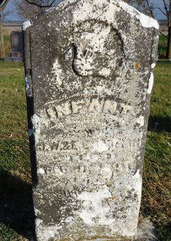
John Rodman
| Birth | : | 11 Jan 1891 Carroll County, Iowa, USA |
| Death | : | 26 Jan 1891 Carroll County, Iowa, USA |
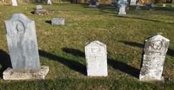
| Burial | : | East Liberty Cemetery, Lidderdale, Carroll County, USA |
| Coordinate | : | 42.1591988, -94.7636032 |
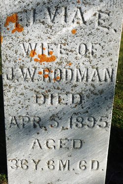
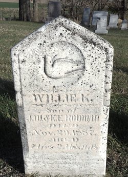
| Description | : | John was the son of Joseph Wright Rodman and Elvia E Snyder. |
frequently asked questions (FAQ):
-
Where is John Rodman's memorial?
John Rodman's memorial is located at: East Liberty Cemetery, Lidderdale, Carroll County, USA.
-
When did John Rodman death?
John Rodman death on 26 Jan 1891 in Carroll County, Iowa, USA
-
Where are the coordinates of the John Rodman's memorial?
Latitude: 42.1591988
Longitude: -94.7636032
Family Members:
Parent
Siblings

Flowers:


Nearby Cemetories:
1. East Liberty Cemetery
Lidderdale, Carroll County, USA
Coordinate: 42.1591988, -94.7636032
2. Immanuel Cemetery
Lidderdale, Carroll County, USA
Coordinate: 42.1389008, -94.8022003
3. Lanesboro Cemetery
Lanesboro, Carroll County, USA
Coordinate: 42.1810989, -94.7230988
4. Holy Family Cemetery
Lidderdale, Carroll County, USA
Coordinate: 42.1178017, -94.7839966
5. Dickson Cemetery
Glidden Township, Carroll County, USA
Coordinate: 42.1074982, -94.6939011
6. North Coon Cemetery
Carroll County, USA
Coordinate: 42.1260986, -94.6716995
7. Cottonwood Cemetery
Lake City, Calhoun County, USA
Coordinate: 42.2491989, -94.7936020
8. West Lawn Cemetery
Glidden, Carroll County, USA
Coordinate: 42.0649986, -94.7406006
9. Our Lady Of Mount Carmel Cemetery
Mount Carmel, Carroll County, USA
Coordinate: 42.1547012, -94.9088974
10. Bishop Cemetery
Calhoun Township, Calhoun County, USA
Coordinate: 42.2230400, -94.6453190
11. Lake City Cemetery
Lake City, Calhoun County, USA
Coordinate: 42.2719002, -94.7574997
12. Saint Marys Catholic Cemetery
Lake City, Calhoun County, USA
Coordinate: 42.2730000, -94.7567000
13. Carroll City Cemetery
Carroll, Carroll County, USA
Coordinate: 42.0560963, -94.8599856
14. Mount Olivet Cemetery
Carroll, Carroll County, USA
Coordinate: 42.0536340, -94.8595510
15. Luckow Cemetery
Auburn, Sac County, USA
Coordinate: 42.2168999, -94.9266968
16. Saint Marys Cemetery
Sac County, USA
Coordinate: 42.2611008, -94.8839035
17. Oak Lawn Cemetery
Auburn, Sac County, USA
Coordinate: 42.2611008, -94.8852997
18. Dillavou Cemetery
Kendrick Township, Greene County, USA
Coordinate: 42.0802994, -94.6138992
19. Saint Francis Cemetery
Maple River, Carroll County, USA
Coordinate: 42.0969009, -94.9372025
20. Grant City Cemetery
Grant City, Sac County, USA
Coordinate: 42.2681007, -94.8908005
21. Saint Bernards Cemetery
Breda, Carroll County, USA
Coordinate: 42.1786003, -94.9732971
22. Saint Patricks Cemetery
Churdan, Greene County, USA
Coordinate: 42.1605988, -94.5511017
23. Old Cedar Cemetery
Adaza, Greene County, USA
Coordinate: 42.1874821, -94.5419194
24. Saint Marys Catholic Cemetery
Willey, Carroll County, USA
Coordinate: 41.9783363, -94.8212204