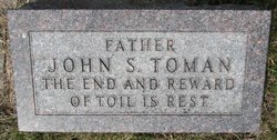
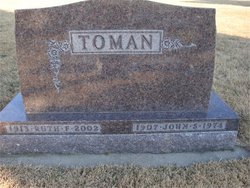
John Stuart Toman
| Birth | : | 23 Mar 1907 Plattsmouth, Cass County, Nebraska, USA |
| Death | : | 24 Mar 1974 Omaha, Douglas County, Nebraska, USA |
| Burial | : | Manahath Cemetery, Glassboro, Gloucester County, USA |
| Coordinate | : | 39.7154236, -75.1141129 |
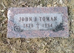
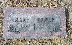
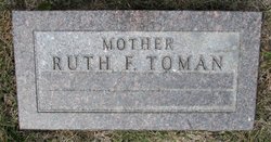
| Description | : | John Stuart Toman, a native of Plattsmouth, died March 25 at a hospital in Omaha. Mr. Toman was born March 23, 1907. His parents were John J. and Mary (Severin) Toman. He was married June 16, 1934 to Ruth F. Rotter. Mr. Toman was a member of the Holy Rosary Church, Plattsmouth. His survivors are his widow, Ruth; three sons, John R. of Santa Barbara, Calif., William A. of Plattsmouth, Charles R. of Troy Mich., and Edward J., also of Plattsmouth; two daughters, Mrs. John (Margaret) Hilgerson of Ames, Iowa, and Mrs. Cher (Jeanne) Gilbronson of Malvern, Iowa; two... Read More |
frequently asked questions (FAQ):
-
Where is John Stuart Toman's memorial?
John Stuart Toman's memorial is located at: Manahath Cemetery, Glassboro, Gloucester County, USA.
-
When did John Stuart Toman death?
John Stuart Toman death on 24 Mar 1974 in Omaha, Douglas County, Nebraska, USA
-
Where are the coordinates of the John Stuart Toman's memorial?
Latitude: 39.7154236
Longitude: -75.1141129
Family Members:
Parent
Spouse
Siblings
Children
Flowers:
Nearby Cemetories:
1. Manahath Cemetery
Glassboro, Gloucester County, USA
Coordinate: 39.7154236, -75.1141129
2. Saint Thomas Episcopal Church Cemetery
Glassboro, Gloucester County, USA
Coordinate: 39.7079200, -75.1101500
3. First United Methodist Church Cemetery
Glassboro, Gloucester County, USA
Coordinate: 39.7068900, -75.1081300
4. Saint Bridgets Cemetery
Glassboro, Gloucester County, USA
Coordinate: 39.7023300, -75.1159000
5. Trinity Bible Cemetery
Glassboro, Gloucester County, USA
Coordinate: 39.7003610, -75.1133800
6. Cost Family Cemetery
Pitman, Gloucester County, USA
Coordinate: 39.7307100, -75.1332310
7. Hillcrest Memorial Park
Hurffville, Gloucester County, USA
Coordinate: 39.7491989, -75.1110992
8. Bunker Hill Presbyterian Church Cemetery
Gloucester County, USA
Coordinate: 39.7451600, -75.0849200
9. Richwood United Methodist Church Cemetery
Richwood, Gloucester County, USA
Coordinate: 39.7211100, -75.1667700
10. Land Of Canaan Cemetery
Glassboro, Gloucester County, USA
Coordinate: 39.6741982, -75.1085968
11. Bethel Methodist Church Cemetery
Hurffville, Gloucester County, USA
Coordinate: 39.7571983, -75.1110992
12. Aura Methodist Cemetery
Aura, Gloucester County, USA
Coordinate: 39.6725006, -75.1374969
13. Downer United Methodist Church Cemetery
Williamstown, Gloucester County, USA
Coordinate: 39.6929700, -75.0523200
14. Mount Zion Methodist Church Cemetery
Barnsboro, Gloucester County, USA
Coordinate: 39.7547540, -75.1629530
15. Driver Cemetery
Barnsboro, Gloucester County, USA
Coordinate: 39.7631000, -75.1554900
16. Cedar Green Cemetery
Clayton, Gloucester County, USA
Coordinate: 39.6613998, -75.0852966
17. Gloucester County Veterans Memorial Cemetery
Williamstown, Gloucester County, USA
Coordinate: 39.6521279, -75.1163586
18. Bunker Hill Presbyterian Church Cemetery
Sewell, Gloucester County, USA
Coordinate: 39.7767514, -75.0931293
19. Jesse Chew Cemetery
Gloucester County, USA
Coordinate: 39.7736800, -75.1498250
20. Cross Keys Methodist Cemetery
Williamstown, Gloucester County, USA
Coordinate: 39.7124800, -75.0273100
21. Saint Johns United Methodist Cemetery
Turnersville, Gloucester County, USA
Coordinate: 39.7598300, -75.0487100
22. Hardingville Cemetery
Hardingville, Gloucester County, USA
Coordinate: 39.6632100, -75.1790400
23. Alms House Cemetery
Lakeland, Camden County, USA
Coordinate: 39.7878700, -75.0823500
24. Grenloch First Presbyterian Church Memorial Garden
Grenloch Terrace, Gloucester County, USA
Coordinate: 39.7806000, -75.0587000

