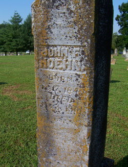
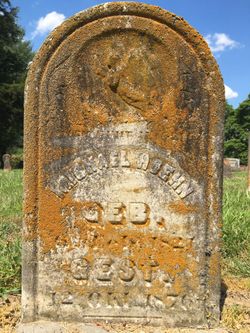
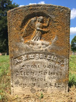
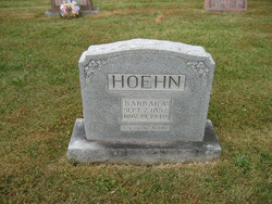
John V. Hoehn
| Birth | : | 17 Feb 1848 Perry County, Missouri, USA |
| Death | : | 3 Feb 1901 |
| Burial | : | East Street Cemetery, Petersham, Worcester County, USA |
| Coordinate | : | 42.4907990, -72.1750031 |
| Plot | : | Row 9 - Tombstone 132 |
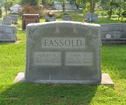
| Description | : | Hoehn, John V. Born 17 February 1848. Son of Michael George and Anna Margaret Bergmann Hoehn. Married Margareta "Barbara" Fassold, widow of Peter "Beda" Fassold 6 November 1877 by Rev. P. H. Holtermann. Was in the record book of 1881. Four of their children married four children of John Boxdorfer. Died 3 February 1901. Buried in Peace Lutheran Cemetery. Friedenberg, Missouri. Friedenberg Remembrances A Story of Peace, Faith and Life Friedenberg Biogaraphies Pages 201-292 |
frequently asked questions (FAQ):
-
Where is John V. Hoehn's memorial?
John V. Hoehn's memorial is located at: East Street Cemetery, Petersham, Worcester County, USA.
-
When did John V. Hoehn death?
John V. Hoehn death on 3 Feb 1901 in
-
Where are the coordinates of the John V. Hoehn's memorial?
Latitude: 42.4907990
Longitude: -72.1750031
Family Members:
Parent
Spouse
Siblings
Children
Flowers:
Nearby Cemetories:
1. East Street Cemetery
Petersham, Worcester County, USA
Coordinate: 42.4907990, -72.1750031
2. Petersham Center Cemetery
Petersham, Worcester County, USA
Coordinate: 42.4877720, -72.1861520
3. Ledgeville Cemetery
Petersham, Worcester County, USA
Coordinate: 42.4897500, -72.1587300
4. Coolidge Cemetery
Petersham, Worcester County, USA
Coordinate: 42.4651500, -72.2020800
5. West Street Cemetery
Petersham, Worcester County, USA
Coordinate: 42.4881900, -72.2216500
6. Harvard Cemetery
Petersham, Worcester County, USA
Coordinate: 42.5305000, -72.1896100
7. Williams Cemetery
Petersham, Worcester County, USA
Coordinate: 42.4786500, -72.1148400
8. Northwest Cemetery
Petersham, Worcester County, USA
Coordinate: 42.5210991, -72.2268982
9. Nichewaug Cemetery
Petersham, Worcester County, USA
Coordinate: 42.4431700, -72.1930600
10. South Cemetery
Phillipston, Worcester County, USA
Coordinate: 42.5318985, -72.1267014
11. Stratton Cemetery
Athol, Worcester County, USA
Coordinate: 42.5407872, -72.2151265
12. New Sherborn Cemetery
Athol, Worcester County, USA
Coordinate: 42.5402985, -72.2166977
13. Adams Road Cemetery
Athol, Worcester County, USA
Coordinate: 42.5425560, -72.2133610
14. Number 9 Cemetery
Barre, Worcester County, USA
Coordinate: 42.4725000, -72.0910800
15. Harty Cemetery
Hubbardston, Worcester County, USA
Coordinate: 42.4791550, -72.0888520
16. Upper Cemetery
Phillipston, Worcester County, USA
Coordinate: 42.5512820, -72.1339770
17. Lower Cemetery
Phillipston, Worcester County, USA
Coordinate: 42.5583000, -72.1425018
18. Fay Cemetery
Athol, Worcester County, USA
Coordinate: 42.5466300, -72.2364200
19. Number 10 Cemetery
Barre, Worcester County, USA
Coordinate: 42.4176300, -72.1782400
20. Ellinwood Cemetery
Athol, Worcester County, USA
Coordinate: 42.5589400, -72.2142600
21. Lincoln Cemetery
Barre, Worcester County, USA
Coordinate: 42.4313120, -72.1125470
22. Jenkins Cemetery
Barre, Worcester County, USA
Coordinate: 42.4157000, -72.1573900
23. Brown's Family Cemetery (Defunct)
Dana, Worcester County, USA
Coordinate: 42.4229200, -72.2223600
24. Dana Center Cemetery (Defunct)
Dana, Worcester County, USA
Coordinate: 42.4222300, -72.2275700

