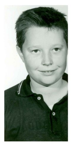
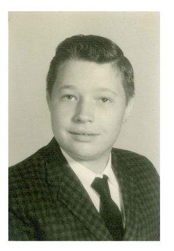
Johnny Ray Handy
| Birth | : | 7 Mar 1948 Mount Airy, Surry County, North Carolina, USA |
| Death | : | 9 Oct 2004 Mount Airy, Surry County, North Carolina, USA |
| Burial | : | Gore Cemetery, Gore, Gore District, New Zealand |
| Coordinate | : | -46.0900000, 168.9360000 |
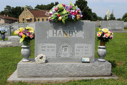
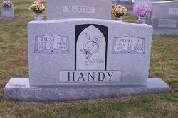
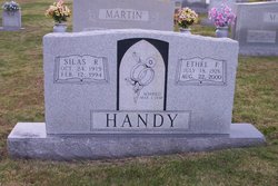
| Description | : | MOUNT AIRY - Mr. Johnny Ray Handy, 56, of 270 Noonkester Drive, Mount Airy, passed away Saturday, Oct. 9, 2004, at Northern Surry Hospital. He was born March 7, 1948, in Surry County to the late Silas Reid Handy and Ethel Flippin Handy. He was a diesel mechanic for Dobson Trucking and a member of White Plains Baptist Church. He is survived by his wife, Mary Frances Johnson Handy of the home; two daughters and a son-in-law, April Handy Worrell of the home and Donna and Mark Shelton of Mount Airy; three grandchildren, Joshua Ray Worrell, Scarlet Shelton and Clay... Read More |
frequently asked questions (FAQ):
-
Where is Johnny Ray Handy's memorial?
Johnny Ray Handy's memorial is located at: Gore Cemetery, Gore, Gore District, New Zealand.
-
When did Johnny Ray Handy death?
Johnny Ray Handy death on 9 Oct 2004 in Mount Airy, Surry County, North Carolina, USA
-
Where are the coordinates of the Johnny Ray Handy's memorial?
Latitude: -46.0900000
Longitude: 168.9360000
Family Members:
Parent
Siblings
Flowers:
Nearby Cemetories:
1. Gore Cemetery
Gore, Gore District, New Zealand
Coordinate: -46.0900000, 168.9360000
2. Charlton Park Cemetery
Gore, Gore District, New Zealand
Coordinate: -46.1265490, 168.8992730
3. Mataura Cemetery
Mataura, Gore District, New Zealand
Coordinate: -46.2016960, 168.8808060
4. Pukerau Cemetery
Pukerau, Gore District, New Zealand
Coordinate: -46.0989170, 169.1057690
5. Otaraia Cemetery
Gore District, New Zealand
Coordinate: -46.1978780, 169.0815990
6. Waikoikoi Cemetery
Waikoikoi, Clutha District, New Zealand
Coordinate: -46.0257040, 169.1568238
7. Waikaka Cemetery
Waikaka, Gore District, New Zealand
Coordinate: -45.9312400, 169.0188900
8. Waipahi Cemetery
Waipahi, Clutha District, New Zealand
Coordinate: -46.1019420, 169.2380910
9. Riversdale Cemetery
Riversdale, Southland District, New Zealand
Coordinate: -45.9180100, 168.7263600
10. Wyndham Cemetery
Wyndham, Southland District, New Zealand
Coordinate: -46.3147020, 168.8823690
11. Edendale Cemetery
Edendale, Southland District, New Zealand
Coordinate: -46.3080400, 168.7327360
12. Tapanui Cemetery
Tapanui, Clutha District, New Zealand
Coordinate: -45.9425830, 169.2832320
13. Clinton Cemetery
Clinton, Clutha District, New Zealand
Coordinate: -46.1971400, 169.3638100
14. Balfour Cemetery
Balfour, Southland District, New Zealand
Coordinate: -45.8391000, 168.5986640
15. Mokoreta Cemetery
Southland District, New Zealand
Coordinate: -46.4332000, 169.0649650
16. Crookston Cemetery
Heriot, Clutha District, New Zealand
Coordinate: -45.8375170, 169.3251600
17. Waikaia Cemetery
Waikaia, Southland District, New Zealand
Coordinate: -45.7169300, 168.8490600
18. Woodlands Cemetery
Woodlands, Southland District, New Zealand
Coordinate: -46.3568800, 168.5463770
19. Forest Hill Cemetery
Southland District, New Zealand
Coordinate: -46.2049720, 168.3969970
20. East Winton Cemetery
Winton, Southland District, New Zealand
Coordinate: -46.1374640, 168.3557030
21. Tuapeka Mouth Cemetery
Tuapeka Mouth, Clutha District, New Zealand
Coordinate: -46.0173020, 169.5216880
22. Winton Cemetery
Winton, Southland District, New Zealand
Coordinate: -46.1289300, 168.3250400
23. Dipton Cemetery
Dipton, Southland District, New Zealand
Coordinate: -45.8957730, 168.3508000
24. Quarry Hills Cemetery
Quarry Hills, Southland District, New Zealand
Coordinate: -46.5433100, 169.0398300

