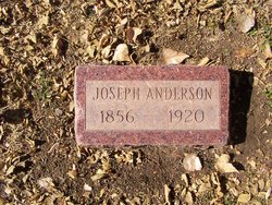
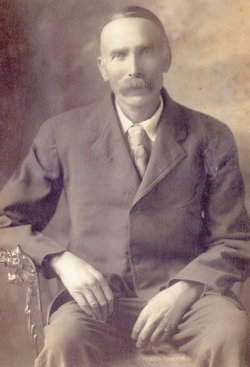
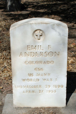
Joseph Anderson
| Birth | : | 1856 |
| Death | : | 29 Sep 1920 |
| Burial | : | Washington Grove Cemetery, Chana, Ogle County, USA |
| Coordinate | : | 41.9315262, -89.2565842 |
| Plot | : | East Lot 1 Block H Space 6 |
| Description | : | Joseph was born in Dalskog, Alvsborg County, Sweden, November 11, 1844. This is in the Western area of Sweden known as Dalsland, near Lake Vanern. Joseph immigrated to America in 1871, following his brother Anders(Andrew) to Blue Rapids, Marshall county,Kansas, where he is found on the 1880 census residing at their home and only 9 houses away from his future wife Emma. He and Emma were married at his brothers home in Blue Rapids, on May 24, 1881. Shrotly thereafter he and Emma moved to the busteling and growing city of Pueblo Colorado. Joseph's occupation... Read More |
frequently asked questions (FAQ):
-
Where is Joseph Anderson's memorial?
Joseph Anderson's memorial is located at: Washington Grove Cemetery, Chana, Ogle County, USA.
-
When did Joseph Anderson death?
Joseph Anderson death on 29 Sep 1920 in
-
Where are the coordinates of the Joseph Anderson's memorial?
Latitude: 41.9315262
Longitude: -89.2565842
Family Members:
Spouse
Children
Flowers:
Nearby Cemetories:
1. Washington Grove Cemetery
Chana, Ogle County, USA
Coordinate: 41.9315262, -89.2565842
2. Chapel Hill Cemetery
Chana, Ogle County, USA
Coordinate: 41.9310989, -89.2491989
3. Lighthouse Cemetery
Daysville, Ogle County, USA
Coordinate: 41.9466667, -89.3023300
4. Daysville Cemetery
Daysville, Ogle County, USA
Coordinate: 41.9742012, -89.3182983
5. Cooley Cemetery
Chana, Ogle County, USA
Coordinate: 41.9692001, -89.1746979
6. Ashton Cemetery
Ashton, Lee County, USA
Coordinate: 41.8600006, -89.2249985
7. County Farm Cemetery
Oregon, Ogle County, USA
Coordinate: 41.9919014, -89.3328018
8. Franklin Grove Cemetery
Franklin Grove, Lee County, USA
Coordinate: 41.8440018, -89.3059998
9. Flagg Center Cemetery
Flagg Center, Ogle County, USA
Coordinate: 41.9399986, -89.1294022
10. Stinsonian Cemetery
Paynes Point, Ogle County, USA
Coordinate: 42.0236015, -89.2174988
11. Mount Pleasant Cemetery
Paynes Point, Ogle County, USA
Coordinate: 42.0258713, -89.2063065
12. Emmanuel Lutheran Cemetery
Paynes Point, Ogle County, USA
Coordinate: 42.0264091, -89.2071533
13. Riverside Cemetery
Oregon, Ogle County, USA
Coordinate: 42.0177994, -89.3308029
14. Riverview Cemetery
Oregon, Ogle County, USA
Coordinate: 42.0275002, -89.3399963
15. Saint Mary's Cemetery
Oregon, Ogle County, USA
Coordinate: 42.0032997, -89.3767014
16. Girton Cemetery
Lee County, USA
Coordinate: 41.8670006, -89.3899994
17. Oak Ridge Cemetery
Grand Detour, Ogle County, USA
Coordinate: 41.9380989, -89.4160995
18. Grand Detour Cemetery
Grand Detour, Ogle County, USA
Coordinate: 41.9020500, -89.4117584
19. Saint Brides Episcopal Cemetery
Oregon, Ogle County, USA
Coordinate: 42.0270271, -89.3536911
20. Saint Peter's Episcopal Church Grounds
Grand Detour, Ogle County, USA
Coordinate: 41.8978300, -89.4147200
21. Better Place Forest
Ogle County, USA
Coordinate: 42.0411546, -89.3341425
22. Emmert Cemetery
Nachusa, Lee County, USA
Coordinate: 41.8381004, -89.3660965
23. Mount Zion Cemetery
Oregon, Ogle County, USA
Coordinate: 41.9930992, -89.4044037
24. Ebenezer Cemetery
Oregon, Ogle County, USA
Coordinate: 42.0572319, -89.2780380


