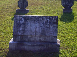
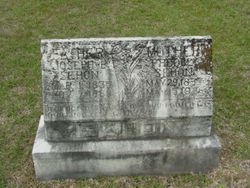
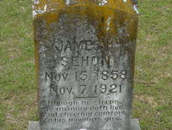
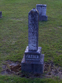
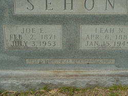
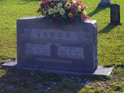
Joseph Bennett Sehon
| Birth | : | 1 Mar 1835 Jackson County, Arkansas, USA |
| Death | : | 7 Nov 1889 Huttig, Union County, Arkansas, USA |
| Burial | : | Cementerio Municipal #1, Caguas, Caguas Municipality, USA |
| Coordinate | : | 18.2344760, -66.0392130 |
frequently asked questions (FAQ):
-
Where is Joseph Bennett Sehon's memorial?
Joseph Bennett Sehon's memorial is located at: Cementerio Municipal #1, Caguas, Caguas Municipality, USA.
-
When did Joseph Bennett Sehon death?
Joseph Bennett Sehon death on 7 Nov 1889 in Huttig, Union County, Arkansas, USA
-
Where are the coordinates of the Joseph Bennett Sehon's memorial?
Latitude: 18.2344760
Longitude: -66.0392130
Family Members:
Spouse
Children
Flowers:
Grandfather
Left by Anonymous on 19 Oct 2003
Left by Anonymous on 21 Mar 2008
Joseph's father was also Joseph Bennett Sehon (b.abt.1804).
Left by Anonymous on 24 Jul 2012
3rd GGF
Left by Anonymous on 05 Oct 2012
My Great-grandfather Joseph was an organizing member of the Harper Springs Missionary Baptist Church in Huttig, Union Co., Arkansas on Nov. 17,1888. In 1889, Joe Sehon and L.T. Lawrence were the Messengers (delegates) from Lapile Post Officer, Pastor, W. T. Smith, Harper Springs Baptist Church, to the Liberty Baptist Association. Read less
Left by Anonymous on 20 Oct 2013

His parents were Joseph Bennett Sehon, Sr. (1804 NC - 1850 AR) and Elizabeth Pinkney Sehon (1802 GA - 1851 AR).
Left by Anonymous on 22 Jan 2022
Nearby Cemetories:
1. Catedral del Dulce Nombre de Jesús
Caguas, Caguas Municipality, USA
Coordinate: 18.2343200, -66.0344180
2. Cementerio Municipal #3
Caguas, Caguas Municipality, USA
Coordinate: 18.2389670, -66.0571690
3. Cementerio Monte Calvario
Caguas, Caguas Municipality, USA
Coordinate: 18.2408850, -66.0155900
4. Cementerio Borinquen Memorial Park II
Caguas, Caguas Municipality, USA
Coordinate: 18.2703810, -66.0210140
5. Cementerio Borinquen Memorial Park I
Caguas, Caguas Municipality, USA
Coordinate: 18.2758810, -66.0394830
6. Cementerio Parque de Luz
Caguas, Caguas Municipality, USA
Coordinate: 18.2871070, -66.0450910
7. Cementerio Municipal #1 Del Pilar
Gurabo, Gurabo Municipality, USA
Coordinate: 18.2503180, -65.9817040
8. Aguas Buenas Cementerio Municipal 1
Aguas Buenas, Aguas Buenas Municipality, USA
Coordinate: 18.2544790, -66.1100400
9. Cementerio Municipal #2
Sumidero, Aguas Buenas Municipality, USA
Coordinate: 18.2487120, -66.1156900
10. Cementerio Municipal Nuevo Barrio Celada
Celada, Gurabo Municipality, USA
Coordinate: 18.2656050, -65.9665170
11. Cementerio Municipal Viejo
San Lorenzo, San Lorenzo Municipality, USA
Coordinate: 18.1919640, -65.9670720
12. Cementerio Ramanso Barrio Quebrada
Quemados, San Lorenzo Municipality, USA
Coordinate: 18.1932020, -65.9617420
13. Cementerio Jardín del Edén
Las Cruces, Cidra Municipality, USA
Coordinate: 18.1670770, -66.0972580
14. Jardin del Eden
Beatriz, Cayey Municipality, USA
Coordinate: 18.1662111, -66.0971139
15. Cementerio Municipal - Cerro Gordo
San Lorenzo, San Lorenzo Municipality, USA
Coordinate: 18.1823700, -65.9591900
16. Cementerio Municipal Nuevo
San Lorenzo, San Lorenzo Municipality, USA
Coordinate: 18.1824850, -65.9588030
17. Cementerio Privado Shalom Memorial
Juncos Municipality, USA
Coordinate: 18.2281740, -65.9283700
18. Cementerio Municipal Viejo
Juncos, Juncos Municipality, USA
Coordinate: 18.2282410, -65.9270080
19. El Señorial Memorial Park
San Juan, San Juan Municipality, USA
Coordinate: 18.3446200, -66.0541130
20. Cementerio Municipal de Trujillo Alto
Trujillo Alto, Trujillo Alto Municipality, USA
Coordinate: 18.3497200, -65.9989000
21. Cementerio La Resurrección
Carolina, Carolina Municipality, USA
Coordinate: 18.3424690, -65.9736260
22. Cementerio Historico de Guaynabo
Guaynabo, Guaynabo Municipality, USA
Coordinate: 18.3489400, -66.1082400
23. Cementerio Municipal de Cidra
Cidra, Cidra Municipality, USA
Coordinate: 18.1722760, -66.1621030
24. Cementerio Municipal Nuevo Torito Plata Cayey
Cayey, Cayey Municipality, USA
Coordinate: 18.1359210, -66.1438320

