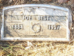
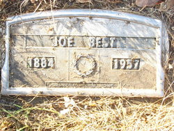
Joseph Blaine Best
| Birth | : | 15 Jun 1883 Murray County, Georgia, USA |
| Death | : | 27 Apr 1957 Custer County, Montana, USA |
| Burial | : | Temple Beth Sholom Cemetery, Sarasota, Sarasota County, USA |
| Coordinate | : | 27.3414000, -82.4945000 |
| Plot | : | Section G2 Row 7 Grave 29 |
| Description | : | He was the son of James Madison Best and Catherine Swan. He married Nelle Theresa Butler, 8 Jan 1908, El Reno, Oklahoma. To this union, Josephine 1908-1908, Cecilla Jane 1910-2006, and John 1914-1914. |
frequently asked questions (FAQ):
-
Where is Joseph Blaine Best's memorial?
Joseph Blaine Best's memorial is located at: Temple Beth Sholom Cemetery, Sarasota, Sarasota County, USA.
-
When did Joseph Blaine Best death?
Joseph Blaine Best death on 27 Apr 1957 in Custer County, Montana, USA
-
Where are the coordinates of the Joseph Blaine Best's memorial?
Latitude: 27.3414000
Longitude: -82.4945000
Family Members:
Parent
Spouse
Siblings
Children
Flowers:
Nearby Cemetories:
1. Temple Beth Sholom Cemetery
Sarasota, Sarasota County, USA
Coordinate: 27.3414000, -82.4945000
2. Unitarian Universalist Church's Memory Garden
Sarasota, Sarasota County, USA
Coordinate: 27.3384610, -82.4889880
3. Sarasota Community Church Columbarium
Sarasota, Sarasota County, USA
Coordinate: 27.3245125, -82.4887278
4. First Congregational United Church of Christ Memorial Garden
Sarasota, Sarasota County, USA
Coordinate: 27.3250390, -82.5171200
5. Palms Memorial Park
Sarasota, Sarasota County, USA
Coordinate: 27.3349991, -82.4638977
6. Sunnyside Mennonite Cemetery
Sarasota, Sarasota County, USA
Coordinate: 27.3267678, -82.4623747
7. Meadows Memorial Garden
Sarasota, Sarasota County, USA
Coordinate: 27.3361092, -82.5308304
8. Saint Paul Lutheran Church Pet Memorial Garden
Sarasota, Sarasota County, USA
Coordinate: 27.3361092, -82.5308304
9. Woodlawn Cemetery
Sarasota, Sarasota County, USA
Coordinate: 27.3464550, -82.5331770
10. Friendship Baptist Cemetery
Sarasota, Sarasota County, USA
Coordinate: 27.3250562, -82.4587084
11. Luke Wood House Burial Ground
Sarasota, Sarasota County, USA
Coordinate: 27.3285310, -82.5323530
12. West Coast Church of the Cross Memorial Garden
Sarasota, Sarasota County, USA
Coordinate: 27.3068950, -82.5127100
13. Saint Martha's Church Garden
Sarasota, Sarasota County, USA
Coordinate: 27.3384780, -82.5383150
14. Galilee Cemetery
Sarasota, Sarasota County, USA
Coordinate: 27.3651780, -82.5295990
15. Marie Selby Botanical Gardens
Sarasota, Sarasota County, USA
Coordinate: 27.3282180, -82.5397900
16. Church of the Redeemer Memory Garden
Sarasota, Sarasota County, USA
Coordinate: 27.3336703, -82.5420542
17. Rosemary Cemetery
Sarasota, Sarasota County, USA
Coordinate: 27.3435150, -82.5432490
18. Church of the Palms Memorial Garden
Sarasota, Sarasota County, USA
Coordinate: 27.2980400, -82.5043760
19. Church of the Incarnation Memorial Garden
Sarasota, Sarasota County, USA
Coordinate: 27.2991238, -82.5114441
20. Church of the Nativity Episcopal Memory Garden
Sarasota, Sarasota County, USA
Coordinate: 27.3857900, -82.5049060
21. Pioneer Whitaker Cemetery
Sarasota, Sarasota County, USA
Coordinate: 27.3485350, -82.5461870
22. Saint Wilfred's Episcopal Church Prayer Garden
Sarasota, Sarasota County, USA
Coordinate: 27.2917998, -82.4941453
23. Saint Paul Lutheran Church Memorial Garden
Sarasota, Sarasota County, USA
Coordinate: 27.3567106, -82.5501713
24. Saint Johns Chapel Cemetery
Sarasota, Sarasota County, USA
Coordinate: 27.2993179, -82.5292997


