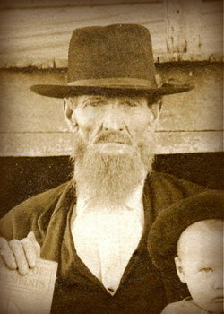
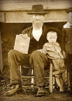
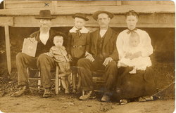
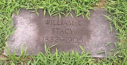
Joseph Marion Stacy
| Birth | : | Jun 1837 Rutherford County, Tennessee, USA |
| Death | : | 10 Jan 1920 Coffee County, Tennessee, USA |
| Burial | : | Jernigan Cemetery, Coffee County, USA |
| Coordinate | : | 35.6875000, -86.2071991 |
| Description | : | MOTHER: Sarah Hanes, 1793 – 1871 FATHER: William Stacy, 1790 – 1871 1st WIFE: Elizabeth Jane Montgomery b. 1836 d. 1880 CHILDREN: John Patrick Stacy, 1856 – 1916 William H Stacy, 1859 – James M Stacy, 1862 – Sarah M Stacy, 1863 – Matilda Margaret Stacy, 1867 – Parcell J Stacy, 1869 – Joseph Haynes Stacy, 1873 – 1928 Hugh Arthur Stacy, 1874 – 1953 2nd WIFE: Lucinda - SOURCES: 1. Civil War Soldier Records and Profiles, 1861-1865 Name: Joseph Stacy Rank at enlistment: Private State Served: Tennessee Service Record: Enlisted in Company F, Tennessee 44th Infantry Regiment. Sources: Index to Compiled Confederate Military Service Source Information: Historical Data Systems, comp. U.S., Civil War Soldier... Read More |
frequently asked questions (FAQ):
-
Where is Joseph Marion Stacy's memorial?
Joseph Marion Stacy's memorial is located at: Jernigan Cemetery, Coffee County, USA.
-
When did Joseph Marion Stacy death?
Joseph Marion Stacy death on 10 Jan 1920 in Coffee County, Tennessee, USA
-
Where are the coordinates of the Joseph Marion Stacy's memorial?
Latitude: 35.6875000
Longitude: -86.2071991
Family Members:
Flowers:
Nearby Cemetories:
1. Jernigan Cemetery
Coffee County, USA
Coordinate: 35.6875000, -86.2071991
2. Hettie Cemetery
Coffee County, USA
Coordinate: 35.6939011, -86.2003021
3. Green Cemetery
Coffee County, USA
Coordinate: 35.7016983, -86.2016983
4. Green-Messick Cemetery
Coffee County, USA
Coordinate: 35.6713982, -86.2027969
5. Green and Douglas Cemetery
Coffee County, USA
Coordinate: 35.7019005, -86.2174988
6. Messick Cemetery
Beech Grove, Coffee County, USA
Coordinate: 35.6744610, -86.2274930
7. Brown Cemetery
Big Springs, Rutherford County, USA
Coordinate: 35.7061005, -86.2228012
8. Sagely Cemetery
Cannon County, USA
Coordinate: 35.7127991, -86.1977997
9. Jernigan Hill Cemetery
Hoodoo, Coffee County, USA
Coordinate: 35.6656617, -86.1842912
10. Burk Cemetery
Donnell Chapel, Rutherford County, USA
Coordinate: 35.7178001, -86.2117004
11. Arnold Cemetery
Rutherford County, USA
Coordinate: 35.7153015, -86.2236023
12. Harrell Cemetery
Rutherford County, USA
Coordinate: 35.7207985, -86.2117004
13. Broyles Cemetery
Rutherford County, USA
Coordinate: 35.6719017, -86.2469025
14. Harrold Cemetery
Rutherford County, USA
Coordinate: 35.7182999, -86.2311020
15. Jernigan Cemetery
Cannon County, USA
Coordinate: 35.7214012, -86.1900024
16. Hopewell Cemetery
Cannon County, USA
Coordinate: 35.7122002, -86.1710968
17. Anderson Cemetery
Coffee County, USA
Coordinate: 35.6567001, -86.1766968
18. Mount Hebron Cemetery
Beech Grove, Coffee County, USA
Coordinate: 35.6493988, -86.2266998
19. Fox Cemetery
Rutherford County, USA
Coordinate: 35.6803400, -86.2578470
20. Burk Cemetery
Beech Grove, Coffee County, USA
Coordinate: 35.6733017, -86.1575012
21. Bynum Cemetery
Cannon County, USA
Coordinate: 35.7164001, -86.1635971
22. Big Creek Cemetery
Big Springs, Rutherford County, USA
Coordinate: 35.7117004, -86.2568970
23. Fox-Kelton Cemetery
Rutherford County, USA
Coordinate: 35.6901000, -86.2654000
24. Todd Cemetery
Big Springs, Rutherford County, USA
Coordinate: 35.7127991, -86.2574997


