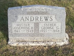
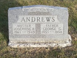
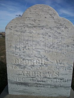
Josephine Rachel “Josie” Ehlers Andrews
| Birth | : | 1863 |
| Death | : | 5 Nov 1949 |
| Burial | : | Grays Point Cemetery, Miller, Lawrence County, USA |
| Coordinate | : | 37.2419014, -93.9867020 |
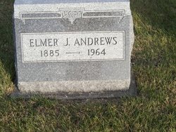
| Description | : | Wife of George C. Andrews. Buried next to son Elmer J. Andrews. Also next to Hattie E. Andrews. |
frequently asked questions (FAQ):
-
Where is Josephine Rachel “Josie” Ehlers Andrews's memorial?
Josephine Rachel “Josie” Ehlers Andrews's memorial is located at: Grays Point Cemetery, Miller, Lawrence County, USA.
-
When did Josephine Rachel “Josie” Ehlers Andrews death?
Josephine Rachel “Josie” Ehlers Andrews death on 5 Nov 1949 in
-
Where are the coordinates of the Josephine Rachel “Josie” Ehlers Andrews's memorial?
Latitude: 37.2419014
Longitude: -93.9867020
Family Members:
Parent
Spouse
Siblings
Children
Flowers:
Nearby Cemetories:
1. Grays Point Cemetery
Miller, Lawrence County, USA
Coordinate: 37.2419014, -93.9867020
2. Salem Cemetery
Red Oak, Lawrence County, USA
Coordinate: 37.2622530, -93.9989590
3. Red Oak Cemetery
Red Oak, Lawrence County, USA
Coordinate: 37.2293400, -94.0177700
4. McCune Cemetery
Lawrence County, USA
Coordinate: 37.2221985, -94.0353012
5. Plew Cemetery
Lawrence County, USA
Coordinate: 37.1963990, -94.0365850
6. Fellowship Cemetery
Miller, Lawrence County, USA
Coordinate: 37.1767000, -93.9634700
7. Round Grove Cemetery
Round Grove, Lawrence County, USA
Coordinate: 37.2720000, -93.9075000
8. Kings Point Cemetery
Kings Point, Dade County, USA
Coordinate: 37.3168793, -93.9366226
9. Colley Cemetery
Lawrence County, USA
Coordinate: 37.1603012, -93.9542007
10. Taylor Cemetery
Sarcoxie, Jasper County, USA
Coordinate: 37.1875000, -94.0777969
11. Zion Lutheran Cemetery
Meinert, Dade County, USA
Coordinate: 37.3361900, -93.9911700
12. Goss Cemetery
Mount Vernon, Lawrence County, USA
Coordinate: 37.1741982, -93.9019012
13. Stemmons Cemetery
Jasper County, USA
Coordinate: 37.2261009, -94.1085968
14. Langston Cemetery
Lawrence County, USA
Coordinate: 37.1478004, -94.0227966
15. Gillock Cemetery
Lawrence County, USA
Coordinate: 37.1444016, -94.0089035
16. Dudenville Cemetery
Dade County, USA
Coordinate: 37.3091200, -94.0826700
17. Webb Cemetery
Miller, Lawrence County, USA
Coordinate: 37.2033005, -93.8672028
18. New Hope Cemetery
Avilla, Jasper County, USA
Coordinate: 37.2164001, -94.1130981
19. Hodges Cemetery
Stotts City, Lawrence County, USA
Coordinate: 37.1338997, -93.9666977
20. Mount Zion Cemetery
Dade County, USA
Coordinate: 37.3266840, -93.8966970
21. Wilson Cemetery
Stotts City, Lawrence County, USA
Coordinate: 37.1302986, -93.9942017
22. Avilla Cemetery
Avilla, Jasper County, USA
Coordinate: 37.2056007, -94.1275024
23. Pennington Cemetery
Phelps, Lawrence County, USA
Coordinate: 37.1514500, -93.8911700
24. Stahl Cemetery
Phelps, Lawrence County, USA
Coordinate: 37.1772003, -93.8617020

