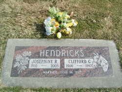
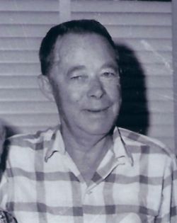
Josephine Rachel Smith Hendricks
| Birth | : | 24 Aug 1910 Piedmont, Canadian County, Oklahoma, USA |
| Death | : | 4 Nov 2005 Spokane, Spokane County, Washington, USA |
| Burial | : | MacLean Cemetery, Hopewell, Pictou County, Canada |
| Coordinate | : | 45.4616700, -62.6882100 |
| Plot | : | North Fraternal Row24 STBLK24 LN7 |
| Inscription | : | Clifford C. Hendricks - m: 6-16-1927 |
| Description | : | JOSEPHINE RACHEL SMITH HENDRICKS - Tuesday - November 8, 2005 Spokane - Josephine Rachel Smith Hendricks, of Spokane, WA passed away on November 4, 2005. "Phine" as she was known by family and friends, was born in Piedmont, Oklahoma to Joseph and Grace Smith on August 24, 1910. She grew up in Chelan, WA. She married Clifford Hendricks in 1926. The couple had two children, Gary and Glenna. Phine was a homemaker, and later owned restaurants in Okanogan, Tekoa and Dayton, WA. She and her husband moved to Spokane in 1980. The last nine years she was... Read More |
frequently asked questions (FAQ):
-
Where is Josephine Rachel Smith Hendricks's memorial?
Josephine Rachel Smith Hendricks's memorial is located at: MacLean Cemetery, Hopewell, Pictou County, Canada.
-
When did Josephine Rachel Smith Hendricks death?
Josephine Rachel Smith Hendricks death on 4 Nov 2005 in Spokane, Spokane County, Washington, USA
-
Where are the coordinates of the Josephine Rachel Smith Hendricks's memorial?
Latitude: 45.4616700
Longitude: -62.6882100
Family Members:
Parent
Spouse
Siblings
Children
Flowers:
Nearby Cemetories:
1. MacLean Cemetery
Hopewell, Pictou County, Canada
Coordinate: 45.4616700, -62.6882100
2. Elgin Pioneer Cemetery
Elgin, Pictou County, Canada
Coordinate: 45.4610200, -62.6878200
3. Saint Columba Cemetery
Hopewell, Pictou County, Canada
Coordinate: 45.4591100, -62.6916500
4. Hopewell Cemetery
Pictou County, Canada
Coordinate: 45.4858100, -62.7024000
5. Springville Cemetery
Springville, Pictou County, Canada
Coordinate: 45.4522220, -62.6313890
6. Marshdale Cemetery
Marshdale, Pictou County, Canada
Coordinate: 45.4498700, -62.7451300
7. Elgin Cemetery
Elgin, Pictou County, Canada
Coordinate: 45.4219500, -62.6698800
8. Lorne Cemetery
Lorne, Pictou County, Canada
Coordinate: 45.4198500, -62.7281100
9. Riverton Cemetery
Riverton, Pictou County, Canada
Coordinate: 45.5148690, -62.6811860
10. MacLeod Cemetery
Fox Brook, Pictou County, Canada
Coordinate: 45.5206111, -62.7106667
11. Churchville Pioneer Cemetery
Churchville, Pictou County, Canada
Coordinate: 45.5189800, -62.6459700
12. Churchville Cemetery
Churchville, Pictou County, Canada
Coordinate: 45.5194444, -62.6451111
13. Birch Hill Cemetery
Rocklin, Pictou County, Canada
Coordinate: 45.4967575, -62.7836800
14. Gray Road Cemetery
Union Centre, Pictou County, Canada
Coordinate: 45.5244800, -62.7529600
15. Bridgeville Cemetery
Bridgeville, Pictou County, Canada
Coordinate: 45.4246400, -62.5895700
16. Highfield-Johnny Whiskey Cemetery
Westville, Pictou County, Canada
Coordinate: 45.5392100, -62.7196600
17. Brookville Cemetery
Brookville, Pictou County, Canada
Coordinate: 45.5003300, -62.5867900
18. Union Centre Pioneer Cemetery
Union Centre, Pictou County, Canada
Coordinate: 45.5275200, -62.7554700
19. Beaton Cemetery
Millbrook, Pictou County, Canada
Coordinate: 45.5210800, -62.7876300
20. Saint Andrews Cemetery
New Gairloch, Pictou County, Canada
Coordinate: 45.4796300, -62.8168200
21. Forest Hill Cemetery
Westville, Pictou County, Canada
Coordinate: 45.5431600, -62.7616800
22. Saint Philip’s Cemetery
Westville, Pictou County, Canada
Coordinate: 45.5586400, -62.7159400
23. MacLellan's Mountain Cemetery
Kirkmount, Pictou County, Canada
Coordinate: 45.5244700, -62.5742500
24. Millbrook Cemetery
Millbrook, Pictou County, Canada
Coordinate: 45.5188400, -62.8083400


