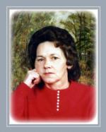
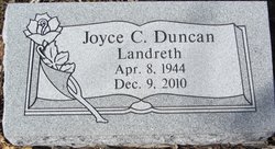
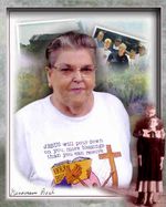
Joyce Carol “Doodle” Landreth Duncan
| Birth | : | 8 Apr 1944 Madison County, Illinois, USA |
| Death | : | 9 Dec 2010 Saint Elizabeth, Miller County, Missouri, USA |
| Burial | : | Capps Cemetery, Miller County, USA |
| Coordinate | : | 38.2426300, -92.3159100 |
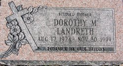
| Description | : | Joyce Carol (Landreth) Duncan "Doodle", age 66, of St. Elizabeth, received angels wings on Thursday, December 9, 2010, at her home. She was born in Madison County, Illinois, on April 8, 1944, daughter of the late Fred and Dorothy (Fancher) Landreth. Joyce was married to Oleph Duncan, who preceded her in death on July 4, 2004. Joyce was an avid George Jones fan and was a member of Humphrey's Creek Christian Church near St. Elizabeth. She is survived by two daughters, Darlene Carol Stickney of St. Elizabeth and Dana Kay Stark of Westphalia; one son, Daniel Paul Stark... Read More |
frequently asked questions (FAQ):
-
Where is Joyce Carol “Doodle” Landreth Duncan's memorial?
Joyce Carol “Doodle” Landreth Duncan's memorial is located at: Capps Cemetery, Miller County, USA.
-
When did Joyce Carol “Doodle” Landreth Duncan death?
Joyce Carol “Doodle” Landreth Duncan death on 9 Dec 2010 in Saint Elizabeth, Miller County, Missouri, USA
-
Where are the coordinates of the Joyce Carol “Doodle” Landreth Duncan's memorial?
Latitude: 38.2426300
Longitude: -92.3159100
Family Members:
Parent
Spouse
Siblings
Flowers:
Nearby Cemetories:
1. Capps Cemetery
Miller County, USA
Coordinate: 38.2426300, -92.3159100
2. King Family Cemetery
Capps, Miller County, USA
Coordinate: 38.2328400, -92.3298000
3. Saint Lawrence Catholic Cemetery
Saint Elizabeth, Miller County, USA
Coordinate: 38.2542200, -92.2708900
4. Bilyeu Cemetery
Tuscumbia, Miller County, USA
Coordinate: 38.1959114, -92.3347626
5. Davy Jones Cemetery
Cole County, USA
Coordinate: 38.2743000, -92.2606000
6. Amos Cemetery
Jefferson City, Cole County, USA
Coordinate: 38.2921000, -92.2824000
7. Old Saint Elizabeth Cemetery
Saint Elizabeth, Miller County, USA
Coordinate: 38.2952900, -92.2860600
8. Ramsey Cemetery
Miller County, USA
Coordinate: 38.1889000, -92.3641968
9. Our Lady of the Snows Cemetery
Marys Home, Miller County, USA
Coordinate: 38.3038440, -92.3567560
10. Musick Family Cemetery
Tuscumbia, Miller County, USA
Coordinate: 38.2659300, -92.4004200
11. Old Berry - McCann Cemetery
Russellville, Cole County, USA
Coordinate: 38.2759000, -92.2342000
12. Stark Cemetery
Miller County, USA
Coordinate: 38.1998200, -92.3935900
13. Jenkins-Bungart Cemetery
Marys Home, Miller County, USA
Coordinate: 38.3133011, -92.3480988
14. Wilson Cemetery
Miller County, USA
Coordinate: 38.1706009, -92.3507996
15. Rush Chapel Cemetery
Miller County, USA
Coordinate: 38.2950600, -92.3902100
16. Hopewell Cemetery
Tuscumbia, Miller County, USA
Coordinate: 38.2024800, -92.4023100
17. Barnhart Cemetery
Miller County, USA
Coordinate: 38.2338982, -92.2086029
18. Bear Cemetery
Miller County, USA
Coordinate: 38.2244070, -92.4236610
19. Saint Anthony Cemetery
Miller County, USA
Coordinate: 38.1583100, -92.2744400
20. Mount Zion Cemetery
Tuscumbia, Miller County, USA
Coordinate: 38.2083900, -92.4254600
21. Nixdorf Cemetery
Tuscumbia, Miller County, USA
Coordinate: 38.1786200, -92.4033300
22. Jarrett Cemetery
Iberia, Miller County, USA
Coordinate: 38.1475300, -92.3125300
23. Bates Burial
Saint Thomas, Cole County, USA
Coordinate: 38.2820000, -92.2016000
24. Smiths Cemetery
Tuscumbia, Miller County, USA
Coordinate: 38.2551651, -92.4403381


