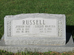
Judson Ray Russell
| Birth | : | 12 Apr 1897 Mahaska County, Iowa, USA |
| Death | : | 19 Dec 1974 Bloomfield, Davis County, Iowa, USA |
| Burial | : | Gympie Cemetery, Gympie, Gympie Region, Australia |
| Coordinate | : | -26.1749860, 152.6530570 |
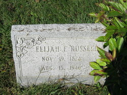
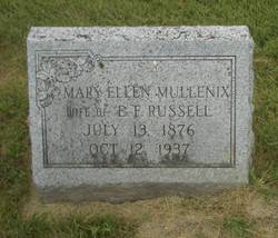
| Description | : | Ray Judson Russell Ray Judson Russell, 77, of Ottumwa Route 3, died Thursday at 7:50 p.m. at Davis County Hospital in Bloomfield. He was born April 12, 1897, in Mahaska County to Elijah and Mary Ellen Mullenix Russell. A resident of the area most of his life, he was a farmer. On Aug. 24, 1920, he married Goldie Larson in Ottumwa. She survives as does one sister, Mrs. Faye Henderson of Ottumwa. The service will be Monday at 1:30 p.m. at the Fremont Funeral Chapel, with the Rev. Russell Reed officiating. Burial will be in McCormick Cemetery near Highland Center. FROM... Read More |
frequently asked questions (FAQ):
-
Where is Judson Ray Russell's memorial?
Judson Ray Russell's memorial is located at: Gympie Cemetery, Gympie, Gympie Region, Australia.
-
When did Judson Ray Russell death?
Judson Ray Russell death on 19 Dec 1974 in Bloomfield, Davis County, Iowa, USA
-
Where are the coordinates of the Judson Ray Russell's memorial?
Latitude: -26.1749860
Longitude: 152.6530570
Family Members:
Parent
Spouse
Flowers:
Nearby Cemetories:
1. Gympie Cemetery
Gympie, Gympie Region, Australia
Coordinate: -26.1749860, 152.6530570
2. Cooloola Coast Crematorium
Monkland, Gympie Region, Australia
Coordinate: -26.2148230, 152.6868250
3. Tozer Park Cemetery (Defunct)
Gympie, Gympie Region, Australia
Coordinate: -26.0008330, 152.7438890
4. Neerdie Cemetery
Gympie, Gympie Region, Australia
Coordinate: -26.0008540, 152.7442570
5. Gunalda Cemetery
Gunalda, Gympie Region, Australia
Coordinate: -25.9877920, 152.5557680
6. Kandanga Cemetery
Kandanga, Gympie Region, Australia
Coordinate: -26.3842440, 152.6888120
7. Pomona Cemetery
Pomona, Noosa Shire, Australia
Coordinate: -26.3441600, 152.8530740
8. Dickabram Cemetery
Miva, Gympie Region, Australia
Coordinate: -25.9604510, 152.4848260
9. Munna Creek Cemetery
Gundiah, Fraser Coast Region, Australia
Coordinate: -25.8943010, 152.4806150
10. Cooroy Cemetery
Cooroy, Noosa Shire, Australia
Coordinate: -26.4095520, 152.9143240
11. Cooloola Coast Cemetery
Cooloola Cove, Gympie Region, Australia
Coordinate: -25.9831920, 152.9677170
12. Kilkivan Cemetery
Kilkivan, Gympie Region, Australia
Coordinate: -26.1072030, 152.2758930
13. Gheerulla Cemetery
Gheerulla, Sunshine Coast Council, Australia
Coordinate: -26.5538100, 152.7713320
14. Tewantin Cemetery
Tewantin, Noosa Shire, Australia
Coordinate: -26.3950054, 153.0254472
15. Eumundi Cemetery
Eumundi, Sunshine Coast Council, Australia
Coordinate: -26.4913680, 152.9405570
16. Deborah Cemetery
Netherby, Fraser Coast Region, Australia
Coordinate: -25.7827119, 152.4940048
17. Tiaro Cemetery
Tiaro, Fraser Coast Region, Australia
Coordinate: -25.7173650, 152.5856850
18. Yandina Cemetery
Yandina, Sunshine Coast Council, Australia
Coordinate: -26.5720000, 152.9570000
19. Mapleton Cemetery
Mapleton, Sunshine Coast Council, Australia
Coordinate: -26.6241030, 152.8479884
20. Kulangoor Lawn Cemetery
Kulangoor, Sunshine Coast Council, Australia
Coordinate: -26.5884880, 152.9647280
21. Nambour Garden Lawn Cemetery
Nambour, Sunshine Coast Council, Australia
Coordinate: -26.6116920, 152.9700810
22. Gregson & Weight Chapel & Crematorium
Nambour, Sunshine Coast Council, Australia
Coordinate: -26.6156420, 152.9649380
23. Nambour General Cemetery
Nambour, Sunshine Coast Council, Australia
Coordinate: -26.6156180, 152.9713150
24. Goomeri Cemetery
Goomeri, Gympie Region, Australia
Coordinate: -26.1825340, 152.0681620


