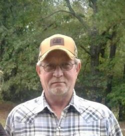
Judy Kay “Honey” Williams Lunsford
| Birth | : | 30 Apr 1954 Lewisville, Lafayette County, Arkansas, USA |
| Death | : | 12 Jul 2021 Pine Bluff, Jefferson County, Arkansas, USA |
| Burial | : | Pleasant Ridge Cemetery, Rison, Cleveland County, USA |
| Coordinate | : | 34.0361670, -92.0499050 |
| Description | : | Wife of Johnny Lunsford, Married July 10, 1985 Judy Kay Lunsford "Honey", age 67 of Rison, Arkansas passed away July 12, 2021 in Pine Bluff due to complications of COVID. It would be wrong to say that she lost her battle, because she never stopped fighting. No matter how sick she was, she was determined. When anyone else would have broken, Honey stayed strong. Through her we know what resistance and perseverance truly look like. There was no quit in Honey. Just because she is no longer here, doesn't mean she lost her fight. She was born April... Read More |
frequently asked questions (FAQ):
-
Where is Judy Kay “Honey” Williams Lunsford's memorial?
Judy Kay “Honey” Williams Lunsford's memorial is located at: Pleasant Ridge Cemetery, Rison, Cleveland County, USA.
-
When did Judy Kay “Honey” Williams Lunsford death?
Judy Kay “Honey” Williams Lunsford death on 12 Jul 2021 in Pine Bluff, Jefferson County, Arkansas, USA
-
Where are the coordinates of the Judy Kay “Honey” Williams Lunsford's memorial?
Latitude: 34.0361670
Longitude: -92.0499050
Family Members:
Parent
Spouse
Flowers:
Nearby Cemetories:
1. Pleasant Ridge Cemetery
Rison, Cleveland County, USA
Coordinate: 34.0361670, -92.0499050
2. Mount Gillard Cemetery
Cleveland County, USA
Coordinate: 34.0107650, -92.0421610
3. Wesley Chapel Cemetery
Cleveland County, USA
Coordinate: 34.0031610, -92.0409960
4. New Home Cemetery
Cleveland County, USA
Coordinate: 34.0349600, -91.9883200
5. Roselawn Memorial Garden
Pine Bluff, Jefferson County, USA
Coordinate: 34.0825005, -92.0224991
6. Mount Zion Cemetery
Rison, Cleveland County, USA
Coordinate: 34.0281556, -92.1148653
7. Harris Cemetery
Kedron, Cleveland County, USA
Coordinate: 34.0202510, -92.1141940
8. Mount Zion Baptist Church Cemetery
Faith, Jefferson County, USA
Coordinate: 34.0858110, -92.0818130
9. Friendship Cemetery
Friendship, Cleveland County, USA
Coordinate: 33.9818993, -92.0291977
10. Harmony Missionary Baptist Church Cemetery
Jefferson County, USA
Coordinate: 34.0864660, -92.0102560
11. Blackwell Hill Cemetery
Jefferson County, USA
Coordinate: 34.0960999, -92.0718994
12. Bethlehem Cemetery
Rison, Cleveland County, USA
Coordinate: 33.9874510, -92.1180710
13. Brown Cemetery
Jefferson County, USA
Coordinate: 34.0952988, -92.1050034
14. Zachary Cemetery
Cleveland County, USA
Coordinate: 33.9933014, -91.9642029
15. Curl Cemetery
Jefferson County, USA
Coordinate: 34.1102982, -92.1035995
16. Owen Cemetery
Cleveland County, USA
Coordinate: 33.9861790, -91.9632480
17. New Owen Cemetery
Star City, Lincoln County, USA
Coordinate: 34.0133018, -91.9475021
18. Culpepper Cemetery
Kedron, Cleveland County, USA
Coordinate: 34.0537260, -92.1594140
19. Niven - Watt Cemetery
Cleveland County, USA
Coordinate: 34.0209370, -92.1636200
20. Jerman Cemetery
Pine Bluff, Jefferson County, USA
Coordinate: 34.1301080, -92.0289980
21. Cypress Memorial Gardens
Pine Bluff, Jefferson County, USA
Coordinate: 34.1230460, -91.9931700
22. Grahams Cemetery
Lincoln County, USA
Coordinate: 34.0567017, -91.9308014
23. Canaan Cemetery
Lincoln County, USA
Coordinate: 34.0784030, -91.9363030
24. Huckaby Cemetery
Lincoln County, USA
Coordinate: 34.0100450, -91.9292280


