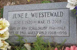
June E. Slagle Wuestewald
| Birth | : | 6 Jun 1920 Magnet, Cedar County, Nebraska, USA |
| Death | : | 13 Mar 2008 West Point, Cuming County, Nebraska, USA |
| Burial | : | Fairfield Cemetery, Correctionville, Woodbury County, USA |
| Coordinate | : | 42.4710999, -95.9210968 |
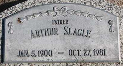
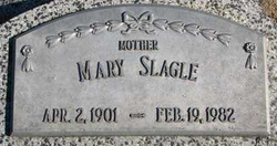
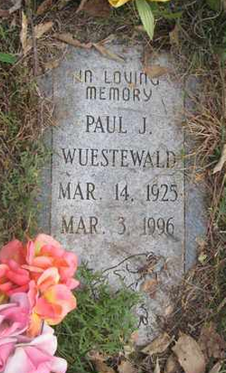
| Description | : | Daughter of Arthur and Mary Moody Slagle. She moved to a farm south east of West Point as a young girl and attended country school. On August 19, 1941 she married Raymond Schulzkump in West Point. The couple farmed south east of West Point. Following Ray's death in January of 1967, June moved into West Point. She was employed at Onie's Café and babysat with her grandchildren. On June 8, 1968, she married Paul Wuestewald. He died in March of 1996. June was a member of Grace Lutheran Church. She was a wonderful seamstress and loved to dance, especially the Polka.... Read More |
frequently asked questions (FAQ):
-
Where is June E. Slagle Wuestewald's memorial?
June E. Slagle Wuestewald's memorial is located at: Fairfield Cemetery, Correctionville, Woodbury County, USA.
-
When did June E. Slagle Wuestewald death?
June E. Slagle Wuestewald death on 13 Mar 2008 in West Point, Cuming County, Nebraska, USA
-
Where are the coordinates of the June E. Slagle Wuestewald's memorial?
Latitude: 42.4710999
Longitude: -95.9210968
Family Members:
Parent
Spouse
Siblings
Flowers:
Nearby Cemetories:
1. Fairfield Cemetery
Correctionville, Woodbury County, USA
Coordinate: 42.4710999, -95.9210968
2. Pleasant Hill Baptist Cemetery
Anthon, Woodbury County, USA
Coordinate: 42.4148300, -95.9420000
3. Wolf Creek Township Cemetery
Anthon, Woodbury County, USA
Coordinate: 42.4033700, -95.9411600
4. Greenwood Cemetery
Pierson, Woodbury County, USA
Coordinate: 42.5318985, -95.8600006
5. Oak Hill Cemetery
Anthon, Woodbury County, USA
Coordinate: 42.3953018, -95.8731003
6. Church of the Brethren Cemetery
Kingsley, Plymouth County, USA
Coordinate: 42.5612000, -95.9293000
7. Lucky Valley Cemetery
Anthon, Woodbury County, USA
Coordinate: 42.3816986, -95.9417038
8. Flemming Family Farm Cemetery
Correctionville, Woodbury County, USA
Coordinate: 42.4888000, -95.7958000
9. Mount Saint Joseph Cemetery
Anthon, Woodbury County, USA
Coordinate: 42.3812510, -95.8818340
10. Arlington Cemetery
Moville, Woodbury County, USA
Coordinate: 42.4968987, -96.0575027
11. St. Michael's Cemetery
Kingsley, Plymouth County, USA
Coordinate: 42.5758018, -95.9599991
12. Correctionville Cemetery
Correctionville, Woodbury County, USA
Coordinate: 42.4728012, -95.7705994
13. Good Hope Cemetery
Pierson, Woodbury County, USA
Coordinate: 42.5391998, -95.7885971
14. Kingsley Cemetery
Kingsley, Plymouth County, USA
Coordinate: 42.5964012, -95.9655991
15. Elkhorn Cemetery
Kingsley, Plymouth County, USA
Coordinate: 42.6041985, -95.9781036
16. Peiro-Bethel Cemetery
Woodbury County, USA
Coordinate: 42.3355103, -95.9762115
17. Rock Cemetery
Woodbury County, USA
Coordinate: 42.4132996, -95.7288971
18. Cushing Cemetery
Cushing, Woodbury County, USA
Coordinate: 42.4658012, -95.6928024
19. Grand Meadow Cemetery
Washta, Cherokee County, USA
Coordinate: 42.6164017, -95.8011017
20. Westfork Township Cemetery
Climbing Hill, Woodbury County, USA
Coordinate: 42.3399990, -96.0773130
21. Saint Paul Lutheran Cemetery
Midway, Woodbury County, USA
Coordinate: 42.3667500, -95.7281500
22. Saint Marys Cemetery
Oto, Woodbury County, USA
Coordinate: 42.2955458, -95.8758426
23. Sunset View Cemetery
Washta, Cherokee County, USA
Coordinate: 42.5783005, -95.7102966
24. Banner Cemetery
Lawton, Woodbury County, USA
Coordinate: 42.4855995, -96.1844025

