
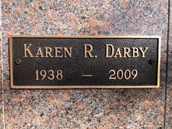
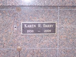
Karen Rae Rupe Darby
| Birth | : | 27 Oct 1938 Eustis, Frontier County, Nebraska, USA |
| Death | : | 20 Apr 2009 Lexington, Dawson County, Nebraska, USA |
| Burial | : | First United Methodist Church Columbarium, Lexington, Dawson County, USA |
| Coordinate | : | 40.7810000, -99.7397000 |
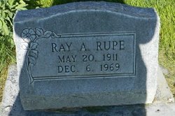
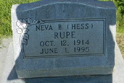
| Description | : | Karen R.Darby Oct 27,1938-April 20,2009 Karen R. Darby, 70, of Lexington, Nebraska, died at her home, April 20, 2009, in Lexington, Nebraska. She was born October 27, 1938, at Eustis, Nebraska, to Ray A. and Neva B. (Hess) Rupe. Karen's primary education was in Eustis, Nebraska and then graduated from Lexington High School with the class of 1956. She was united in marriage to Philip E. Darby, Jr. on July 22, 1956, at the United Methodist Church in Lexington. Six beautiful daughters were blessed to this marriage. Following her marriage Karen was employed at Kjar Hay & Grain, the United Methodist Church,... Read More |
frequently asked questions (FAQ):
-
Where is Karen Rae Rupe Darby's memorial?
Karen Rae Rupe Darby's memorial is located at: First United Methodist Church Columbarium, Lexington, Dawson County, USA.
-
When did Karen Rae Rupe Darby death?
Karen Rae Rupe Darby death on 20 Apr 2009 in Lexington, Dawson County, Nebraska, USA
-
Where are the coordinates of the Karen Rae Rupe Darby's memorial?
Latitude: 40.7810000
Longitude: -99.7397000
Family Members:
Parent
Siblings

Flowers:


Nearby Cemetories:
1. First United Methodist Church Columbarium
Lexington, Dawson County, USA
Coordinate: 40.7810000, -99.7397000
2. Greenwood Cemetery
Lexington, Dawson County, USA
Coordinate: 40.7956467, -99.7286682
3. Saint Anns Cemetery
Lexington, Dawson County, USA
Coordinate: 40.7789001, -99.7114029
4. Evergreen Cemetery
Lexington, Dawson County, USA
Coordinate: 40.7639008, -99.6791992
5. Mount Hope Cemetery
Dawson County, USA
Coordinate: 40.8293991, -99.6733017
6. Hewitt Cemetery
Lexington, Dawson County, USA
Coordinate: 40.8588982, -99.7769012
7. Buffalo Grove Presbyterian Church Cemetery
Buffalo, Dawson County, USA
Coordinate: 40.8721000, -99.8270000
8. Robb Cemetery
Smithfield, Gosper County, USA
Coordinate: 40.6710691, -99.6996001
9. Hillside Cemetery
Dawson County, USA
Coordinate: 40.8946991, -99.7869034
10. Grace Cemetery
Cozad, Dawson County, USA
Coordinate: 40.8602982, -99.8644028
11. Saint Johns Lutheran Cemetery
Lexington, Dawson County, USA
Coordinate: 40.9019012, -99.8458023
12. Plum Creek Massacre Cemetery
Phelps County, USA
Coordinate: 40.6726840, -99.6058220
13. Quakerville Cemetery
Gosper County, USA
Coordinate: 40.6189003, -99.8097000
14. Overton Cemetery
Overton, Dawson County, USA
Coordinate: 40.7317009, -99.5222015
15. Cozad Cemetery
Cozad, Dawson County, USA
Coordinate: 40.8605995, -99.9475021
16. Adullam Cemetery
Bertrand, Phelps County, USA
Coordinate: 40.6265000, -99.5856000
17. Fairview Cemetery
Dawson County, USA
Coordinate: 40.7719002, -99.9955978
18. Elwood Cemetery
Elwood, Gosper County, USA
Coordinate: 40.5999300, -99.8397300
19. Cottonwood Cemetery
Dawson County, USA
Coordinate: 40.9322014, -99.9197006
20. Saint Patricks Cemetery
Eddyville, Dawson County, USA
Coordinate: 40.9747009, -99.6093979
21. Keely Cemetery
Smithfield, Gosper County, USA
Coordinate: 40.5727500, -99.6563500
22. Hope Lutheran Cemetery
Smithfield, Gosper County, USA
Coordinate: 40.5667500, -99.6800000
23. Rhinehart Cemetery
Cozad, Dawson County, USA
Coordinate: 40.9599000, -99.9105000
24. Rose Hill Cemetery
Dawson County, USA
Coordinate: 40.9888992, -99.8442001