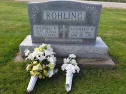
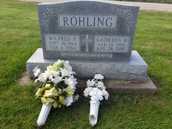
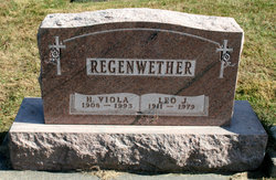
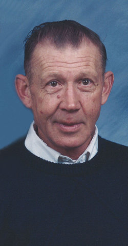
Kathleen M. “Kay” Regenwether Rohling
| Birth | : | 14 Apr 1916 Maquoketa, Jackson County, Iowa, USA |
| Death | : | 28 Aug 2012 Wheatland, Clinton County, Iowa, USA |
| Burial | : | Sacred Heart Cemetery, Lost Nation, Clinton County, USA |
| Coordinate | : | 41.9659500, -90.8199500 |
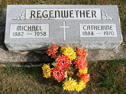
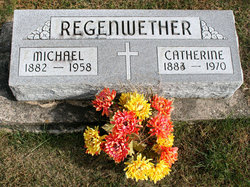
| Description | : | Kathleen "Kay" Rohling, 96, of Lost Nation, Iowa, died on Tuesday, August 28, 2012, at Wheatland Manor in Wheatland, Iowa. A mass celebrating "Kay's" life will be held at 10 A.M., Friday, August 31, 2012, from the Sacred Heart Catholic Church in Lost Nation, Iowa. Visitation will be held prior to the mass from 9 A.M. until service time. Kathleen "Kay" Regenwether was born on April 14, 1916 in Maquoketa, Iowa, to Michael and Catherine (Sprank) Regenwether. She was a graduate of Maquoketa High School. She married Wilfred P. Rohling on January 30, 1940 in Maquoketa, Iowa. He preceded her in... Read More |
frequently asked questions (FAQ):
-
Where is Kathleen M. “Kay” Regenwether Rohling's memorial?
Kathleen M. “Kay” Regenwether Rohling's memorial is located at: Sacred Heart Cemetery, Lost Nation, Clinton County, USA.
-
When did Kathleen M. “Kay” Regenwether Rohling death?
Kathleen M. “Kay” Regenwether Rohling death on 28 Aug 2012 in Wheatland, Clinton County, Iowa, USA
-
Where are the coordinates of the Kathleen M. “Kay” Regenwether Rohling's memorial?
Latitude: 41.9659500
Longitude: -90.8199500
Family Members:
Parent
Spouse
Siblings
Children
Flowers:
Nearby Cemetories:
1. Lost Nation Cemetery
Lost Nation, Clinton County, USA
Coordinate: 41.9654000, -90.8184000
2. Rustic Park
Clinton County, USA
Coordinate: 41.9712334, -90.8088684
3. Smithtown Cemetery
Lost Nation, Clinton County, USA
Coordinate: 41.9955000, -90.8555000
4. Busch Cemetery
Clinton County, USA
Coordinate: 41.9996986, -90.7818985
5. Washington Cemetery
Clinton County, USA
Coordinate: 42.0119019, -90.8399963
6. Elwood Cemetery
Elwood, Clinton County, USA
Coordinate: 41.9935989, -90.7307968
7. Rose Hill Cemetery
Toronto, Clinton County, USA
Coordinate: 41.9028015, -90.8660965
8. Saint James Cemetery
Toronto, Clinton County, USA
Coordinate: 41.9014015, -90.8681030
9. Massillon Cemetery
Massillon, Cedar County, USA
Coordinate: 41.9150000, -90.9205000
10. Saint Columbkille Cemetery
Bliedorn, Clinton County, USA
Coordinate: 41.9337330, -90.7039300
11. Goddard Cemetery
Maquoketa, Jackson County, USA
Coordinate: 42.0391998, -90.7335968
12. Mayflower Cemetery
Oxford Junction, Jones County, USA
Coordinate: 41.9935989, -90.9494019
13. Pine Hill Cemetery
Bliedorn, Clinton County, USA
Coordinate: 41.9309300, -90.6836500
14. Buckhorn Waterford Cemetery
Buckhorn, Jackson County, USA
Coordinate: 42.0607986, -90.7517014
15. Pence Cemetery
Baldwin, Jackson County, USA
Coordinate: 42.0746994, -90.8106003
16. Monmouth Cemetery
Monmouth, Jackson County, USA
Coordinate: 42.0679300, -90.8798400
17. Holy Trinity Catholic Cemetery
Baldwin, Jackson County, USA
Coordinate: 42.0770000, -90.8420000
18. Hershberger Cemetery
Baldwin, Jackson County, USA
Coordinate: 42.0772309, -90.8418011
19. Center Cemetery
Cedar County, USA
Coordinate: 41.9019012, -90.9555969
20. Oxford Junction Cemetery
Jones County, USA
Coordinate: 41.9764800, -90.9854200
21. Union Cemetery
Brookfield Township, Clinton County, USA
Coordinate: 42.0182991, -90.6694031
22. Pine Hill Cemetery
Wheatland, Clinton County, USA
Coordinate: 41.8446999, -90.8582993
23. Dubois Cemetery
Calamus, Clinton County, USA
Coordinate: 41.8438988, -90.7714005
24. Saint Paul's Cemetery
Wheatland, Clinton County, USA
Coordinate: 41.8382988, -90.8336029

