
| Birth | : | 31 Mar 1926 St. Francois County, Missouri, USA |
| Death | : | 18 Feb 1993 St. Louis City, Missouri, USA |
| Burial | : | Joe Hall Cemetery, Dry Creek, Knott County, USA |
| Coordinate | : | 37.3581009, -82.7861023 |
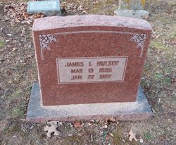
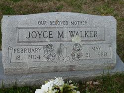
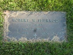
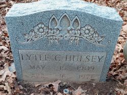
| Description | : | Daughter of James L. and Joyce (Gettinger) Hulsey. Married (1) Robert Sherrod and (2) Lonnie Stringer. Information taken from obituary (Under last name of Stringer) found at http://mackleygenealogy.com/~mackley/Obit_Display.php?pid=ST_000848.jpg |
frequently asked questions (FAQ):
-
Where is Kathryn Hulsey Stringer's memorial?
Kathryn Hulsey Stringer's memorial is located at: Joe Hall Cemetery, Dry Creek, Knott County, USA.
-
When did Kathryn Hulsey Stringer death?
Kathryn Hulsey Stringer death on 18 Feb 1993 in St. Louis City, Missouri, USA
-
Where are the coordinates of the Kathryn Hulsey Stringer's memorial?
Latitude: 37.3581009
Longitude: -82.7861023
Family Members:
Parent
Spouse
Siblings


Nearby Cemetories:
1. Joe Hall Cemetery
Dry Creek, Knott County, USA
Coordinate: 37.3581009, -82.7861023
2. Waddles Cemetery
Kite, Knott County, USA
Coordinate: 37.3368710, -82.8132920
3. Buckingham Cemetery
Buckingham, Floyd County, USA
Coordinate: 37.3696670, -82.7434300
4. William Thornsberry Cemetery
Kite, Knott County, USA
Coordinate: 37.3266640, -82.8155980
5. Thornsberry Cemetery
Kite, Knott County, USA
Coordinate: 37.3266640, -82.8156010
6. Henry Tuttle Cemetery
Kite, Knott County, USA
Coordinate: 37.3266500, -82.8156280
7. Burke Cemetery
Floyd County, USA
Coordinate: 37.3555984, -82.7352982
8. Strange Cemetery
Kite, Knott County, USA
Coordinate: 37.3143290, -82.7917500
9. Jonah Hall Cemetery
Kite, Knott County, USA
Coordinate: 37.3138340, -82.8150840
10. Gibson Cemetery #1
Knott County, USA
Coordinate: 37.3969002, -82.8339005
11. Bald Hill Cemetery
Knott County, USA
Coordinate: 37.3596992, -82.8546982
12. Cook Cemetery
Floyd County, USA
Coordinate: 37.3153000, -82.7347031
13. Slone - Pigman Cemetery
Dema, Floyd County, USA
Coordinate: 37.4189130, -82.7964380
14. Morgan Slone Cemetery
Dema, Floyd County, USA
Coordinate: 37.4224107, -82.8080691
15. Collins Cemetery #1
Floyd County, USA
Coordinate: 37.4241982, -82.8106003
16. Holbrook-Thomas Cemetery
Kite, Knott County, USA
Coordinate: 37.2887830, -82.7846930
17. Wilburn Hall Cemetery
Kite, Knott County, USA
Coordinate: 37.2966000, -82.7437900
18. Caleb Johnson Cemetery
Kite, Knott County, USA
Coordinate: 37.2954130, -82.8266870
19. Ben Hall Cemetery
Kite, Knott County, USA
Coordinate: 37.2907140, -82.7400940
20. Ode Osborne Cemetery
East McDowell, Floyd County, USA
Coordinate: 37.3906600, -82.6872900
21. Denver Tackett Cemetery
Floyd County, USA
Coordinate: 37.3467800, -82.6753180
22. Sparkman Cemetery
Mousie, Knott County, USA
Coordinate: 37.3798830, -82.8955330
23. Jay Conley Family Cemetery
Mousie, Knott County, USA
Coordinate: 37.4067740, -82.8816840
24. Wicker Family Cemetery
Mousie, Knott County, USA
Coordinate: 37.4233170, -82.8658170