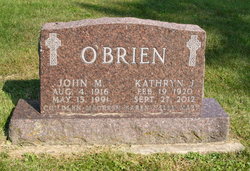
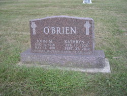
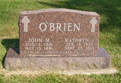
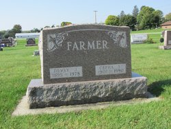
Kathryn Julia Farmer O'Brien
| Birth | : | 19 Feb 1920 Strawberry Point, Clayton County, Iowa, USA |
| Death | : | 27 Sep 2012 Guttenberg, Clayton County, Iowa, USA |
| Burial | : | Sacred Heart Cemetery, Clayton County, USA |
| Coordinate | : | 42.7542000, -91.4916992 |
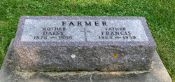
| Description | : | Kathryn Julia O'Brien, 92, of Strawberry Point, Iowa, died Thursday, September 27, 2012, at the Guttenberg Care Center. She was born February 19, 1920, on the family farm, rural Strawberry Point. She was the eleventh and youngest child of Francis and Daisy (Carpenter) Farmer. Kathryn walked to the rural school in the district through eighth grade and attended Strawberry Point High School her freshman year. She continued her education at Elkader High School, graduating in 1937, with a normal training teaching certificate. She was not old enough to teach the following year and opted to stay home to... Read More |
frequently asked questions (FAQ):
-
Where is Kathryn Julia Farmer O'Brien's memorial?
Kathryn Julia Farmer O'Brien's memorial is located at: Sacred Heart Cemetery, Clayton County, USA.
-
When did Kathryn Julia Farmer O'Brien death?
Kathryn Julia Farmer O'Brien death on 27 Sep 2012 in Guttenberg, Clayton County, Iowa, USA
-
Where are the coordinates of the Kathryn Julia Farmer O'Brien's memorial?
Latitude: 42.7542000
Longitude: -91.4916992
Family Members:
Parent
Spouse
Siblings
Flowers:
Nearby Cemetories:
1. Sacred Heart Cemetery
Clayton County, USA
Coordinate: 42.7542000, -91.4916992
2. Ross Cemetery
Clayton County, USA
Coordinate: 42.7528000, -91.4933014
3. Watkins Cemetery
Osborne, Clayton County, USA
Coordinate: 42.7833180, -91.4584733
4. Saint Sebald Lutheran Church Cemetery
Saint Sebald, Clayton County, USA
Coordinate: 42.7386000, -91.5460000
5. Mederville Cemetery
Elkader, Clayton County, USA
Coordinate: 42.7638893, -91.4194412
6. Cords Cemetery
Osborne, Clayton County, USA
Coordinate: 42.7973308, -91.4377662
7. Dohrer Cemetery
Osborne, Clayton County, USA
Coordinate: 42.8124846, -91.4584734
8. Hillcrest Cemetery
Volga, Clayton County, USA
Coordinate: 42.8047000, -91.5509000
9. Sacred Heart Cemetery
Volga, Clayton County, USA
Coordinate: 42.8050003, -91.5508270
10. Old Stone School Cemetery
Volga, Clayton County, USA
Coordinate: 42.7973000, -91.5661000
11. Strawberry Point Cemetery
Strawberry Point, Clayton County, USA
Coordinate: 42.6813800, -91.5236100
12. Union Cemetery
Littleport, Clayton County, USA
Coordinate: 42.7388992, -91.3780975
13. Garretson Cemetery
Volga, Clayton County, USA
Coordinate: 42.7422100, -91.6067580
14. Reed Cemetery
Clayton County, USA
Coordinate: 42.7353000, -91.6052000
15. Sacred Heart Cemetery
Littleport, Clayton County, USA
Coordinate: 42.7425003, -91.3747025
16. Noble Cemetery
Edgewood, Clayton County, USA
Coordinate: 42.6735992, -91.4471970
17. Green Hill Cemetery
Edgewood, Clayton County, USA
Coordinate: 42.6739006, -91.4207993
18. Hartman Cemetery
Cox Creek Township, Clayton County, USA
Coordinate: 42.8155360, -91.3880840
19. Communia Cemetery
Volga Township, Clayton County, USA
Coordinate: 42.7868996, -91.3630981
20. Meenan Cemetery
Communia, Clayton County, USA
Coordinate: 42.7999862, -91.3584693
21. Eberhard Cemetery
Littleport, Clayton County, USA
Coordinate: 42.7583201, -91.3418020
22. Blanchaine Cemetery
Volga, Clayton County, USA
Coordinate: 42.7676210, -91.3389040
23. Taylorsville Cemetery
Arlington, Fayette County, USA
Coordinate: 42.7694283, -91.6469727
24. Saint Josephs Cemetery
Elkader, Clayton County, USA
Coordinate: 42.8488998, -91.4021988

