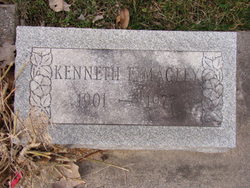
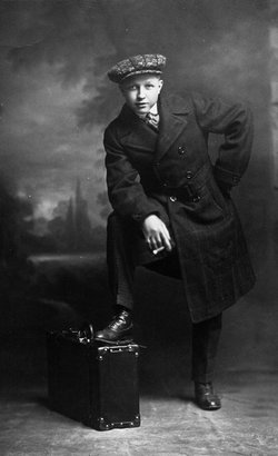
Kenneth E. Magley
| Birth | : | 15 Feb 1901 Thorncreek Township, Whitley County, Indiana, USA |
| Death | : | 18 Jul 1977 Columbia City, Whitley County, Indiana, USA |
| Burial | : | Fellowship Baptist Cemetery, Maryville, Blount County, USA |
| Coordinate | : | 35.7472000, -84.0017014 |
| Plot | : | Brand-2-5 |
| Description | : | Kenny Magley, a ditching & crane operator in this area, had his own airport on the first road off Rt.9 North of Columbia City. This road became known as Airport Road, soon after Kenny hung up a big sock to show the direction of the wind, and built a metal garage to house his Waco. Kenny used to start his Waco by having someone else wind the propeller until the motor was tight, then upon the pilot saying "contact" the winding man stepped back, and released the propeller, and the propeller spun around like a windmill. The motor either started... Read More |
frequently asked questions (FAQ):
-
Where is Kenneth E. Magley's memorial?
Kenneth E. Magley's memorial is located at: Fellowship Baptist Cemetery, Maryville, Blount County, USA.
-
When did Kenneth E. Magley death?
Kenneth E. Magley death on 18 Jul 1977 in Columbia City, Whitley County, Indiana, USA
-
Where are the coordinates of the Kenneth E. Magley's memorial?
Latitude: 35.7472000
Longitude: -84.0017014
Family Members:
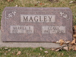
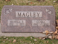
Parent
Spouse
Siblings
Children
Flowers:
Nearby Cemetories:
1. Fellowship Baptist Cemetery
Maryville, Blount County, USA
Coordinate: 35.7472000, -84.0017014
2. Morganton Acres Presbyterian Church Cemetery
Blount County, USA
Coordinate: 35.7462400, -84.0123860
3. Maple Grove Cemetery
Maryville, Blount County, USA
Coordinate: 35.7514153, -83.9898529
4. Old Quaker Cemetery
Blount County, USA
Coordinate: 35.7516600, -83.9813200
5. Saint Paul Evangelical Lutheran Church Columbarium
Maryville, Blount County, USA
Coordinate: 35.7259800, -83.9917900
6. Russells Cemetery
Louisville, Blount County, USA
Coordinate: 35.7655454, -84.0185676
7. Maryville Baptist Tabernacle
Maryville, Blount County, USA
Coordinate: 35.7656000, -84.0196910
8. Old Mount Tabor Cemetery
Maryville, Blount County, USA
Coordinate: 35.7655700, -84.0201300
9. Centennial Cemetery
Maryville, Blount County, USA
Coordinate: 35.7606642, -83.9771331
10. New Providence Cemetery
Maryville, Blount County, USA
Coordinate: 35.7532997, -83.9728012
11. Magnolia Cemetery
Maryville, Blount County, USA
Coordinate: 35.7503014, -83.9705963
12. Laurel Bank Baptist Church Cemetery
Friendsville, Blount County, USA
Coordinate: 35.7439003, -84.0357971
13. Our Lady of Fatima Catholic Church Columbarium
Alcoa, Blount County, USA
Coordinate: 35.7744140, -83.9901060
14. Mount Gilead Methodist Cemetery
Alcoa, Blount County, USA
Coordinate: 35.7619800, -83.9706000
15. Dotson Memorial Cemetery
Maryville, Blount County, USA
Coordinate: 35.7283478, -84.0315247
16. College Cemetery
Maryville, Blount County, USA
Coordinate: 35.7493600, -83.9607400
17. Cedar Lawn Cemetery
Blount County, USA
Coordinate: 35.7806015, -83.9878006
18. Armona Baptist Church Cemetery
Maryville, Blount County, USA
Coordinate: 35.7902985, -84.0130997
19. Mount Zion Baptist Church Cemetery
Maryville, Blount County, USA
Coordinate: 35.7698000, -84.0509900
20. Forest Hill Cemetery
Maryville, Blount County, USA
Coordinate: 35.7052994, -83.9674988
21. Long Crooked Creek Family Cemetery
Maryville, Blount County, USA
Coordinate: 35.7071700, -83.9617900
22. Faith Encounter Church Cemetery
Maryville, Blount County, USA
Coordinate: 35.7265520, -83.9432290
23. Hopewell Cemetery
Maryville, Blount County, USA
Coordinate: 35.7083015, -84.0475006
24. Pecks Chapel Cemetery
Maryville, Blount County, USA
Coordinate: 35.7336006, -83.9375000

