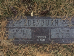
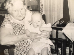
Kenneth J Edenburn
| Birth | : | 27 Feb 1912 Beverly, Lincoln County, Kansas, USA |
| Death | : | 24 Feb 1988 Council Bluffs, Pottawattamie County, Iowa, USA |
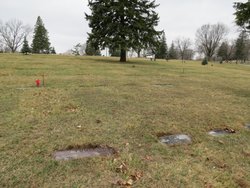
| Burial | : | Mansfield Catholic Cemetery, Mansfield, Richland County, USA |
| Coordinate | : | 40.7477240, -82.5139980 |
| Plot | : | Crestlawn Section, Lot 57, Grave 2 |
| Description | : | Kenneth Edenburn, age 75 years, owner and operator of Diamond Brothers Garage, Council Bluffs, Pottawattamie County, Iowa, passed away Wednesday, February 24, 1988. He was a Council Bluffs resident for the past 70 years. Preceded in death by wife Gladys in 1982. Funeral services Saturday at 10:30 A.M. in Woodring Chapel with Rev. Alvin Jenkins, Emanuel Lutheran Church officiating. Interment in Cedar Lawn Cemetery. Scheduled visitation Friday 7 to 8:30 P.M. at Woodrings Funeral Parlor. Information found in the Council Bluffs Nonpareil, February 26, 1988 |
frequently asked questions (FAQ):
-
Where is Kenneth J Edenburn's memorial?
Kenneth J Edenburn's memorial is located at: Mansfield Catholic Cemetery, Mansfield, Richland County, USA.
-
When did Kenneth J Edenburn death?
Kenneth J Edenburn death on 24 Feb 1988 in Council Bluffs, Pottawattamie County, Iowa, USA
-
Where are the coordinates of the Kenneth J Edenburn's memorial?
Latitude: 40.7477240
Longitude: -82.5139980
Family Members:
Parent
Spouse
Siblings
Flowers:
Nearby Cemetories:
1. Mansfield Cemetery
Mansfield, Richland County, USA
Coordinate: 40.7445030, -82.5110016
2. East Grave Yard (Defunct)
Mansfield, Richland County, USA
Coordinate: 40.7558880, -82.5117850
3. West Grave Yard (Defunct)
Mansfield, Richland County, USA
Coordinate: 40.7559420, -82.5183860
4. First English Lutheran Church Columbarium
Mansfield, Richland County, USA
Coordinate: 40.7583390, -82.5177620
5. Grace Episcopal Church Columbarium
Mansfield, Richland County, USA
Coordinate: 40.7598310, -82.5234630
6. First Congregational Church Columbarium
Mansfield, Richland County, USA
Coordinate: 40.7477740, -82.5394620
7. Painter Gravesite
Mansfield, Richland County, USA
Coordinate: 40.7700600, -82.4968400
8. Lantz Cemetery
Mansfield, Richland County, USA
Coordinate: 40.7517014, -82.4710999
9. Prince of Peace Catholic Cemetery
Mansfield, Richland County, USA
Coordinate: 40.7517630, -82.4687680
10. Ohio State Reformatory Cemetery
Mansfield, Richland County, USA
Coordinate: 40.7875460, -82.5028690
11. Marlow Cemetery
Mansfield, Richland County, USA
Coordinate: 40.7470200, -82.5719250
12. Caesarea Cemetery
Mansfield, Richland County, USA
Coordinate: 40.7106100, -82.4804400
13. Petit Cemetery
Mifflin Township, Richland County, USA
Coordinate: 40.7655983, -82.4550018
14. Emanuel Cemetery
Mifflin Township, Richland County, USA
Coordinate: 40.7417050, -82.4487230
15. Barr Cemetery
Mansfield, Richland County, USA
Coordinate: 40.7736220, -82.5742470
16. German Church Cemetery
Mansfield, Richland County, USA
Coordinate: 40.6913890, -82.5122500
17. Washington Village Cemetery
Little Washington, Richland County, USA
Coordinate: 40.6956000, -82.4772800
18. Valley Estates Gardens
Mansfield, Richland County, USA
Coordinate: 40.6977780, -82.5581940
19. Mansfield Memorial Park
Ontario, Richland County, USA
Coordinate: 40.7574997, -82.6053009
20. Saint Peters Evangelical Cemetery
Mansfield, Richland County, USA
Coordinate: 40.6778800, -82.5104900
21. Odd Fellows Cemetery
Lucas, Richland County, USA
Coordinate: 40.7047800, -82.4373878
22. Kisling Cemetery
Little Washington, Richland County, USA
Coordinate: 40.6745900, -82.5259440
23. Pleasant Grove Cemetery
Mansfield, Richland County, USA
Coordinate: 40.7821999, -82.4272003
24. Windsor Park Cemetery
Mansfield, Richland County, USA
Coordinate: 40.8018990, -82.4441986


