
| Birth | : | 1742 |
| Death | : | 12 Oct 1798 Friendsville, Garrett County, Maryland, USA |
| Burial | : | Öjeby Kyrkogård, Ojebyn, Piteå kommun, Sweden |
| Coordinate | : | 65.3455660, 21.3933039 |
| Plot | : | none |
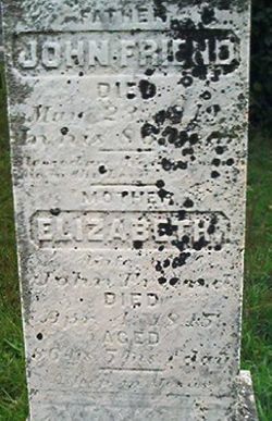
| Inscription | : | There is no extent marker or record of burial. |
| Description | : | Wife of Gabriel Friend, daughter of Job Hyatt. Her mother was a Native American, probably Delaware Indian. Her name (Kerrenhappuch) usually confuses people so that they think it is an Indian name of some sort when, in fact, it's a Biblical name taken from the book of Job.∼While her parents have yet to be proven, many suspect a family tie to Jost Heydt or "Joist Hite", a prominent figure in MD/VA history. Kerenhappuch was the wife of John L. Friend Sr., the first white settler to Garrett Co. Maryland. Their homestead eventually became the site for the town... Read More |
frequently asked questions (FAQ):
-
Where is Kerren happuch Hyatt Friend's memorial?
Kerren happuch Hyatt Friend's memorial is located at: Öjeby Kyrkogård, Ojebyn, Piteå kommun, Sweden.
-
When did Kerren happuch Hyatt Friend death?
Kerren happuch Hyatt Friend death on 12 Oct 1798 in Friendsville, Garrett County, Maryland, USA
-
Where are the coordinates of the Kerren happuch Hyatt Friend's memorial?
Latitude: 65.3455660
Longitude: 21.3933039
Family Members:
Spouse

Children
Flowers:


Nearby Cemetories:
1. Öjeby Kyrkogård
Ojebyn, Piteå kommun, Sweden
Coordinate: 65.3455660, 21.3933039
2. Muslimska Kyrkogården
Ojebyn, Piteå kommun, Sweden
Coordinate: 65.3690850, 21.3619690
3. Hedens Kyrkogård
Piteå, Piteå kommun, Sweden
Coordinate: 65.3718390, 21.3629990
4. Hortlax Kyrkogård
Hortlax, Piteå kommun, Sweden
Coordinate: 65.2852000, 21.3988000
5. Hortlax Skogskyrkogård
Hortlax, Piteå kommun, Sweden
Coordinate: 65.2840170, 21.4021820
6. Norrfjärden Kyrkogården
Norrfjarden, Piteå kommun, Sweden
Coordinate: 65.4215400, 21.4895700
7. Nederluleå kyrkogård
Gammelstad, Luleå kommun, Sweden
Coordinate: 65.6445700, 22.0288400
8. Innerstadens griftegård
Luleå, Luleå kommun, Sweden
Coordinate: 65.5914314, 22.1575676
9. Långträsk Kyrkogård
Piteå kommun, Sweden
Coordinate: 65.3866563, 20.3234943
10. Skogskyrkogården Södra Svartbyn
Bodens kommun, Sweden
Coordinate: 65.7964697, 21.7598486
11. Lundagård Kyrkogård
Boden, Bodens kommun, Sweden
Coordinate: 65.8193519, 21.6787128
12. Överluleå Gamla Kyrkogården
Boden, Bodens kommun, Sweden
Coordinate: 65.8296808, 21.6871287
13. Alhems Kyrkogård (skogskyrkogården)
Skellefteå, Skellefteå kommun, Sweden
Coordinate: 64.7557797, 20.9985884
14. Skellefteå Västra kyrkogård
Skellefteå, Skellefteå kommun, Sweden
Coordinate: 64.7519900, 20.9186000
15. Lund Cemetery
Lund, Skellefteå kommun, Sweden
Coordinate: 64.7491080, 20.9055672
16. Råneå kyrkogård
Råneå, Luleå kommun, Sweden
Coordinate: 65.8671127, 22.2993637
17. Vara Cemetery
Vara, Vara kommun, Sweden
Coordinate: 64.7456327, 20.8466761
18. Sävenäs
Savenas, Skellefteå kommun, Sweden
Coordinate: 64.6924063, 21.2107215
19. Gråträsk Kyrkogård
Gratrask, Piteå kommun, Sweden
Coordinate: 65.4861640, 19.7961550
20. Bureå Kyrkogård
Burea, Skellefteå kommun, Sweden
Coordinate: 64.6195220, 21.2026780
21. Glommersträsk Kyrkogård
Glommerstrask, Arvidsjaurs kommun, Sweden
Coordinate: 65.2812400, 19.6099900
22. Älvkyrkogården
Kalix kommun, Sweden
Coordinate: 65.8596210, 23.1327860
23. Morjärvs Kyrkogård
Kalix kommun, Sweden
Coordinate: 66.0693020, 22.7007360
24. Norsjö kyrkogård
Norsjö, Norsjö kommun, Sweden
Coordinate: 64.9147237, 19.4762989