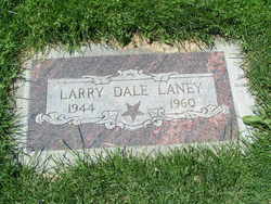
Larry Dale Laney
| Birth | : | 1944 Washington, USA |
| Death | : | 16 Aug 1960 Monroe, Snohomish County, Washington, USA |
| Burial | : | Mount Zion Cemetery, New Richmond, Clermont County, USA |
| Coordinate | : | 38.9176800, -84.2324400 |
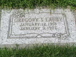
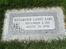
| Description | : | Washington Death Certificate Name Larry Dale Laney Death date 15 Aug 1960 Death place Monroe, Snohomish, Washington Gender Male Age at death 16 years Estimated birth year 1944 Father name Gregory S. Laney Mother name Rosamond Winders Film number 2034037 Digital GS number 4224600 Image number 166 Reference number 17362 |
frequently asked questions (FAQ):
-
Where is Larry Dale Laney's memorial?
Larry Dale Laney's memorial is located at: Mount Zion Cemetery, New Richmond, Clermont County, USA.
-
When did Larry Dale Laney death?
Larry Dale Laney death on 16 Aug 1960 in Monroe, Snohomish County, Washington, USA
-
Where are the coordinates of the Larry Dale Laney's memorial?
Latitude: 38.9176800
Longitude: -84.2324400
Family Members:
Parent
Siblings
Flowers:
Nearby Cemetories:
1. Mount Zion Cemetery
New Richmond, Clermont County, USA
Coordinate: 38.9176800, -84.2324400
2. Clark Cemetery
Clermontville, Clermont County, USA
Coordinate: 38.9207878, -84.2416153
3. Point Pleasant Cemetery
Point Pleasant, Clermont County, USA
Coordinate: 38.8972321, -84.2300568
4. Demeris Burial Site
Laurel, Clermont County, USA
Coordinate: 38.9393950, -84.2168490
5. John Fisher Cemetery
Laurel, Clermont County, USA
Coordinate: 38.9284750, -84.2020170
6. Collard Cemetery
Clermontville, Clermont County, USA
Coordinate: 38.9317861, -84.2624250
7. Franklin Cemetery
Laurel, Clermont County, USA
Coordinate: 38.9455700, -84.2278600
8. Laurel Cemetery
Laurel, Clermont County, USA
Coordinate: 38.9207993, -84.1949997
9. Sherwin Cemetery
Point Pleasant, Clermont County, USA
Coordinate: 38.8920720, -84.2073560
10. Dunlap Grave
California, Campbell County, USA
Coordinate: 38.9223520, -84.2742330
11. Grandview Cemetery
Mentor, Campbell County, USA
Coordinate: 38.8880997, -84.2557983
12. Beall Family Cemetery
Mentor, Campbell County, USA
Coordinate: 38.8866882, -84.2624588
13. Corbin Family Cemetery
Carthage, Campbell County, USA
Coordinate: 38.9168500, -84.2828330
14. Greenmound Cemetery
New Richmond, Clermont County, USA
Coordinate: 38.9435997, -84.2703018
15. Shaw Cemetery
New Richmond, Clermont County, USA
Coordinate: 38.9572670, -84.2236000
16. Alexander Robb Cemetery
Monroe Township, Clermont County, USA
Coordinate: 38.9582330, -84.2329500
17. Flagg Springs Baptist Church Cemetery
Flagg Spring, Campbell County, USA
Coordinate: 38.8836110, -84.2641667
18. Ball Family Graveyard
California, Campbell County, USA
Coordinate: 38.9276670, -84.2864170
19. Watkins Hill Cemetery
New Richmond, Clermont County, USA
Coordinate: 38.9510994, -84.2707977
20. Moreland Cemetery
New Richmond, Clermont County, USA
Coordinate: 38.9646988, -84.2525024
21. Fee Cemetery
Point Pleasant, Clermont County, USA
Coordinate: 38.8787117, -84.1912766
22. Tarvin-Moore Cemetery
Carthage, Campbell County, USA
Coordinate: 38.9328070, -84.2974950
23. James Lindsey Cemetery
California, Campbell County, USA
Coordinate: 38.9453680, -84.2926330
24. Light-Springer Cemetery
New Richmond, Clermont County, USA
Coordinate: 38.9612070, -84.2748170


