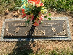
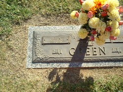
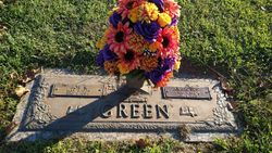
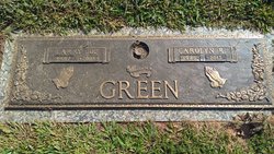
Larry Joe Green
| Birth | : | 1947 |
| Death | : | 2008 |
| Burial | : | Elmwood Cemetery, Otisfield, Oxford County, USA |
| Coordinate | : | 44.1019630, -70.5504070 |
| Plot | : | The Garden Of Saint John, Section C |
| Description | : | Larry Joe Green, 60, of 202 Murphy Lane, husband of Carolyn Robertson Green, died Friday, February 8, 2008. Born in Greenville, he was the son of Sue Harvey Green of Mauldin and the late J.B. Green. Mr. Green was co-owner of J.B. Green Trucking Company and attended Brookwood Church. Surviving, in addition to his wife and mother, are two daughters, Cindy Green of Mauldin, and Susan Green Schoening and her husband, Klaus, of Mauldin; five granddaughters, Jessi Curtis, Karson Childers, Ashton, Lauren and Hannah Schoening; two grandsons, Nick "Bubba" Curtis and Dieter Schoening; a sister, Brenda Gardo and her husband, Guy, of Maudlin;... Read More |
frequently asked questions (FAQ):
-
Where is Larry Joe Green's memorial?
Larry Joe Green's memorial is located at: Elmwood Cemetery, Otisfield, Oxford County, USA.
-
When did Larry Joe Green death?
Larry Joe Green death on 2008 in
-
Where are the coordinates of the Larry Joe Green's memorial?
Latitude: 44.1019630
Longitude: -70.5504070
Family Members:
Parent
Spouse
Flowers:
Nearby Cemetories:
1. Elmwood Cemetery
Otisfield, Oxford County, USA
Coordinate: 44.1019630, -70.5504070
2. Bell Hill Cemetery
Otisfield, Oxford County, USA
Coordinate: 44.0883130, -70.5602760
3. Wight Cemetery
Otisfield, Oxford County, USA
Coordinate: 44.0890990, -70.5381570
4. East Otisfield Cemetery
Otisfield, Oxford County, USA
Coordinate: 44.0950300, -70.5237500
5. Highland Cemetery
Otisfield, Oxford County, USA
Coordinate: 44.1007100, -70.5796200
6. Scribner Hill Cemetery Lower Yard
Otisfield, Oxford County, USA
Coordinate: 44.0769660, -70.5261470
7. Oakdale Cemetery
Otisfield, Oxford County, USA
Coordinate: 44.1013900, -70.6014500
8. Richville Cemetery
Oxford, Oxford County, USA
Coordinate: 44.1340390, -70.5226510
9. Bolster's Mills Cemetery
Harrison, Cumberland County, USA
Coordinate: 44.1171700, -70.5987020
10. Cobb Hill Cemetery
Otisfield, Oxford County, USA
Coordinate: 44.0746000, -70.5095000
11. Merrill Memorial Cemetery
Otisfield, Oxford County, USA
Coordinate: 44.1474250, -70.5608830
12. Stuarts Corner Cemetery
Bolsters Mills, Cumberland County, USA
Coordinate: 44.1417700, -70.5975200
13. Ryefield Cemetery
Cumberland County, USA
Coordinate: 44.1417007, -70.5994034
14. Riverside Cemetery
Oxford, Oxford County, USA
Coordinate: 44.1338921, -70.4907227
15. Maple Ridge Cemetery
Harrison, Cumberland County, USA
Coordinate: 44.0936012, -70.6278000
16. Caswells Corner Cemetery
Harrison, Cumberland County, USA
Coordinate: 44.1312003, -70.6191605
17. Cedar Crest Cemetery
Otisfield, Oxford County, USA
Coordinate: 44.0442009, -70.5438995
18. Oak Hill Cemetery
Otisfield, Oxford County, USA
Coordinate: 44.0464040, -70.5762640
19. Unidentified Cemetery
Harrison, Cumberland County, USA
Coordinate: 44.1222448, -70.6322634
20. Perley Cemetery
Harrison, Cumberland County, USA
Coordinate: 44.1222220, -70.6324794
21. South Otisfield Cemetery
Otisfield, Oxford County, USA
Coordinate: 44.0428560, -70.5131290
22. Summit Hill Cemetery
Harrison, Cumberland County, USA
Coordinate: 44.1269770, -70.6354860
23. Craigie Cemetery
Oxford, Oxford County, USA
Coordinate: 44.1383430, -70.4717770
24. Carsley Cemetery
Harrison, Cumberland County, USA
Coordinate: 44.0586560, -70.6224610


