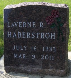
LaVerne R O'Brien Haberstroh
| Birth | : | 16 Jul 1933 Rock Lake, Towner County, North Dakota, USA |
| Death | : | 9 Mar 2011 Pendleton, Umatilla County, Oregon, USA |
| Burial | : | Parklawns Memorial Gardens, Chambersburg, Franklin County, USA |
| Coordinate | : | 39.9741516, -77.6243362 |
| Plot | : | Block A Lot 16 |
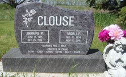
| Description | : | July 16, 1933-March 9, 2011 ROLLA LaVerne R. Haberstroh, 77, Rolla, died Wednesday, March 9, 2011, in a Pendleton, Ore., nursing home. She was born July 16, 1933, to Roy and Julia O'Brien in Rock Lake. She married Anthony Voltz in 1951. He died in 1976. She married Gerald Haberstroh in October 1979 in Sisseton, S.D. They divorced in 2004. Survivors: sons, Terry Voltz, Mesa, Ariz., Brian Voltz, Gold Canyon, Ariz.; daughter, Robin Tucker, Pendleton, Ore.; eight grandchildren; four great-grandchildren; sister, Lorraine Clouse, Rolla. Funeral: Thursday, 1 p.m., in Elick Funeral Home, Rolla. Burial: IOOF Cemetery, Rock Lake, |
frequently asked questions (FAQ):
-
Where is LaVerne R O'Brien Haberstroh's memorial?
LaVerne R O'Brien Haberstroh's memorial is located at: Parklawns Memorial Gardens, Chambersburg, Franklin County, USA.
-
When did LaVerne R O'Brien Haberstroh death?
LaVerne R O'Brien Haberstroh death on 9 Mar 2011 in Pendleton, Umatilla County, Oregon, USA
-
Where are the coordinates of the LaVerne R O'Brien Haberstroh's memorial?
Latitude: 39.9741516
Longitude: -77.6243362
Family Members:
Parent
Siblings
Flowers:
Nearby Cemetories:
1. Parklawns Memorial Gardens
Chambersburg, Franklin County, USA
Coordinate: 39.9741516, -77.6243362
2. Shirk's Mennonite Cemetery
Chambersburg, Franklin County, USA
Coordinate: 39.9720190, -77.6319010
3. Norland Cemetery
Chambersburg, Franklin County, USA
Coordinate: 39.9667400, -77.6372500
4. Green Village United Methodist Cemetery
Green Village, Franklin County, USA
Coordinate: 39.9922910, -77.6106940
5. Brinzer-Brainer Cemetery
Chambersburg, Franklin County, USA
Coordinate: 39.9636870, -77.6483340
6. Chambersburg Mennonite Cemetery
Chambersburg, Franklin County, USA
Coordinate: 39.9567000, -77.6453000
7. Greenvillage Lutheran Cemetery
Chambersburg, Franklin County, USA
Coordinate: 39.9946000, -77.6074000
8. Culbertson Mennonite Church Cemetery
Chambersburg, Franklin County, USA
Coordinate: 39.9994300, -77.6247400
9. Salem United Brethren Church Cemetery
Chambersburg, Franklin County, USA
Coordinate: 39.9851000, -77.6555000
10. Scotland United Methodist Church Cemetery
Franklin County, USA
Coordinate: 39.9695000, -77.5869000
11. Covenanter Cemetery
Scotland, Franklin County, USA
Coordinate: 39.9693867, -77.5864995
12. Park Avenue United Methodist Church Columbarium
Chambersburg, Franklin County, USA
Coordinate: 39.9491570, -77.6486410
13. Witwer Farm Graveyard
Scotland, Franklin County, USA
Coordinate: 39.9497780, -77.5932380
14. Saint Paul United Methodist Church Columbarium
Chambersburg, Franklin County, USA
Coordinate: 39.9422500, -77.6409630
15. Rocky Spring Churchyard
Chambersburg, Franklin County, USA
Coordinate: 39.9886290, -77.6756130
16. Air Hill Cemetery
Chambersburg, Franklin County, USA
Coordinate: 40.0169500, -77.6355000
17. Falling Spring Presbyterian Church Cemetery
Chambersburg, Franklin County, USA
Coordinate: 39.9410670, -77.6615500
18. Franklin County Memorial Garden
Chambersburg, Franklin County, USA
Coordinate: 39.9307050, -77.6317550
19. Cedar Grove Cemetery
Chambersburg, Franklin County, USA
Coordinate: 39.9417000, -77.6644000
20. Trinity Episcopal Church Columbarium
Chambersburg, Franklin County, USA
Coordinate: 39.9362440, -77.6590820
21. Israel Benevolent Society Cemetery
Chambersburg, Franklin County, USA
Coordinate: 39.9340900, -77.6557900
22. Lincoln Cemetery
Chambersburg, Franklin County, USA
Coordinate: 39.9297500, -77.6450000
23. Stoufferstown Cemetery
Chambersburg, Franklin County, USA
Coordinate: 39.9277000, -77.6399000
24. First Evangelical United Brethren Church Cemetery
Chambersburg, Franklin County, USA
Coordinate: 39.9337240, -77.6603470


