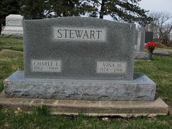
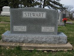
Lavina Helena “Vina” Moody Stewart
| Birth | : | 13 Dec 1874 Sweden |
| Death | : | 17 Oct 1966 Pawnee County, Nebraska, USA |
| Burial | : | Moascar War Cemetery, Egypt |
| Coordinate | : | 30.6024800, 32.2220500 |
| Plot | : | Hazel Hill 5 Section, Lot 2, Grave 11 |
| Description | : | PAWNEE REPUBLICAN, Pawnee City, Nebraska, Thursday, November 3, 1966. Page 5. VINA STEWART Vina Helena Moody was born Dec. 13, 1874, near Stockholm, Sweden, one of eight children, to John and Johanna Moody. When she was six years old, her family came to the United States in a sailing boat. The family settled on a farm near Helvey, Nebr. Vina was married to Charles Elliott Stewart on June 13, 1893, and Mr. and Mrs. Stewart lived in Pawnee City all their married life until 1908, at which time they moved to Lakin, Kans. Mr. and Mrs. Stewart had six... Read More |
frequently asked questions (FAQ):
-
Where is Lavina Helena “Vina” Moody Stewart's memorial?
Lavina Helena “Vina” Moody Stewart's memorial is located at: Moascar War Cemetery, Egypt.
-
When did Lavina Helena “Vina” Moody Stewart death?
Lavina Helena “Vina” Moody Stewart death on 17 Oct 1966 in Pawnee County, Nebraska, USA
-
Where are the coordinates of the Lavina Helena “Vina” Moody Stewart's memorial?
Latitude: 30.6024800
Longitude: 32.2220500
Family Members:
Parent
Spouse
Siblings
Children
Flowers:
Nearby Cemetories:
1. Moascar War Cemetery
Egypt
Coordinate: 30.6024800, 32.2220500
2. Fayid War Cemetery
Egypt
Coordinate: 30.3063600, 32.3281800
3. Kibbutz Mefalsim Cemetery
Israel
Coordinate: 31.4950540, 34.5549890
4. Yeroham Cemetery
Israel
Coordinate: 30.9814360, 34.9469950
5. Gan Yavne Old Cemetery
Israel
Coordinate: 31.7989410, 34.7156950
6. Be'er Ya'akov Cemetery
Israel
Coordinate: 31.9355476, 34.8225859
7. Kibuutz Tzora
Israel
Coordinate: 31.7659110, 34.9682360
8. Arad Cemetery
Israel
Coordinate: 31.2739750, 35.2286910
9. Savyon Cemetery
Israel
Coordinate: 32.0483510, 34.8906150
10. Kfar Shmaryahu Cemetery
Israel
Coordinate: 32.1899880, 34.8277520
11. Kibbutz Einat Cemetery
Israel
Coordinate: 32.0785108, 34.9341869
12. باب السل
Israel
Coordinate: 31.7747251, 35.2332976
13. Kfar Khayim Common Cemetery Kfar Khayim
Israel
Coordinate: 32.3629975, 34.9023282
14. בית עלמין - מועצה מקומית בית אל Beit El Cemetery
Israel
Coordinate: 31.9419080, 35.2285347
15. Sha'ar Menashe Regional Cemetery
Israel
Coordinate: 32.4488000, 35.0130000
16. Kibbutz Ein Shemer
Israel
Coordinate: 32.4629131, 35.0071901
17. Ma'anit
Israel
Coordinate: 32.4549779, 35.0304369
18. Kibbutz Barkai Cemetery
Israel
Coordinate: 32.4740481, 35.0337857
19. Zikaron Yaakov Cemetery
Israel
Coordinate: 32.5695945, 34.9525107
20. Ein Hod Cemetery
Israel
Coordinate: 32.7034916, 34.9829427
21. Yokne'am Cemetery
Israel
Coordinate: 32.6672870, 35.1015948
22. AlMisdar
Jordan
Coordinate: 31.9117035, 35.9393549
23. Kfar Vradim
Israel
Coordinate: 33.0013007, 35.2546278
24. Kibbutz Ein-Gev Cemetery
Israel
Coordinate: 32.7861000, 35.6429700

