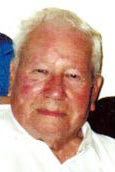
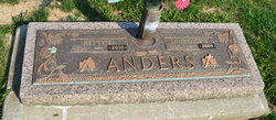
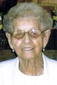
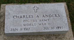
Lawrence E Anders
| Birth | : | 12 Jan 1920 Corbin, Knox County, Kentucky, USA |
| Death | : | 16 Oct 2009 Lima, Allen County, Ohio, USA |
| Burial | : | Short Ridge Cemetery, Garland, McDowell County, USA |
| Coordinate | : | 37.3724200, -81.7769440 |
| Description | : | Lima - Lawrence E. "Bunk" Anders, 89, died at noon Oct. 16, 2009, at Lima Memorial Health System. He was born June 12, 1920, in Corbin, Ky., to John F. and Alice Petrey Anders, who preceded him in death. On May 30, 1942, he married Betty E. Furry, who survives. Mr. Anders was an Army veteran of World War II, serving from 1942 to 1945. He retired in 1982 as a tester and inspector from Westinghouse Electric Corp. He was a member of Lima Baptist Temple. He was a life member of Lodge 205 Free & Accepted Masons, for 62 years. He... Read More |
frequently asked questions (FAQ):
-
Where is Lawrence E Anders's memorial?
Lawrence E Anders's memorial is located at: Short Ridge Cemetery, Garland, McDowell County, USA.
-
When did Lawrence E Anders death?
Lawrence E Anders death on 16 Oct 2009 in Lima, Allen County, Ohio, USA
-
Where are the coordinates of the Lawrence E Anders's memorial?
Latitude: 37.3724200
Longitude: -81.7769440
Family Members:
Parent
Spouse
Siblings
Flowers:
Nearby Cemetories:
1. Short Ridge Cemetery
Garland, McDowell County, USA
Coordinate: 37.3724200, -81.7769440
2. Deskins Cemetery
Atwell, McDowell County, USA
Coordinate: 37.3711014, -81.7506027
3. Click-Garlic Cemetery on Coal Camp Hill
Bradshaw, McDowell County, USA
Coordinate: 37.3541800, -81.7925300
4. Blevins Cemetery
Avondale, McDowell County, USA
Coordinate: 37.3972015, -81.7593994
5. Woods Cemetery
Bradshaw, McDowell County, USA
Coordinate: 37.3502998, -81.8217010
6. Powell Cemetery
Iaeger, McDowell County, USA
Coordinate: 37.4099998, -81.8161011
7. Roberts Cemetery
Beartown, McDowell County, USA
Coordinate: 37.3976120, -81.8367830
8. Rowe Cemetery
Bradshaw, McDowell County, USA
Coordinate: 37.3838997, -81.8443985
9. Jacob H Rowe Cemetery
Beartown, McDowell County, USA
Coordinate: 37.3841439, -81.8444955
10. Kelly Cemetery
McDowell County, USA
Coordinate: 37.4219017, -81.8143997
11. Bowles Cemetery
McDowell County, USA
Coordinate: 37.4303017, -81.7932968
12. Horn Cemetery
McDowell County, USA
Coordinate: 37.3932991, -81.8486023
13. Brant Cemetery
McDowell County, USA
Coordinate: 37.3946991, -81.8482971
14. Candy Cemetery
McDowell County, USA
Coordinate: 37.3955994, -81.8510971
15. Mitchell Cemetery
Jolo, McDowell County, USA
Coordinate: 37.3193606, -81.8347545
16. W. G. Hatifield Cemetery
Jolo, McDowell County, USA
Coordinate: 37.3104920, -81.8291280
17. Buckeye Cemetery
Jolo, McDowell County, USA
Coordinate: 37.3100014, -81.8292007
18. Kennedy Cemetery
McDowell County, USA
Coordinate: 37.3647003, -81.8767014
19. Day Cemetery
McDowell County, USA
Coordinate: 37.3191986, -81.8644028
20. Keen Cemetery
McDowell County, USA
Coordinate: 37.3130989, -81.8617020
21. Robert Cemetery
Iaeger, McDowell County, USA
Coordinate: 37.4606018, -81.8035965
22. Roberts Cemetery
Iaeger, McDowell County, USA
Coordinate: 37.4606670, -81.8034480
23. Knob Cemetery
McDowell County, USA
Coordinate: 37.2811012, -81.7928009
24. Reynolds Cemetery
Iaeger, McDowell County, USA
Coordinate: 37.4639800, -81.8135500

