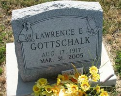
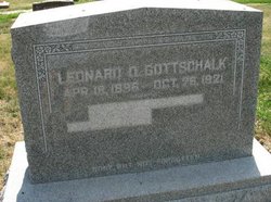
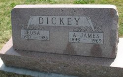
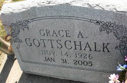
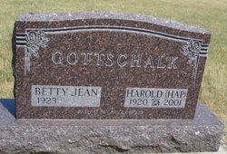
Lawrence Edward Gottschalk
| Birth | : | 17 Aug 1917 Minburn, Dallas County, Iowa, USA |
| Death | : | 31 Mar 2005 Marshalltown, Marshall County, Iowa, USA |
| Burial | : | St. Swithins Cemetery, Lincoln, City of Lincoln, England |
| Coordinate | : | 53.2197390, -0.5221790 |
| Description | : | Lawrence E. Gottschalk, 87, died March 31, 2005 at the Iowa Veteran's Home in Marshalltown. Lawrence was born August 17, 1917 in Minburn, Iowa. He served in the U.S. Navy in World War II. He owned and operated his own TV repair business in California. He had lived in Marshalltown for the past three years. He enjoyed fixing things. Lawrence is survived by his daughter, Diana Collins of Pleasant Hill; his sons, Leonard Gottschalk of Mesa, Arizona, Ralph Gottschalk of Temecula, California, and Darrell Gottschalk of Warner Springs, California, his sister, Dorothy... Read More |
frequently asked questions (FAQ):
-
Where is Lawrence Edward Gottschalk's memorial?
Lawrence Edward Gottschalk's memorial is located at: St. Swithins Cemetery, Lincoln, City of Lincoln, England.
-
When did Lawrence Edward Gottschalk death?
Lawrence Edward Gottschalk death on 31 Mar 2005 in Marshalltown, Marshall County, Iowa, USA
-
Where are the coordinates of the Lawrence Edward Gottschalk's memorial?
Latitude: 53.2197390
Longitude: -0.5221790
Family Members:
Parent
Spouse
Siblings
Flowers:

May The Lord bless you and keep you. May The Lord shine His face upon you and be gracious unto you. May The Lord lift up His countenance upon you and give you peace. Amen!
Left by Anonymous on 12 Nov 2006

Was a resident at the Iowa Veterans Home located in Marshalltown; Marshall County, Iowa.
Left by Anonymous on 12 Nov 2006
Nearby Cemetories:
1. St. Swithins Cemetery
Lincoln, City of Lincoln, England
Coordinate: 53.2197390, -0.5221790
2. Lincoln Crematorium
Lincoln, City of Lincoln, England
Coordinate: 53.2199540, -0.5192020
3. Canwick Road New Cemetery
Lincoln, City of Lincoln, England
Coordinate: 53.2192760, -0.5252190
4. All Saints Churchyard
Canwick, North Kesteven District, England
Coordinate: 53.2159000, -0.5236900
5. Canwick Road Old Cemetery
Lincoln, City of Lincoln, England
Coordinate: 53.2188730, -0.5325570
6. Greyfriars Cemetery
Lincoln, City of Lincoln, England
Coordinate: 53.2291600, -0.5368920
7. St Peter at Gowts Churchyard
Lincoln, City of Lincoln, England
Coordinate: 53.2217400, -0.5438700
8. St Anne's Bede Houses
Lincoln, City of Lincoln, England
Coordinate: 53.2336100, -0.5261500
9. Lincoln Prison Cemetery
Lincoln, City of Lincoln, England
Coordinate: 53.2355150, -0.5177630
10. Saint Margaret in the Close Churchyard
Lincoln, City of Lincoln, England
Coordinate: 53.2338310, -0.5352511
11. St. Martin's Churchyard
Lincoln, City of Lincoln, England
Coordinate: 53.2303499, -0.5425414
12. St. Michael on the Mount Churchyard
Lincoln, City of Lincoln, England
Coordinate: 53.2334150, -0.5378640
13. Lincoln Cathedral
Lincoln, City of Lincoln, England
Coordinate: 53.2341805, -0.5363450
14. St. Peter in Eastgate Churchyard
Lincoln, City of Lincoln, England
Coordinate: 53.2355350, -0.5335080
15. Eastgate Cemetery
Lincoln, City of Lincoln, England
Coordinate: 53.2371410, -0.5312100
16. Lincoln Castle Cemetery
Lincoln, City of Lincoln, England
Coordinate: 53.2342640, -0.5415700
17. Saint Mary Magdalene in the Bail Churchyard
Lincoln, City of Lincoln, England
Coordinate: 53.2366000, -0.5402700
18. St Nicholas Parish Churchyard
Lincoln, City of Lincoln, England
Coordinate: 53.2400800, -0.5376400
19. Newport Cemetery
Lincoln, City of Lincoln, England
Coordinate: 53.2405150, -0.5362590
20. St Helen's Churchyard
Boultham, City of Lincoln, England
Coordinate: 53.2101160, -0.5571000
21. All Saints Churchyard
Greetwell, West Lindsey District, England
Coordinate: 53.2312000, -0.4831000
22. St John's Hospital Cemetery
Bracebridge Heath, North Kesteven District, England
Coordinate: 53.1941467, -0.5310204
23. All Saints Churchyard
Bracebridge, City of Lincoln, England
Coordinate: 53.1992080, -0.5522560
24. St. John Churchyard
Washingborough, North Kesteven District, England
Coordinate: 53.2229620, -0.4758650

