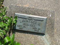
Lawrence Harvey Shanks
| Birth | : | 24 Sep 1887 Maryville, Nodaway County, Missouri, USA |
| Death | : | 20 Nov 1940 Maryville, Nodaway County, Missouri, USA |
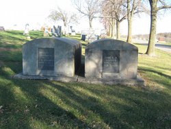
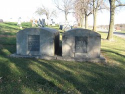
| Burial | : | Sunset Rest Cemetery, Northwood, Worth County, USA |
| Coordinate | : | 43.4481010, -93.2281036 |
| Plot | : | Central B (5), Row 10 |
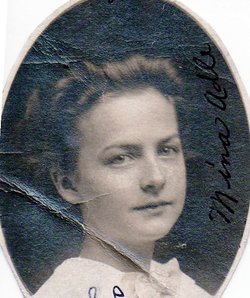
| Description | : | Wife: Mina Adle Gett Shanks as per Dan Hoffman, FAG#47494005, 07 Sep, 2015. |
frequently asked questions (FAQ):
-
Where is Lawrence Harvey Shanks's memorial?
Lawrence Harvey Shanks's memorial is located at: Sunset Rest Cemetery, Northwood, Worth County, USA.
-
When did Lawrence Harvey Shanks death?
Lawrence Harvey Shanks death on 20 Nov 1940 in Maryville, Nodaway County, Missouri, USA
-
Where are the coordinates of the Lawrence Harvey Shanks's memorial?
Latitude: 43.4481010
Longitude: -93.2281036
Family Members:
Parent
Spouse
Siblings
Flowers:
Nearby Cemetories:
1. Sunset Rest Cemetery
Northwood, Worth County, USA
Coordinate: 43.4481010, -93.2281036
2. South Shell Rock Cemetery
Northwood, Worth County, USA
Coordinate: 43.4439011, -93.2414017
3. North Shell Rock Cemetery
Northwood, Worth County, USA
Coordinate: 43.4566994, -93.2600021
4. Stateline Cemetery
Northwood, Worth County, USA
Coordinate: 43.4874992, -93.2416992
5. Wanderers Rest Cemetery
Gordonsville, Freeborn County, USA
Coordinate: 43.5133286, -93.2094421
6. London and Deer Creek Cemetery
Worth County, USA
Coordinate: 43.4874992, -93.1239014
7. Deer Creek Cemetery
London, Freeborn County, USA
Coordinate: 43.5005989, -93.1235962
8. Elk Grove Cemetery
Kensett, Worth County, USA
Coordinate: 43.3581009, -93.2643967
9. Towne Cemetery
Northwood, Worth County, USA
Coordinate: 43.4805000, -93.3502000
10. Kensett Cemetery
Kensett, Worth County, USA
Coordinate: 43.3558006, -93.2003021
11. Pilgrims Rest Cemetery
Myrtle, Freeborn County, USA
Coordinate: 43.5430603, -93.1750031
12. Elk Creek Lutheran Cemetery
Kensett, Worth County, USA
Coordinate: 43.3577805, -93.3002777
13. Silver Lake Lutheran Church Cemetery
Silver Lake, Worth County, USA
Coordinate: 43.4772186, -93.3780594
14. Our Saviors Danish Lutheran Cemetery
Myrtle, Freeborn County, USA
Coordinate: 43.5580400, -93.1697300
15. South Silver Lake Cemetery
Silver Lake Township, Worth County, USA
Coordinate: 43.4508330, -93.3988890
16. Sion Lutheran Church Cemetery
Bristol, Worth County, USA
Coordinate: 43.4186096, -93.3986130
17. Greenwood Cemetery
Glenville, Freeborn County, USA
Coordinate: 43.5727997, -93.2675018
18. Round Prairie Cemetery
Glenville, Freeborn County, USA
Coordinate: 43.5411987, -93.3529968
19. Mockingbird Hill Cemetery (Defunct)
Myrtle, Freeborn County, USA
Coordinate: 43.5574989, -93.1299973
20. Somber Lutheran Cemetery
Somber, Worth County, USA
Coordinate: 43.4150009, -93.4047165
21. Bristol Cemetery
Joice, Worth County, USA
Coordinate: 43.3866200, -93.3993700
22. North Round Prairie Cemetery
Glenville, Freeborn County, USA
Coordinate: 43.5531006, -93.3649979
23. Deer Creek Lutheran Church Cemetery
Carpenter, Mitchell County, USA
Coordinate: 43.4297218, -93.0236130
24. Sacred Heart Catholic Church Cemetery
Manly, Worth County, USA
Coordinate: 43.2911110, -93.2013931

