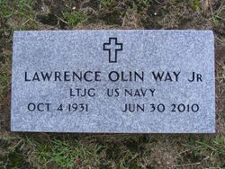
Lawrence Olin Way Jr.
| Birth | : | 4 Oct 1931 Holly Hill, Orangeburg County, South Carolina, USA |
| Death | : | 30 Jun 2010 Holly Hill, Orangeburg County, South Carolina, USA |
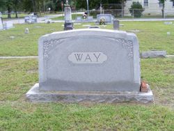
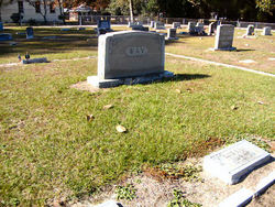
| Burial | : | Porter Grove Baptist Church Cemetery, Coxville, Crockett County, USA |
| Coordinate | : | 35.8322080, -89.0034930 |
| Description | : | Lawrence Olin Way, Jr., of Holly Hill, died June 30, 2010. Born October 4, 1931, in Holly Hill, he was the third child of the late Eloise Breeland Way and Lawrence Olin Way, Sr. Mr. Way attended Furman University attaining a degree in Business Administration. He applied for Naval Reserve officer school during the Korean War and was commissioned a Navy ensign in 1953 and was discharged in 1955. Upon discharge from the Navy, he was a cotton and grain farmer from 1955 to 1980. He established Holly Hill Milling Company, Inc. serving as owner from 1957 to 1980. He later... Read More |
frequently asked questions (FAQ):
-
Where is Lawrence Olin Way Jr.'s memorial?
Lawrence Olin Way Jr.'s memorial is located at: Porter Grove Baptist Church Cemetery, Coxville, Crockett County, USA.
-
When did Lawrence Olin Way Jr. death?
Lawrence Olin Way Jr. death on 30 Jun 2010 in Holly Hill, Orangeburg County, South Carolina, USA
-
Where are the coordinates of the Lawrence Olin Way Jr.'s memorial?
Latitude: 35.8322080
Longitude: -89.0034930
Family Members:
Parent
Spouse
Siblings
Children
Flowers:
Nearby Cemetories:
1. Porter Grove Baptist Church Cemetery
Coxville, Crockett County, USA
Coordinate: 35.8322080, -89.0034930
2. Porter Graveyard
Coxville, Crockett County, USA
Coordinate: 35.8324830, -89.0114610
3. McLeary-James Graveyard
Coxville, Crockett County, USA
Coordinate: 35.8252360, -88.9943360
4. Cox's Chapel Church of Christ Cemetery
Coxville, Crockett County, USA
Coordinate: 35.8222860, -89.0154960
5. James Cemetery
Coxville, Crockett County, USA
Coordinate: 35.8268170, -88.9797220
6. Salem Cemetery
Gadsden, Crockett County, USA
Coordinate: 35.8054090, -89.0133110
7. Richardson-Boon Cemetery
Gadsden, Crockett County, USA
Coordinate: 35.8157390, -88.9694740
8. Harpole Cemetery
Alamo, Crockett County, USA
Coordinate: 35.8136360, -88.9695470
9. Motley Cemetery
Gibson County, USA
Coordinate: 35.8535995, -88.9702988
10. Newhouse Cemetery
Gibson County, USA
Coordinate: 35.8466988, -88.9586029
11. Tinsley Cemetery
Gadsden, Crockett County, USA
Coordinate: 35.7946310, -88.9895340
12. Center Church Cemetery
Gadsden, Crockett County, USA
Coordinate: 35.8009620, -89.0353820
13. Collinsworth Cemetery
Crockett County, USA
Coordinate: 35.8005950, -88.9637700
14. Watkins Cemetery
Gadsden, Crockett County, USA
Coordinate: 35.7867020, -89.0004230
15. McLeary Cemetery
Humboldt, Gibson County, USA
Coordinate: 35.8478012, -88.9499969
16. Dial Cemetery
Humboldt, Gibson County, USA
Coordinate: 35.8698600, -89.0374100
17. Antioch M.B. Church Cemetery
Gadsden, Crockett County, USA
Coordinate: 35.7904190, -88.9760440
18. Wortham Cemetery
Christian Chapel, Gibson County, USA
Coordinate: 35.8791400, -89.0127300
19. Blakemore Cemetery
Humboldt, Gibson County, USA
Coordinate: 35.8229100, -88.9450790
20. Averys Cemetery
Alamo, Crockett County, USA
Coordinate: 35.8307470, -89.0647430
21. Smyrna Primitive Baptist Church Cemetery
Fruitland, Gibson County, USA
Coordinate: 35.8783530, -88.9786840
22. Rosamon Cemetery
Gadsden, Crockett County, USA
Coordinate: 35.7845300, -88.9807400
23. Jones Grove Cemetery
Humboldt, Gibson County, USA
Coordinate: 35.8796630, -88.9796610
24. Baxter Family Cemetery
Crockett County, USA
Coordinate: 35.7954000, -88.9566900

