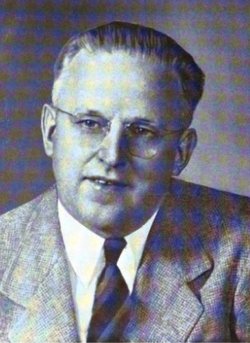
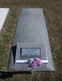
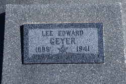
Lee Edward Geyer Famous memorial
| Birth | : | 9 Sep 1888 Wetmore, Nemaha County, Kansas, USA |
| Death | : | 11 Oct 1941 Washington, District of Columbia, District of Columbia, USA |
| Burial | : | Mountain View Cemetery, Marriottsville, Howard County, USA |
| Coordinate | : | 39.3143997, -76.9368973 |
| Description | : | U.S. Congressman. He graduated from Baker University Kansas, in 1922, was a teacher in Nemaha County, Kansas, (1908-12) and principal of Hamlin High School, (1916-18). During World War I, he served as a Private in the 3rd Company, 1st Battalion, Central Officers’ Training School, Camp Grant, Illinois. After the war, he was a teacher-administrator in high schools in California, (1919-38) and a member of the California State House of Representatives, (1934-36). In 1939, he was elected as a Democrat to the Seventy-sixth and Seventy-seventh Congresses, serving until his death from pneumonia at age 53. |
frequently asked questions (FAQ):
-
Where is Lee Edward Geyer Famous memorial's memorial?
Lee Edward Geyer Famous memorial's memorial is located at: Mountain View Cemetery, Marriottsville, Howard County, USA.
-
When did Lee Edward Geyer Famous memorial death?
Lee Edward Geyer Famous memorial death on 11 Oct 1941 in Washington, District of Columbia, District of Columbia, USA
-
Where are the coordinates of the Lee Edward Geyer Famous memorial's memorial?
Latitude: 39.3143997
Longitude: -76.9368973
Family Members:
Parent
Spouse
Siblings
Flowers:
Nearby Cemetories:
1. Mountain View Cemetery
Marriottsville, Howard County, USA
Coordinate: 39.3143997, -76.9368973
2. Crest Lawn Memorial Gardens
Marriottsville, Howard County, USA
Coordinate: 39.3118896, -76.9338837
3. Oneal Cemetery
Marriottsville, Howard County, USA
Coordinate: 39.3485388, -76.9163338
4. McKendree Cemetery
Howard County, USA
Coordinate: 39.3141500, -76.9962300
5. Sharon Missionary Baptist Church Cemetery
West Friendship, Howard County, USA
Coordinate: 39.3141632, -76.9964066
6. Brown Family Cemetery at Good Fellowship
Woodstock, Howard County, USA
Coordinate: 39.3214800, -76.8762500
7. Harmony Cemetery
Glenwood, Howard County, USA
Coordinate: 39.3119900, -77.0007400
8. Saint Lukes United Methodist Cemetery
Howard County, USA
Coordinate: 39.3609352, -76.9676437
9. Saint Barnabas Episcopal Church Cemetery
Howard County, USA
Coordinate: 39.3610001, -76.9700928
10. Saint Josephs Cemetery
Sykesville, Carroll County, USA
Coordinate: 39.3646700, -76.9684800
11. Cemetery Lane Part Of Doughoreagan Manor
Ellicott City, Howard County, USA
Coordinate: 39.2827950, -76.8766380
12. Saint Alphonsus Cemetery
Granite, Baltimore County, USA
Coordinate: 39.3340900, -76.8660000
13. Woodstock College Jesuit Theologate Cemetery
Granite, Baltimore County, USA
Coordinate: 39.3357900, -76.8662000
14. Jesuit Cemetery
Baltimore County, USA
Coordinate: 39.3359000, -76.8662000
15. France Family Cemetery
Glenwood, Howard County, USA
Coordinate: 39.3090900, -77.0211700
16. Springfield Cemetery
Sykesville, Carroll County, USA
Coordinate: 39.3736000, -76.9738998
17. Pine Orchard Methodist Episcopal Cemetery
Ellicott City, Howard County, USA
Coordinate: 39.2808610, -76.8619390
18. Granite Presbyterian Cemetery
Granite, Baltimore County, USA
Coordinate: 39.3412300, -76.8531900
19. Bushy Park Community Cemetery
Woodbine, Howard County, USA
Coordinate: 39.3163000, -77.0281670
20. Oak Grove Cemetery
Glenwood, Howard County, USA
Coordinate: 39.2949200, -77.0251500
21. Saint Pauls Methodist Episcopal Church Cemetery
Granite, Baltimore County, USA
Coordinate: 39.3431900, -76.8528100
22. Fuller-Kane-Smith Cemetery
Ellicott City, Howard County, USA
Coordinate: 39.2973310, -76.8458110
23. Wight Family Cemetery
Eldersburg, Carroll County, USA
Coordinate: 39.3887700, -76.9370000
24. Anatomy Board Gravesite
Sykesville, Carroll County, USA
Coordinate: 39.3895300, -76.9616530

