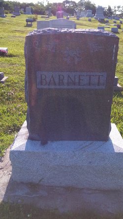
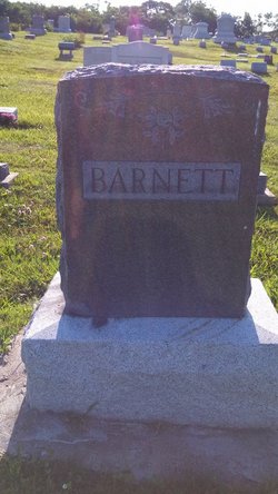
Leeta L. Maxwell Barnett
| Birth | : | 26 Mar 1871 Lancaster, Schuyler County, Missouri, USA |
| Death | : | 20 Nov 1931 Lancaster, Schuyler County, Missouri, USA |
| Burial | : | All Saints Cemetery, Waterford, Oakland County, USA |
| Coordinate | : | 42.7016449, -83.4411697 |
| Description | : | This information supplied by the following web site: The authors of this work is unknown, but much appreciation and gratitude go to these people for all their hard work and dedication: *********************************** mother-2-mother.com/genealogy/schuyler |
frequently asked questions (FAQ):
-
Where is Leeta L. Maxwell Barnett's memorial?
Leeta L. Maxwell Barnett's memorial is located at: All Saints Cemetery, Waterford, Oakland County, USA.
-
When did Leeta L. Maxwell Barnett death?
Leeta L. Maxwell Barnett death on 20 Nov 1931 in Lancaster, Schuyler County, Missouri, USA
-
Where are the coordinates of the Leeta L. Maxwell Barnett's memorial?
Latitude: 42.7016449
Longitude: -83.4411697
Family Members:
Parent
Spouse
Siblings
Children
Flowers:
Nearby Cemetories:
1. All Saints Cemetery
Waterford, Oakland County, USA
Coordinate: 42.7016449, -83.4411697
2. Hillview Memorial Gardens
Clarkston, Oakland County, USA
Coordinate: 42.7086868, -83.4639664
3. Lakeview Cemetery
Clarkston, Oakland County, USA
Coordinate: 42.7263985, -83.4272003
4. Waterford Village Cemetery
Waterford, Oakland County, USA
Coordinate: 42.7038193, -83.4029694
5. Ottawa Park Cemetery
Clarkston, Oakland County, USA
Coordinate: 42.7146988, -83.4056015
6. Colombiere Center Cemetery
Clarkston, Oakland County, USA
Coordinate: 42.7333650, -83.4571700
7. Drayton Plains Cemetery
Waterford, Oakland County, USA
Coordinate: 42.6894836, -83.3857880
8. Saint Andrew's Episcopal Church Memorial Garden
Waterford, Oakland County, USA
Coordinate: 42.6744070, -83.3935960
9. Andersonville Cemetery
Andersonville, Oakland County, USA
Coordinate: 42.7303696, -83.4873581
10. Granger Cemetery
White Lake, Oakland County, USA
Coordinate: 42.6692009, -83.4942017
11. Bridge Lake Cemetery
Clarkston, Oakland County, USA
Coordinate: 42.7449989, -83.4774017
12. Crescent Hills Cemetery
Waterford, Oakland County, USA
Coordinate: 42.6692009, -83.3878021
13. Waterford Center Cemetery
Waterford, Oakland County, USA
Coordinate: 42.6523972, -83.4075775
14. Sashabaw Cemetery
Clarkston, Oakland County, USA
Coordinate: 42.7194328, -83.3634644
15. Springfield Plains Cemetery
Davisburg, Oakland County, USA
Coordinate: 42.7667007, -83.4630966
16. Oxbow Lakeside Cemetery
White Lake, Oakland County, USA
Coordinate: 42.6400840, -83.4786270
17. White Lake Cemetery
White Lake, Oakland County, USA
Coordinate: 42.6918983, -83.5325012
18. Saint Patricks Church Catholic Cemetery
Union Lake, Oakland County, USA
Coordinate: 42.6296960, -83.4615580
19. Central United Methodist Church Memorial Garden
Waterford, Oakland County, USA
Coordinate: 42.6485748, -83.3627853
20. Davisburg Cemetery
Davisburg, Oakland County, USA
Coordinate: 42.7543983, -83.5306015
21. Four Towns Cemetery
Waterford, Oakland County, USA
Coordinate: 42.6188354, -83.4114532
22. Oakland Cemetery
Pontiac, Oakland County, USA
Coordinate: 42.6610985, -83.3274994
23. Bigelow Cemetery
Springfield, Oakland County, USA
Coordinate: 42.7797012, -83.5235977
24. Mount Bethel Cemetery
Ortonville, Oakland County, USA
Coordinate: 42.8027610, -83.4926610


