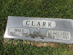
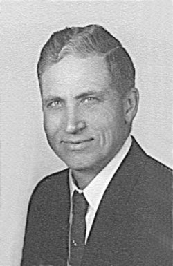
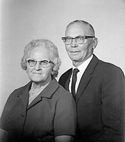
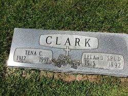
Leland Pierce “Spud” Clark
| Birth | : | 28 Mar 1915 |
| Death | : | 25 Aug 1992 |
| Burial | : | Mission Hill Congregational Cemetery, Mission Hill, Yankton County, USA |
| Coordinate | : | 42.9247900, -97.2795370 |
| Description | : | Leland P Clark Sr. lived most of his life in Mission Hill. He attended the Mission Hill Elementary School and graduated from Gayville High School. He farmed the Missouri River Island with Vern Metz. Leland married Tena Peterka Kirkham at Vangen Lutheran Church on Jan. 11, 1942 prior to entering the United States Army Air Corps. He was a WWII combat veteran serving in the South Pacific, including the battle of Iwo Jima. He was discharged in 1945 and returned to Mission Hill. Spud was employed as a mechanic at Tauge/Anderson Ford Garage in Yankton, he managed and owned Bettys... Read More |
frequently asked questions (FAQ):
-
Where is Leland Pierce “Spud” Clark's memorial?
Leland Pierce “Spud” Clark's memorial is located at: Mission Hill Congregational Cemetery, Mission Hill, Yankton County, USA.
-
When did Leland Pierce “Spud” Clark death?
Leland Pierce “Spud” Clark death on 25 Aug 1992 in
-
Where are the coordinates of the Leland Pierce “Spud” Clark's memorial?
Latitude: 42.9247900
Longitude: -97.2795370
Family Members:
Parent
Spouse
Flowers:
Nearby Cemetories:
1. Mission Hill Congregational Cemetery
Mission Hill, Yankton County, USA
Coordinate: 42.9247900, -97.2795370
2. Vangen Church Cemetery
Mission Hill, Yankton County, USA
Coordinate: 42.9260120, -97.2650100
3. Rosenberg Cemetery
Mission Hill, Yankton County, USA
Coordinate: 42.9501090, -97.2596880
4. Gayville Community Cemetery
Gayville, Yankton County, USA
Coordinate: 42.8950005, -97.1800003
5. Zion Cemetery
Volin, Yankton County, USA
Coordinate: 42.9963300, -97.2234600
6. Garden of Memories Cemetery
Yankton, Yankton County, USA
Coordinate: 42.9043999, -97.3927994
7. Sacred Heart Cemetery
Yankton, Yankton County, USA
Coordinate: 42.9007988, -97.3927994
8. Yankton City Cemetery
Yankton, Yankton County, USA
Coordinate: 42.8985200, -97.3941800
9. State Hospital Cemetery
Yankton, Yankton County, USA
Coordinate: 42.9101000, -97.4004900
10. Volin Cemetery
Volin, Yankton County, USA
Coordinate: 42.9672012, -97.1707993
11. Walshtown Catholic Cemetery
Mission Hill, Yankton County, USA
Coordinate: 43.0105500, -97.3208300
12. Pierre Dorion Memorial
Yankton, Yankton County, USA
Coordinate: 42.8685000, -97.4000400
13. Benedictine Convent Cemetery
Yankton, Yankton County, USA
Coordinate: 42.8734900, -97.4135900
14. Trondhjem Cemetery
Volin, Yankton County, USA
Coordinate: 43.0325400, -97.2346200
15. Walshtown Cemetery
Yankton County, USA
Coordinate: 43.0393982, -97.3094025
16. Saint Helena Cemetery
Saint Helena, Cedar County, USA
Coordinate: 42.8121986, -97.2347031
17. Union Cemetery
Wakonda, Clay County, USA
Coordinate: 42.9827995, -97.1222000
18. Rahn Cemetery
Utica, Yankton County, USA
Coordinate: 43.0182000, -97.4113400
19. Trinity Danish Lutheran Church Cemetery
Gayville, Yankton County, USA
Coordinate: 42.8222008, -97.1605988
20. Saint Marys Catholic Cemetery
Saint Helena, Cedar County, USA
Coordinate: 42.7866000, -97.2681500
21. Martinus Cemetery
Utica, Yankton County, USA
Coordinate: 43.0111008, -97.4293976
22. Voll Cemetery
Yankton County, USA
Coordinate: 43.0567017, -97.3768997
23. Aten Cemetery
Cedar County, USA
Coordinate: 42.8377991, -97.4533005
24. Sigel Cemetery
Utica, Yankton County, USA
Coordinate: 43.0390400, -97.4216000


