| Birth | : | 6 Oct 1906 West Virginia, USA |
| Death | : | 15 Oct 2000 Boone County, West Virginia, USA |
| Burial | : | Benton County Memorial Park, Rogers, Benton County, USA |
| Coordinate | : | 36.3342018, -94.1722031 |
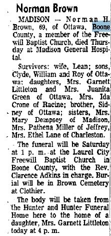
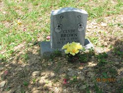
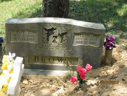
| Description | : | Lena is the daughter of Alfred Miller and Mary Belle Pauley. Lena married Norman Brown thier children are Roy, Clyde, Ralph, Garnett, Ida |
frequently asked questions (FAQ):
-
Where is Lena Esther Miller Brown's memorial?
Lena Esther Miller Brown's memorial is located at: Benton County Memorial Park, Rogers, Benton County, USA.
-
When did Lena Esther Miller Brown death?
Lena Esther Miller Brown death on 15 Oct 2000 in Boone County, West Virginia, USA
-
Where are the coordinates of the Lena Esther Miller Brown's memorial?
Latitude: 36.3342018
Longitude: -94.1722031
Family Members:
Parent
Spouse
Siblings
Children
Flowers:
Nearby Cemetories:
1. Benton County Memorial Park
Rogers, Benton County, USA
Coordinate: 36.3342018, -94.1722031
2. Oakley Chapel Cemetery
Rogers, Benton County, USA
Coordinate: 36.3344002, -94.1735992
3. Bland Cemetery
Rogers, Benton County, USA
Coordinate: 36.3372002, -94.1844025
4. Putman Cemetery
Bentonville, Benton County, USA
Coordinate: 36.3340874, -94.1870880
5. Dodson Cemetery
Benton County, USA
Coordinate: 36.3424988, -94.1975021
6. Rest Haven Pet Cemetery
Bentonville, Benton County, USA
Coordinate: 36.3424988, -94.1983032
7. Horsley Cemetery
Rogers, Benton County, USA
Coordinate: 36.3373430, -94.1436550
8. First Presbyterian Church Columbarium
Rogers, Benton County, USA
Coordinate: 36.3118020, -94.1564570
9. Mount Eden Cemetery
Bentonville, Benton County, USA
Coordinate: 36.3670000, -94.1696000
10. Hart Cemetery
Rogers, Benton County, USA
Coordinate: 36.3135986, -94.2074966
11. Rogers Cemetery
Rogers, Benton County, USA
Coordinate: 36.3278010, -94.1278000
12. Saint Andrews Episcopal Church Columbarium
Rogers, Benton County, USA
Coordinate: 36.3260470, -94.1272080
13. Bates Cemetery
Bentonville, Benton County, USA
Coordinate: 36.3696570, -94.1915260
14. Woods Cemetery
Little Flock, Benton County, USA
Coordinate: 36.3685989, -94.1493988
15. Jefferson Cemetery
Bentonville, Benton County, USA
Coordinate: 36.3744011, -94.1742020
16. Alley Cemetery
Siloam Springs, Benton County, USA
Coordinate: 36.3708960, -94.1463570
17. Little Flock Cemetery
Little Flock, Benton County, USA
Coordinate: 36.3758011, -94.1444016
18. Robbins Cemetery
Benton County, USA
Coordinate: 36.3795334, -94.1897594
19. Bentonville Cemetery
Bentonville, Benton County, USA
Coordinate: 36.3683014, -94.2174988
20. First Presbyterian Church Columbarium
Bentonville, Benton County, USA
Coordinate: 36.3813160, -94.1976120
21. Pinnacle Memorial Gardens
Rogers, Benton County, USA
Coordinate: 36.2826570, -94.1946910
22. Old Rogers Cemetery
Benton County, USA
Coordinate: 36.3587720, -94.1111190
23. Pleasant Grove Cemetery
Rogers, Benton County, USA
Coordinate: 36.2827988, -94.1466980
24. Saint Stephens Columbarium
Bentonville, Benton County, USA
Coordinate: 36.3867800, -94.1954100


