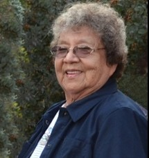
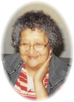
Leona Blackwolf Limberhand
| Birth | : | 27 Sep 1942 Lame Deer, Rosebud County, Montana, USA |
| Death | : | 26 Apr 2014 Ashland, Rosebud County, Montana, USA |
| Burial | : | Muddy Creek Cemetery, Muddy, Big Horn County, USA |
| Coordinate | : | 45.5741997, -106.7406006 |
| Description | : | Leona So’taa’e (Suhtai Woman) Limberhand died April 26, 2014 at the Billings Clinic in Billings, MT after battling a long illness. She was 71 years old. Born in Lame Deer, MT, a daughter of Henry Blackwolf and Pauline Flying Blackwolf. Leona was also a 4th generation direct descendant of Chief Dull Knife, which she was very proud of. She attended school at St. Labre Indian School. She later attended college at Eastern Montana College in Billings, MT where she pursued a teacher degree. In her earlier years she was a switchboard operator, an aide, a mailing clerk and a teacher. ... Read More |
frequently asked questions (FAQ):
-
Where is Leona Blackwolf Limberhand's memorial?
Leona Blackwolf Limberhand's memorial is located at: Muddy Creek Cemetery, Muddy, Big Horn County, USA.
-
When did Leona Blackwolf Limberhand death?
Leona Blackwolf Limberhand death on 26 Apr 2014 in Ashland, Rosebud County, Montana, USA
-
Where are the coordinates of the Leona Blackwolf Limberhand's memorial?
Latitude: 45.5741997
Longitude: -106.7406006
Family Members:
Parent
Spouse
Siblings
Children
Flowers:
Nearby Cemetories:
1. Muddy Creek Cemetery
Muddy, Big Horn County, USA
Coordinate: 45.5741997, -106.7406006
2. Lame Deer Cemetery
Lame Deer, Rosebud County, USA
Coordinate: 45.6264000, -106.6619034
3. Busby Cemetery
Busby, Big Horn County, USA
Coordinate: 45.5358009, -106.9505997
4. Two Moons Gravesite
Busby, Big Horn County, USA
Coordinate: 45.5308840, -106.9564430
5. Lee Cemetery
Rosebud County, USA
Coordinate: 45.7792015, -106.5413971
6. Birney Cemetery
Rosebud County, USA
Coordinate: 45.2846985, -106.5868988
7. Saint Labre Cemetery
Ashland, Rosebud County, USA
Coordinate: 45.6070930, -106.2836910
8. Ashland Cemetery
Ashland, Rosebud County, USA
Coordinate: 45.5867170, -106.2645560
9. Brown Cemetery
Colstrip, Rosebud County, USA
Coordinate: 45.8321991, -106.4180984
10. Colstrip Cemetery
Colstrip, Rosebud County, USA
Coordinate: 45.9096985, -106.6194000
11. Bean Cemetery
Rosebud County, USA
Coordinate: 45.8535995, -106.4011002
12. Willow Crossing Cemetery
Powder River County, USA
Coordinate: 45.5382996, -106.1931000
13. Little Bighorn Battlefield National Monument
Little Big Horn Battle Site, Big Horn County, USA
Coordinate: 45.5703000, -107.4273500
14. Custer National Cemetery
Crow Agency, Big Horn County, USA
Coordinate: 45.5699000, -107.4318000
15. Garryowen Cemetery
Crow Agency, Big Horn County, USA
Coordinate: 45.5295868, -107.4309464
16. Crow Agency Cemetery
Crow Agency, Big Horn County, USA
Coordinate: 45.6044006, -107.4730988
17. Lodge Grass Cemetery
Lodge Grass, Big Horn County, USA
Coordinate: 45.3223340, -107.3785110
18. Apsaalooke Veterans Cemetery
Crow Agency, Big Horn County, USA
Coordinate: 45.6055500, -107.4776900
19. Forty Mile Colony Cemetery
Big Horn County, USA
Coordinate: 45.2856738, -107.3520215
20. Dufford Cemetery
Powder River County, USA
Coordinate: 45.1091995, -106.2316971
21. North Stacey Cemetery
Powder River County, USA
Coordinate: 45.7569008, -105.8814011
22. Fairview Cemetery
Hardin, Big Horn County, USA
Coordinate: 45.7394981, -107.6415024
23. Brightwing Cemetery
Big Horn County, USA
Coordinate: 45.1199989, -107.4383011
24. Twin Pine Cemetery
Sonnette, Powder River County, USA
Coordinate: 45.3665600, -105.8292100


