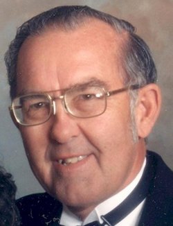
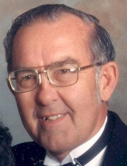
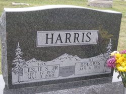
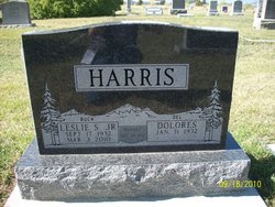
Leslie Stanley “Buck” Harris Jr.
| Birth | : | 17 Sep 1932 Jefferson City, Jefferson County, Montana, USA |
| Death | : | 3 Mar 2010 East Helena, Lewis and Clark County, Montana, USA |
| Burial | : | Leveldale Cemetery, Mason County, USA |
| Coordinate | : | 40.2355995, -89.8086014 |
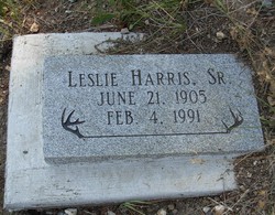
| Description | : | Leslie S. (Buck) Harris Jr. passed away peacefully at his home with family on March 3, 2010, after a courageous battle with brain cancer. Buck was born on Sept. 17, 1932, to Leslie S. Harris Sr. and Nilda Schiavon in Jefferson City. He grew up in Elkhorn and Boulder and graduated from Jefferson County High School in 1950. Buck obtained an associate's degree in gunsmithing in Trinidad, Colo., and he attended Montana State College in Bozeman before starting a successful career with the Montana State Highway Department in Helena. Buck married his high school sweetheart, Dolores Lemelin, on Dec. 28, 1952, in the... Read More |
frequently asked questions (FAQ):
-
Where is Leslie Stanley “Buck” Harris Jr.'s memorial?
Leslie Stanley “Buck” Harris Jr.'s memorial is located at: Leveldale Cemetery, Mason County, USA.
-
When did Leslie Stanley “Buck” Harris Jr. death?
Leslie Stanley “Buck” Harris Jr. death on 3 Mar 2010 in East Helena, Lewis and Clark County, Montana, USA
-
Where are the coordinates of the Leslie Stanley “Buck” Harris Jr.'s memorial?
Latitude: 40.2355995
Longitude: -89.8086014
Family Members:
Parent
Flowers:
Nearby Cemetories:
1. Leveldale Cemetery
Mason County, USA
Coordinate: 40.2355995, -89.8086014
2. Mason County Farm Cemetery
Teheran, Mason County, USA
Coordinate: 40.2246940, -89.7991320
3. Leases Grove Cemetery
Mason County, USA
Coordinate: 40.2153015, -89.8052979
4. Easton Cemetery
Easton, Mason County, USA
Coordinate: 40.2181015, -89.8546982
5. Danville Cemetery
Mason City, Mason County, USA
Coordinate: 40.1930900, -89.8195400
6. Walkers Grove Cemetery
Easton, Mason County, USA
Coordinate: 40.2056007, -89.8566971
7. Crites Cemetery
Mason City, Mason County, USA
Coordinate: 40.1838875, -89.7541656
8. Heater Cemetery
Mason County, USA
Coordinate: 40.2767019, -89.9039962
9. Pehlam Family Cemetery
Easton, Mason County, USA
Coordinate: 40.1691000, -89.8766000
10. Sears Cemetery
Easton, Mason County, USA
Coordinate: 40.1795915, -89.9014627
11. Big Grove Cemetery
Mason County, USA
Coordinate: 40.1464005, -89.7608032
12. Pleasant Hill Cemetery
Forest City, Mason County, USA
Coordinate: 40.3335991, -89.8127975
13. Saint Johns Cemetery
Topeka, Mason County, USA
Coordinate: 40.3259570, -89.8677377
14. Lewis Cemetery
Easton, Mason County, USA
Coordinate: 40.2324450, -89.9415680
15. Samms Cemetery
Mason County, USA
Coordinate: 40.2516827, -89.9447572
16. Mason City Cemetery
Mason City, Mason County, USA
Coordinate: 40.2024994, -89.6753006
17. Wehmhoff Cemetery
Bishop, Mason County, USA
Coordinate: 40.3362880, -89.8667740
18. Wehmhoff Cemetery
Bishop, Mason County, USA
Coordinate: 40.3363890, -89.8669440
19. Allens Grove Cemetery
Mason County, USA
Coordinate: 40.2855988, -89.6785965
20. New Lebanon Cemetery
Kilbourne, Mason County, USA
Coordinate: 40.1845168, -89.9392935
21. Carter Cemetery
Mason County, USA
Coordinate: 40.1680984, -89.9263992
22. Baker Cemetery
Mason County, USA
Coordinate: 40.1958008, -89.9477997
23. Chaney Cemetery
Mason County, USA
Coordinate: 40.2294006, -89.9589005
24. Cherry Grove Cemetery
Mason City, Mason County, USA
Coordinate: 40.2318993, -89.6567001

