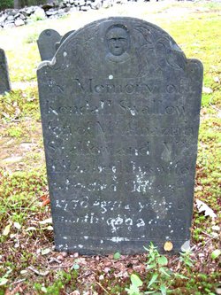
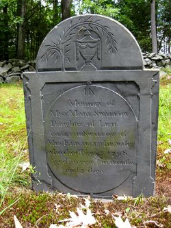
Lieut Amaziah Swallow
| Birth | : | 22 Nov 1732 Groton, Middlesex County, Massachusetts, USA |
| Death | : | 21 Jan 1803 Dunstable, Middlesex County, Massachusetts, USA |
| Burial | : | Corpus Christi Cemetery, Fort Dodge, Webster County, USA |
| Coordinate | : | 42.5243988, -94.1802979 |
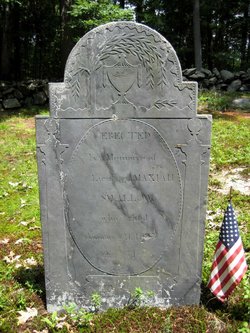
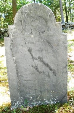
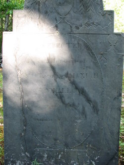
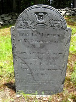
| Inscription | : | Erected in Memory of LIEUT. AMAZIAH SWALLOW who died Jan. 21st, 1803 Source: Nason, Elias "History of Dunstable, Massachusetts": A Mudge & Son, printers, Boston 1877 |
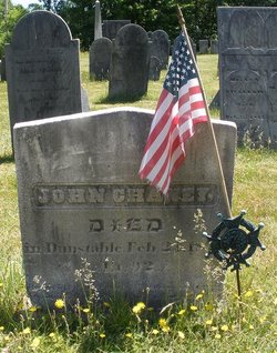
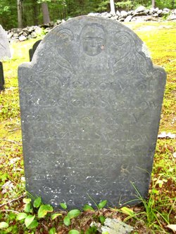
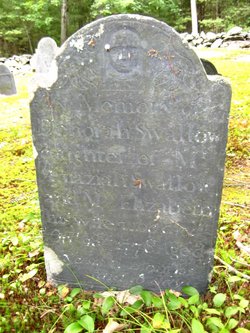
| Description | : | Lieut. Amaziah Swallow, son of John and Deborah Swallow, born in Groton, Middlesex, Massachusetts 22 November 1732; married (1st) in Billerica, Middlesex, Massachusetts 19 June 1759, Elizabeth Kendall. He married (2nd) at Groton, Middlesex, Massachusetts 16 February 1786, Mary (Taylor) Woods, daughter of Samuel and Susannah (Perham) Taylor, and widow of Capt. Solomon Woods. Children of Lt. Amaziah and Elizabeth (Kendall) Swallow: 1. Elizabeth, born 18 May 1760, married Lieut. John Cheney 2. Rebecca, born 4 December 1763, died 17 August 1765 3. Ruth, born 22 July 1765, married Isaac Kendall 4. Asa, born 1 May 1767 5. Rebecca, born 24 April 1768, married... Read More |
frequently asked questions (FAQ):
-
Where is Lieut Amaziah Swallow's memorial?
Lieut Amaziah Swallow's memorial is located at: Corpus Christi Cemetery, Fort Dodge, Webster County, USA.
-
When did Lieut Amaziah Swallow death?
Lieut Amaziah Swallow death on 21 Jan 1803 in Dunstable, Middlesex County, Massachusetts, USA
-
Where are the coordinates of the Lieut Amaziah Swallow's memorial?
Latitude: 42.5243988
Longitude: -94.1802979
Family Members:
Spouse
Children
Flowers:
Nearby Cemetories:
1. Corpus Christi Cemetery
Fort Dodge, Webster County, USA
Coordinate: 42.5243988, -94.1802979
2. Oakland Cemetery
Fort Dodge, Webster County, USA
Coordinate: 42.5214005, -94.1800003
3. North Lawn Cemetery
Fort Dodge, Webster County, USA
Coordinate: 42.5290000, -94.1778000
4. Fort Dodge Memorial Park
Fort Dodge, Webster County, USA
Coordinate: 42.5032997, -94.1472015
5. Saint Olafs Cemetery
Fort Dodge, Webster County, USA
Coordinate: 42.5017014, -94.2153015
6. Carpenter Cemetery
Webster County, USA
Coordinate: 42.5015907, -94.2166061
7. Concordia Cemetery
Fort Dodge, Webster County, USA
Coordinate: 42.5628014, -94.1949997
8. Willowledge Cemetery
Fort Dodge, Webster County, USA
Coordinate: 42.5250015, -94.2388916
9. Burns Cemetery
Webster County, USA
Coordinate: 42.5249970, -94.2759880
10. Webster County Home Cemetery
Fort Dodge, Webster County, USA
Coordinate: 42.4563710, -94.2181420
11. Trinity Lutheran Cemetery
Webster County, USA
Coordinate: 42.5875015, -94.2581024
12. Old Lizard Cemetery
Webster County, USA
Coordinate: 42.5249720, -94.3141340
13. Graceland Cemetery
Elkhorn Township, Webster County, USA
Coordinate: 42.4275017, -94.2127991
14. Holaday Creek Cemetery
Webster County, USA
Coordinate: 42.4472008, -94.0886002
15. Elkhorn Cemetery
Webster County, USA
Coordinate: 42.4277992, -94.2328033
16. Elkhorn Township Cemetery
Fort Dodge, Webster County, USA
Coordinate: 42.4276120, -94.2329690
17. Hovey Cemetery
Badger, Webster County, USA
Coordinate: 42.6290000, -94.1730000
18. Pioneer Cemetery
Badger, Webster County, USA
Coordinate: 42.6306000, -94.1477966
19. Blossom Hill Cemetery
Badger, Webster County, USA
Coordinate: 42.6286011, -94.1100006
20. Colfax Cemetery
Webster County, USA
Coordinate: 42.5224991, -94.0194016
21. Our Lady of Good Counsel Cemetery
Moorland, Webster County, USA
Coordinate: 42.4427986, -94.3043976
22. Newark Township Cemetery
Vincent, Webster County, USA
Coordinate: 42.6021996, -94.0408020
23. Otho Cemetery
Otho, Webster County, USA
Coordinate: 42.4025002, -94.1153030
24. Fulton Township Cemetery
Moorland, Webster County, USA
Coordinate: 42.4272000, -94.3159000

