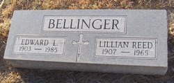
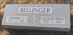
Lillian Irene Reed Bellinger
| Birth | : | 1 Sep 1907 Dawson County, Nebraska, USA |
| Death | : | Sep 1965 Omaha, Douglas County, Nebraska, USA |
| Burial | : | Saint Anns Cemetery, Lexington, Dawson County, USA |
| Coordinate | : | 40.7789001, -99.7114029 |
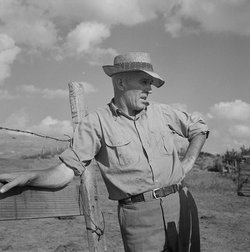
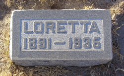
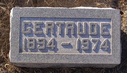
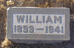
| Description | : | Mrs. Bellinger taken by Death Mrs. E. L. Bellinger, the former Lillian Reed, a lifelong resident of Lexington, died Friday in an Omaha hospital, which she had entered Thursday. She had been in failing health for some time. Mr. Bellinger, her sister, Miss Gertrude Reed, and her brother, Tom Reed, were at her bedside Friday. Funeral services will be at 9:30 Monday morning (today) in St. Ann's Catholic church and interment will be in St. Ann's cemetery. Rosary will be recited at the church at 7:30 Sunday evening. Mrs. Bellinger, daughter of the late Mr. and Mrs. William Reed, pioneer settlers north... Read More |
frequently asked questions (FAQ):
-
Where is Lillian Irene Reed Bellinger's memorial?
Lillian Irene Reed Bellinger's memorial is located at: Saint Anns Cemetery, Lexington, Dawson County, USA.
-
When did Lillian Irene Reed Bellinger death?
Lillian Irene Reed Bellinger death on Sep 1965 in Omaha, Douglas County, Nebraska, USA
-
Where are the coordinates of the Lillian Irene Reed Bellinger's memorial?
Latitude: 40.7789001
Longitude: -99.7114029
Family Members:
Parent
Spouse
Siblings
Flowers:
Nearby Cemetories:
1. Greenwood Cemetery
Lexington, Dawson County, USA
Coordinate: 40.7956467, -99.7286682
2. First United Methodist Church Columbarium
Lexington, Dawson County, USA
Coordinate: 40.7810000, -99.7397000
3. Evergreen Cemetery
Lexington, Dawson County, USA
Coordinate: 40.7639008, -99.6791992
4. Mount Hope Cemetery
Dawson County, USA
Coordinate: 40.8293991, -99.6733017
5. Hewitt Cemetery
Lexington, Dawson County, USA
Coordinate: 40.8588982, -99.7769012
6. Robb Cemetery
Smithfield, Gosper County, USA
Coordinate: 40.6710691, -99.6996001
7. Buffalo Grove Presbyterian Church Cemetery
Buffalo, Dawson County, USA
Coordinate: 40.8721000, -99.8270000
8. Hillside Cemetery
Dawson County, USA
Coordinate: 40.8946991, -99.7869034
9. Plum Creek Massacre Cemetery
Phelps County, USA
Coordinate: 40.6726840, -99.6058220
10. Grace Cemetery
Cozad, Dawson County, USA
Coordinate: 40.8602982, -99.8644028
11. Overton Cemetery
Overton, Dawson County, USA
Coordinate: 40.7317009, -99.5222015
12. Saint Johns Lutheran Cemetery
Lexington, Dawson County, USA
Coordinate: 40.9019012, -99.8458023
13. Quakerville Cemetery
Gosper County, USA
Coordinate: 40.6189003, -99.8097000
14. Adullam Cemetery
Bertrand, Phelps County, USA
Coordinate: 40.6265000, -99.5856000
15. Cozad Cemetery
Cozad, Dawson County, USA
Coordinate: 40.8605995, -99.9475021
16. Elwood Cemetery
Elwood, Gosper County, USA
Coordinate: 40.5999300, -99.8397300
17. Platte Valley Cemetery
Phelps County, USA
Coordinate: 40.6425018, -99.5028000
18. Keely Cemetery
Smithfield, Gosper County, USA
Coordinate: 40.5727500, -99.6563500
19. Saint Patricks Cemetery
Eddyville, Dawson County, USA
Coordinate: 40.9747009, -99.6093979
20. Sandstrom Cemetery
Phelps County, USA
Coordinate: 40.5983009, -99.5661011
21. Jewell Cemetery
Sumner, Dawson County, USA
Coordinate: 40.9599991, -99.5646973
22. Hope Lutheran Cemetery
Smithfield, Gosper County, USA
Coordinate: 40.5667500, -99.6800000
23. Fairview Cemetery
Dawson County, USA
Coordinate: 40.7719002, -99.9955978
24. Cottonwood Cemetery
Dawson County, USA
Coordinate: 40.9322014, -99.9197006

